Download
1 / 13
130 likes | 156 Views
Explore the digitized archive of historical aerial photos of Indiana, dating back to the late 1930s. IHAPI allows users to access photomosaics and ID points for various counties online. Locate your site of interest with ease!

E N D
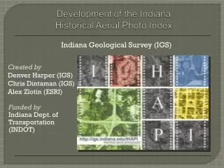
Indiana Geological Survey (IGS) Created by Denver Harper (IGS) Chris Dintaman (IGS) Alex Zlotin (ESRI) Funded by Indiana Dept. of Transportation (INDOT)
Collected by the Soil Conservation Service (NRCS) of the U.S.D.A. • Started in late 1930s • Collected as county-based surveys • Used for agricultural and topographic mapping • Compiled in various archival collections
Individual Photos Size = 9 x 9 inches Date of collection Unique ID number
Individual Photos Significant overlap for stereo viewing Usually N-S flight lines Several hundred photos per county per year
Created to facilitate retrieval • Individual photos were physically mosaicked and then re-photographed • Photomosaics are low-resolution
951 photo-mosaic index maps, showing locations of 113,035 individual photos • 39,992 individual photos
Digitization of the IGS Archive • 2005 - Scanned by Historical Information Gatherers, Inc. • Photomosaics scanned at 300 dpi • Individual photos scanned at 600 dpi • Scans of individual photos are not available for public distribution • Upon request, IGS personnel will re-scan individual photos at 800 dpi
Digitization of the IGS Archive • 2006 – Photomosaics georeferenced by IGS • ArcGIS georeferencing tool • Leica Image Analyst extension for ArcGIS used to mosaic index maps that were split into parts • Loaded into SDE as raster catalog
Digitization of the IGS Archive • 2007 - Point index layer completed by IGS • A point was placed over each ID number on each photomosaic (113,035 points) • Each point was attributed with county name, year, photo ID, flight orientation, and availability from various archives • Loaded into SDE
Digitization of the IGS Archive 2007-2008 - IHAPI interactive map was developed and made public on January 23
Purpose: Create an interactive map, so that the public can obtain historical aerial photos of interest without leaving their home or office. • IHAPI Features • ESRI ArcIMS AXL-based map service • Customized definition queries are accessed through the user interface to display the photomosaics and ID points • Customized interface to assist users in finding their site of interest
Read the instructions or watch the narrated video tutorial • Open the interactive map (http://igs.indiana.edu/IHAPI) • Specify your county of interest • Select your year of interest • Find your site of interest • Zoom tools • Locate by address or coordinates • Reference layers • Determine identification number • Contact archival collections (such as IGS) for copies of high-resolution photos
Http://igs.indiana.edu/IHAPI Find historical aerial photos showing the site of the football stadium of Indiana University