Download
1 / 24
240 likes | 335 Views
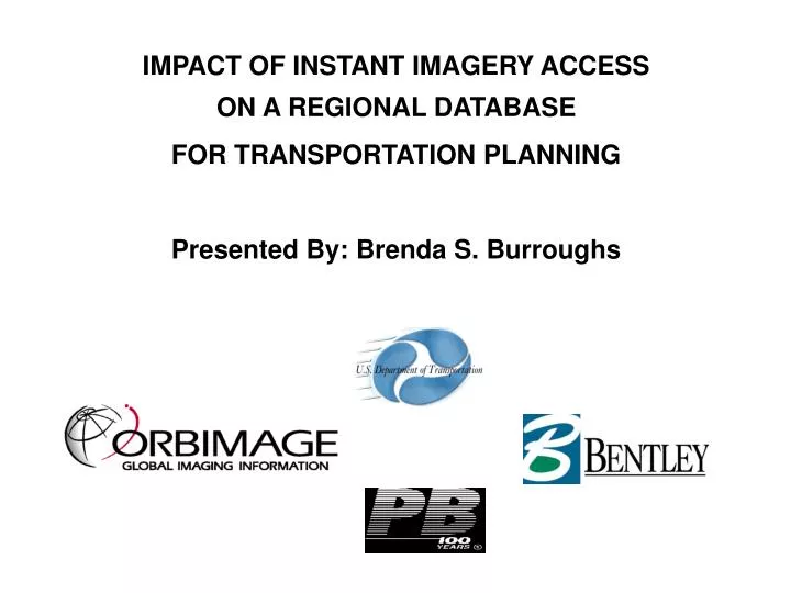
IMPACT OF INSTANT IMAGERY ACCESS ON A REGIONAL DATABASE FOR TRANSPORTATION PLANNING Presented By: Brenda S. Burroughs. Overview. Objectives Project Workflow Project Status and Accomplishments Transportation Planning Needs Transportation Application Areas

E N D
IMPACT OF INSTANT IMAGERY ACCESS ON A REGIONAL DATABASE FOR TRANSPORTATION PLANNING Presented By: Brenda S. Burroughs
Overview • Objectives • Project Workflow • Project Status and Accomplishments • Transportation Planning Needs • Transportation Application Areas • Demonstration of ‘Instant Imagery Access’ (IIA) Software • Conclusions – Benefits of IIA Impact of Instant Image Access on a Regional Database for Transportation Planning
Objectives • Determine operational transportation planning requirements • Identify imagery and vector data for candidate demonstration area • Develop ‘Instant Imagery Access’ demonstration using Bentley MicroStation CAD and Viecon Publisher software • Evaluate the methodology and usability of ‘Instant Imagery Access’ for operational transportation planning Impact of Instant Image Access on a Regional Database for Transportation Planning
DEVELOP CONCEPTUAL DEMONSTRATION CONCEPT DEVELOPMENT TECHNICAL EXCHANGE MEETINGS (TEMS) DEVELOP DETAILED TRANSPORTATION DEMONSTRATION USER RECOMMENDATIONS JUL 00 - APR 01 COMPILED MAY 01 SEP 01 – Dec 01 APPLICATION USER FEEDBACK APPLICATION SEMINARS DEC 01 - Feb 02 Project Workflow Impact of Instant Image Access on a Regional Database for Transportation Planning
Project Deliverables • Results of technical exchange meetings • Transportation planning demonstration slide show • Presentation of transportation planning demonstration • ‘Instant Imagery Access’ add-on software for Bentley Microstation v 8.0 • Feedback and conclusions on impact of ‘Instant Imagery Access’ in transportation planning • Develop implementation plan for state DOTs and engineering companies • Quarterly progress reports to DOT Impact of Instant Image Access on a Regional Database for Transportation Planning
Project Status/Accomplishments • Met with transportation planners at various levels • Conducted 15 briefings & 3 technical exchange meetings • Defined demonstration study area for live software demonstration • Collected digital imagery and GIS vector data • Completed oral presentation for Transportation planners • Developed demo MicroStation and Viecon Publisher software • Presented Demonstration of ‘Instant Imagery Access’ (IIA) • Completed Implementation plan for IIA • Contributed to NRSTC publications • Presented project at TRB 2001 and GIS-T 2002 conferences • Submitted quarterly reports Impact of Instant Image Access on a Regional Database for Transportation Planning
Transportation Planning Needs Summarized from Technical Exchange Meetings: • Facilitate image use by making image processing steps transparent to user • Diverse Imagery is important for project decision making and presentations • Data integrity is required between planning company and other Federal and State agencies • Image data must be up-to-date for land use and change detection analysis • Sensitive areas (parks, churches, schools, etc) must be detected early in the planning stage • Images at different scales are needed • Freeway and corridor studies, and rail station site assessments are common • It is necessary to have readily available metadata including source reference • It was suggested that ‘Instant Imagery Access’ be used by universities and public schools Impact of Instant Image Access on a Regional Database for Transportation Planning
Transportation Application Areas • Airports – Reagan National Airport • Waterports – Newport News • Railroad – Union Station • Transmission systems • Roads Impact of Instant Image Access on a Regional Database for Transportation Planning
Airports – Reagan National Airport OrbView Cities PLUS 1m panchromatic imagery, Arlington, VA, collected April 2001 Vectors (roads, railways etc.)- Geographic Data Technologies (GDT) Dynamap Scale approx. 1:17,200 Impact of Instant Image Access on a Regional Database for Transportation Planning
Waterports – Newport News OrbView Cities Standard 1m panchromatic imagery, Newport News, VA, collected September, 1999 Vectors (roads, railways) Geographic Data Technologies (GDT) Dynamap Scale approx. 1:15,000 Impact of Instant Image Access on a Regional Database for Transportation Planning
Railroad – Union Station OrbView Cities PLUS 1m panchromatic imagery , collected April 2001 Vectors (roads, railways etc.)- Geographic Data Technologies (GDT) Dynamap Scale approx. 1:6,000 Impact of Instant Image Access on a Regional Database for Transportation Planning
Transmission systems - Electric OrbView Cities Standard 1m panchromatic imagery, Salt Lake City, UT, collected August, 1999 Vectors (roads, railways)- PacifiCorp. Scale not calculated. Impact of Instant Image Access on a Regional Database for Transportation Planning
Roads - Study Area Route 1 Widening Project - Woodrow Wilson Bridge in Alexandria, VA to Dale City, VA Impact of Instant Image Access on a Regional Database for Transportation Planning
Roads - ‘Instant Imagery Access’ Demo Demonstration built on Bentley Viecon Publisher and MicroStation software using image data on remote servers Impact of Instant Image Access on a Regional Database for Transportation Planning
On-Line Access Software Bentley Viecon Publisher software • Contains functions for image manipulation commands • Basis for commands required to access image and vector data • Supported in MicroStation CAD and HTML browser interfaces Impact of Instant Image Access on a Regional Database for Transportation Planning
Imagery and GIS Vector Data • LANDSAT 25 m color • 1 Meter ORBIMAGE Cities B/W • 1 Foot Aerial Color • Van-Collected Roadway Photographs • Environmental vectors (eg. wetlands, endangered species) • Utility Vectors • Road Centerline Vectors • Parcel Vectors • Demographic Vectors Impact of Instant Image Access on a Regional Database for Transportation Planning
IIA Planning Demonstration work flow • Open project design files • Zoom into area of interest or use overview • Select project region • Specify project map projection • Select desired imagery based on metadata • Review digital photographs using engineering links • Interpret imagery with GIS vector data • Evaluate project design based on imagery and GIS vector data • Make decisions and refine design Impact of Instant Image Access on a Regional Database for Transportation Planning
Select Project Region Impact of Instant Image Access on a Regional Database for Transportation Planning
Select Project Map Projection Impact of Instant Image Access on a Regional Database for Transportation Planning
Select image Impact of Instant Image Access on a Regional Database for Transportation Planning
Image / Vector merge Imagery augments interpretations from traditional vector base maps Impact of Instant Image Access on a Regional Database for Transportation Planning
Van-collected photos Impact of Instant Image Access on a Regional Database for Transportation Planning
Benefits To Transportation Planners Government Agencies • Minimize impacts to environment, infrastructure, traffic • Enhance initial project scoping • Facilitate RFP preparation • Improve inter-government agency coordination • Facilitate project monitoring Commercial Engineering Firms • Facilitate response to RFPs - provide better briefings • Decrease costs, keep on schedule, minimize risks • Enhances engineering design processes • Accelerates the project initiation phase • Facilitate changes in requirements throughout the project Impact of Instant Image Access on a Regional Database for Transportation Planning
Thank You Brenda S. Burroughs 407-273-4114 Burroughs.brenda@orbimage.com www.ORBIMAGE.com Impact of Instant Image Access on a Regional Database for Transportation Planning