Download
1 / 44
440 likes | 573 Views
35 th Conference on Radar Meteorology 30 September 2011. Analysis of forecast improvement from radar-data assimilation within RUC, Rapid Refresh and HRRR models. GSD – Assimilation and Modeling Branch.

E N D
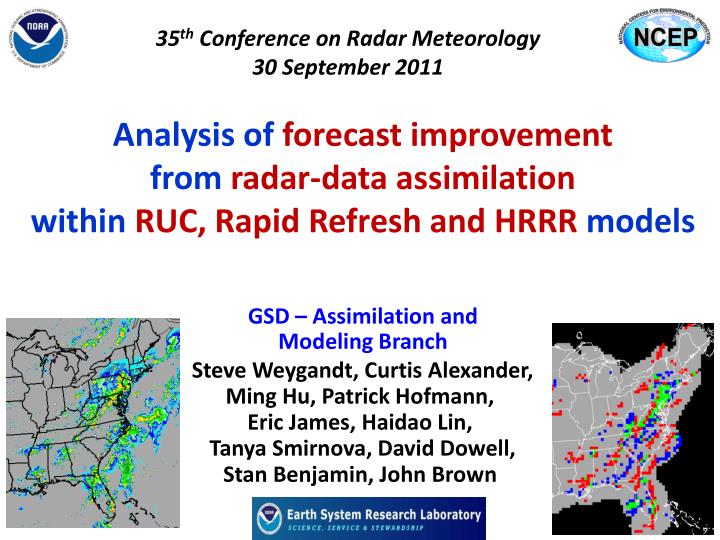
35th Conference on Radar Meteorology30 September 2011 Analysis of forecast improvement from radar-data assimilation within RUC, Rapid Refresh and HRRR models GSD – Assimilation and Modeling Branch Steve Weygandt, Curtis Alexander, Ming Hu, Patrick Hofmann, Eric James, Haidao Lin, Tanya Smirnova, David Dowell, Stan Benjamin, John Brown
Hourly Updated NOAA NWP Models Rapid Refresh (RR) replaces RUC at NCEP in 2011 WRF, GSI with RUC features 13km Rapid Refresh (mesoscale) 13km RUC (mesoscale) 3km HRRR (storm-scale) RUC – current oper Model, new 18h fcst every hour High-Resolution Rapid Refresh Experimental 3km nest inside RR, new 15-h fcst every hour
Models at NOAA/ESRL/GSD/AMB RR physics behavior similar to RUC – good for aviation, convective environment , surface and sensible weather NCEP upgrade from RUC to RR will provides more advanced model and analysis components - WRF-ARW: advanced numerics, non-hydrostatic - GSI: advanced satellite DA, 4DVAR/EnKF development - Both community-based, ongoing code contributions
Background / Goals • “Radar-DFI” assimilation procedure in NCEP RUC sinceNov. 2008 improved fcsts precip systems • Radar-DFIin GSD RR since 2008, RR to replace • RUC at NCEP late 2011 • Hourly CONUS HRRR nest in RUC since 2008 • HRRR benefitted from RUC radar-DFI • HRRR switched to run as nest within RR (with RR radar-DFI) in April 2011. • HRRR run in real-time to support CoSPA, SPC, NWS regions, renewable energy • Quantify radar DFI impact on RUC, RR • and HRRR nests for summer-time convection • Establish baseline for more sophisticated radar assimilation efforts
Rapid Refresh Hourly Cycle / Observations Hourly updating using all available observations Data types used Rawinsonde (balloons) Wind Profilers (405 MHz, 915 MHz) RASS virtual temperatures VAD winds (WSR-88D radars) Aircraft (ACARS, TAMDAR) Surface (METAR , Buoy, Mesonet ) Precipitable water (GPS, GOES, SSM/I) GOES cloud-drift winds GOES cloud-top pressure/temp Radar reflectivity, lightning Ship reports/dropsondes Satellite radiances (RR) 1-hr fcst 1-hr fcst 1-hr fcst Back- ground Fields Analysis Fields 3DVAR 3DVAR Obs Obs Time (UTC) 11 12 13
Spring 2011 Hourly HRRR Initialization from RR 15-h fcst 15-h fcst Hourly HRRR Interp to 3 km grid Lateral Boundary Conditions Interp to 3 km grid 18-h fcst 18-h fcst Use 1-h old LBC to reduce latency Initial Condition Fields 18-h fcst Use most recent IC (post-DFI) to get latest radar info 1-hr fcst DDFI DDFI 1-hr fcst 1-hr fcst Back- ground Fields Analysis Fields Reduced Latency: ~2h for 2011 Hourly RR 3DVAR 3DVAR Obs Obs Time (UTC) 11 z 12 z 13 z
Radar reflectivity assimilation Digital Filter-based reflectivity assimilation initializes ongoing precipitation regions -20 min -10 min Initial +10 min + 20 min Backwards integration, no physics Forward integration,full physics with radar-based latent heating Initial fields with improved balance, storm-scale circulation RUC / RR HRRR model forecast
Radar reflectivity assimilation Digital Filter-based reflectivity assimilation initializes ongoing precipitation regions -20 min -10 min Initial +10 min + 20 min Backwards integration, no physics Forward integration,full physics with radar-based latent heating Initial fields with improved balance, storm-scale circulation RUC / RR HRRR model forecast No precipitation hydrometeor specification* + RUC/RR Convection suppression
Diabatic Digital Filter Initialization Reduce noise in RUC and Rapid Refresh Noise parameter
Rapid Refresh (GSI + ARW) reflectivity assimilation example Upper-level Divergence Low-level Convergence NSSL radar reflectivity (dBZ) K=17 U-comp. diff (radar - norad) K=4 U-comp. diff (radar - norad) 14z 22 Oct 2008 Z = 3 km
Issues / Questions • No cycling on the 3-km HRRR grid, • must “spin-up storms within each run • followed by accelerated storm evolution • “match” with real-world evolution depends on stage of actual storm evolution • How effective is cycled “radar-DFI” procedure applied on mesoscale grid? • -- for mesoscale “parent” grid? • -- for storm-scale “child” grid? • How does parameterized convection on parent grid impact evolution of storm-scale model? • Similarities / difference RUC-HRRR vs. RR-HRRR?
Issues / Questions • To what degree is storm evolution controlled • by mesoscale vs. storm-scale forcing? • Highly variable based on regime, • but mesoscale forcing is very significant • -- We don’t accurately observe or predict mesoscale • mesoscale forcing == high predictability • -- Strong mesoscale forcing does imply reduced impact from radar data assimilation, unless • assimilated radar data improves mesoscale fields (cold pools, low-level wind fields, etc.)
R/T-Retro Experiment Weather NO radar assimilation RUC -- HRRR RETROSPECTIVE RR -- HRRR YES radar assimilation RUC REAL-TIME RR Aug 2011 11 12 13 14 15 16 17 18 19 20 21
R/T-Retro Experiment Weather NO radar assimilation RUC -- HRRR RETROSPECTIVE RR -- HRRR YES radar assimilation RUC REAL-TIME RR Aug 2011 11 12 13 14 15 16 17 18 19 20 21
R/T-Retro Experiment Weather NO radar assimilation RUC -- HRRR RETROSPECTIVE RR -- HRRR YES radar assimilation Every 2 hours Every 1 hour RUC -- HRRR REAL-TIME RR -- HRRR Aug 2011 11 12 13 14 15 16 17 18 19 20 21
R/T-Retro Experiment Weather NO radar assimilation RUC RETROSPECTIVE RR YES radar assimilation Every 2 hours Every 1 hour RUC -- HRRR REAL-TIME RR -- HRRR Aug 2011 11 12 13 14 15 16 17 18 19 20 21
R/T-Retro Experiment Weather NO radar assimilation RUC -- HRRR RETROSPECTIVE RR -- HRRR YES radar assimilation Every 2 hours Every 1 hour RUC -- HRRR REAL-TIME RR -- HRRR Aug 2011 11 12 13 14 15 16 17 18 19 20 21
R/T-Retro Experiment Weather 00z 13 Aug 02z 12 Aug NO radar assimilation RUC -- HRRR RETROSPECTIVE RR -- HRRR YES radar assimilation Every 2 hours Every 1 hour RUC -- HRRR REAL-TIME RR -- HRRR Aug 2011 11 12 13 14 15 16 17 18 19 20 21
R/T-Retro Experiment Weather 22z 13 Aug 00z 13 Aug 02z 12 Aug NO radar assimilation RUC -- HRRR RETROSPECTIVE RR -- HRRR YES radar assimilation Every 2 hours Every 1 hour RUC -- HRRR REAL-TIME RR -- HRRR Aug 2011 11 12 13 14 15 16 17 18 19 20 21
R/T-Retro Experiment Weather 22z 13 Aug 00z 15 Aug 00z 13 Aug 14z 14 Aug 02z 12 Aug NO radar assimilation RUC -- HRRR RETROSPECTIVE RR -- HRRR YES radar assimilation Every 2 hours Every 1 hour RUC -- HRRR REAL-TIME RR -- HRRR Aug 2011 11 12 13 14 15 16 17 18 19 20 21
R/T-Retro Experiment Weather 22z 13 Aug 00z 15 Aug 00z 13 Aug 14z 14 Aug 02z 12 Aug 04z 19 Aug 20z 19 Aug NO radar assimilation RUC -- HRRR RETROSPECTIVE RR -- HRRR YES radar assimilation Every 2 hours Every 1 hour RUC -- HRRR REAL-TIME RR -- HRRR Aug 2011 11 12 13 14 15 16 17 18 19 20 21
“neighborhood” verification of 6-h forecasts from 3-km HRRR verification:10 June – 26 Sept 2010 80-km 25 dBZ 6-h fcst 40-km 20-km 3-km valid (GMT) valid (EDT) 00 02 04 06 08 10 12 14 16 18 20 22 8p 10p 12 2a 4a 6a 8a 10a 12 2p 4p 6p
“neighborhood” verification of 6-h forecasts from 3-km HRRR verification:10 June – 26 Sept 2010 80-km 25 dBZ 6-h fcst Convective Initiation period 40-km Initiation 20-km 3-km valid (GMT) valid (EDT) 00 02 04 06 08 10 12 14 16 18 20 22 8p 10p 12 2a 4a 6a 8a 10a 12 2p 4p 6p
Convective Decay period “neighborhood” verification of 6-h forecasts from 3-km HRRR verification:10 June – 26 Sept 2010 80-km 25 dBZ 6-h fcst Convective Initiation period 40-km Initiation Decay 20-km 3-km valid (GMT) valid (EDT) 00 02 04 06 08 10 12 14 16 18 20 22 8p 10p 12 2a 4a 6a 8a 10a 12 2p 4p 6p
Convective Decay period “neighborhood” verification of 6-h forecasts from 3-km HRRR verification:10 June – 26 Sept 2010 80-km 25 dBZ 6-h fcst Convective Initiation period 40-km Initiation Decay Transition 20-km 3-km valid (GMT) valid (EDT) 00 02 04 06 08 10 12 14 16 18 20 22 8p 10p 12 2a 4a 6a 8a 10a 12 2p 4p 6p
R/T-Retro Experiment Configuration also RUC RR HRRR HRRR RUC RR YES radar assim NO radar assim Mostly compare RUC-HRRR vs. RR-HRRR (w/ and w/o radar) Also compare RUC and RR (w/ and w/o radar assimilation) Reflectivity and precipitation verification (also upper-air, surface)
R/T-Retro Experiment Configuration also RUC RR HRRR HRRR RUC RR YES radar assim NO radar assim Mostly compare RUC-HRRR vs. RR-HRRR (w/ and w/o radar) Also compare RUC and RR (w/ and w/o radar assimilation) Reflectivity and precipitation verification (also upper-air, surface) Initial Hydrometeor specification: RUC – No precipitation hydrometeor specification 0-h RUC-HRRR reflectivity from 1-h RUC explicit hydrometeors RR – Specify snow hydrometeors only 0-h RR-HRRR reflectivity from 1-h RR explicit HMs + radar snow
CSI (x 100) Rapid Refresh vs. RUC Precipitation Verification RR radar RR no radar RUC radar RUC no radar 13-km Eastern US Matched comparison 2 X 12 hr fcst vs. CPC 24-h analysis 11 – 21 Aug. 2011 All init times Threshold | | | | | | | 0.01 0.10 0.25 0.50 1.00 1.50 2.00 in. RR radar RR no radar 100 (1.0) • Radar assim improves precip CSIs scores, but also increases bias RUC radar bias (x 100) RUC no radar | | | | | | | 0.01 0.10 0.25 0.50 1.00 1.50 2.00 in.
CSI (x 100) “parent” vs. “child” Reflectivity Verification RR-HRRR radar RR-HRRR no radar RR radar RR no radar 25 dBZ 13-km Eastern US Matched Comparison 12,13,14,19 Aug. 2011 All init times | | | | | | | 0-h 2-h 4-h 6-h 8-h 10-h 12-h Forecast Lead Time CSI (x 100) RUC-HRRR radar • 3-km fcsts improve upon parent 13-km forecasts • radar assim adds skill at both 13-km and 3-km RUC radar RUC-HRRR no radar RUC no radar | | | | | | | 0-h 2-h 4-h 6-h 8-h 10-h 12-h
CSI (x 100) RUC-HRRR vs. RR-HRRR Reflectivity Verification RUC-HRRR radar RR-HRRR radar RR-HRRR no radar Eastern US, 25 dBZ 13-km CSI 3-km bias Matched Comparison 12,13,14,19 Aug. 2011 All init times RUC-HRRR no radar | | | | | | | 0-h 2-h 4-h 6-h 8-h 10-h 12-h Forecast Lead Time RR-HRRR radar RR-HRRR no radar • Radar assim improves precip CSIs scores, but also increases bias 100 (1.0) RUC-HRRR radar bias (x 100) RUC-HRRR no radar | | | | | | | 0-h 2-h 4-h 6-h 8-h 10-h 12-h
18z inits CSI for different Initialization times 00z inits RUC-HRRR radar RR-HRRR radar RUC-HRRR no radar RR-HRRR no radar 18z 00z 06z 00z 06z 12z | | | | | | | 0-h 2-h 4-h 6-h 8-h 10-h 12-h | | | | | | | 0-h 2-h 4-h 6-h 8-h 10-h 12-h Forecast Lead Time Forecast Lead Time 06z inits 12z inits 06z 12z 18z 12z 18z 00z | | | | | | | 0-h 2-h 4-h 6-h 8-h 10-h 12-h | | | | | | | 0-h 2-h 4-h 6-h 8-h 10-h 12-h
RUC HRRR RADAR RR HRRR RADAR 01z 13 Aug 2011 00z init RR HRRR no radar NSSL mosaic RUC HRRR no radar
RUC HRRR RADAR RR HRRR RADAR CSI scores 01z 13 Aug 2011 00z init RR HRRR no radar 0h 2h 4h 6h 8h NSSL mosaic RUC HRRR no radar
RUC HRRR RADAR RR HRRR RADAR 00z + 1 hr fcsts 01z 13 Aug 2011 RUC HRRR no radar RR HRRR no radar NSSL mosaic
RUC HRRR RADAR 00z initialization 00z 13 Aug 2011 NSSL mosaic
RUC HRRR RADAR RR HRRR RADAR 00z initialization 00z 13 Aug 2011 RR HRRR no radar NSSL mosaic RUC HRRR no radar
RUC HRRR RADAR RR HRRR RADAR 00z initialization 00z 13 Aug 2011 RR HRRR no radar NSSL mosaic RUC HRRR no radar
RR HRRR RADAR RUC HRRR RADAR NSSL mosaic 00z initialization 00z 13 Aug 2011 RR HRRR no radar RUC HRRR no radar
RUC HRRR RADAR RR HRRR RADAR 00z + 1 hr fcsts 01z 13 Aug 2011 RUC HRRR no radar RR HRRR no radar NSSL mosaic
RUC HRRR RADAR RR HRRR RADAR 00z + 2 hr fcsts 02z 13 Aug 2011 RUC HRRR no radar RR HRRR no radar NSSL mosaic
RUC HRRR RADAR RR HRRR RADAR NSSL mosaic 00z + 4 hr fcsts 04z 13 Aug 2011 RUC HRRR no radar RR HRRR no radar
RUC HRRR RADAR RR HRRR RADAR NSSL mosaic 00z + 6 hr fcsts 06z 13 Aug 2011 RUC HRRR no radar RR HRRR no radar
Conclusions and future work • “Radar-DFI” in mesoscale model improves mesoscale model precipitation and nested storm- scale reflectivity forecasts • Results very similar for RUC-HRRR, RR-HRRR • Radar-DFI focuses mesocale convective areas, suggestion of indirect convective suppression • Radar data impact quite case dependent, • strong diurnal aspect with little retention across mid-day convective minimum • RR-HRRR convects more easily than RUC-HRRR, HRRR has difficulty propagating leading convective lines for both RR and RUC fields, especially for strongly capped environments • Limitations to non-cycled 3-km forecasts