Download
1 / 11
110 likes | 237 Views
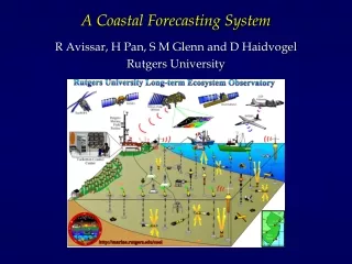
Building a Portuguese Coastal Operational Modelling System. Henrique Coelho and Paulo Leitão - Hidromod Guillaume Riflet, Angela Cânas, Rodrigo Fernandes and Ramiro Neves - Maretec. Goal – Downscale from coastal to local. Operational Products.

E N D
Building a Portuguese Coastal Operational Modelling System Henrique Coelho and Paulo Leitão - Hidromod Guillaume Riflet, Angela Cânas, Rodrigo Fernandes and Ramiro Neves - Maretec
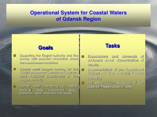
Operational Products • Support water quality monitorization (ex: waste water, eutrophication analysis, HAB’s); • Oil Spills (Emergence Response Systems); • Seal level (floods, coastal erosion);
Helping Monitorization MERIS Upwelling Index versus Nitrate in the discharge area of the Guia Outfall
Methodology • Atmospheric fluxes (MM5); • Large scale circulation (Mercator or HYCOM); • Rivers run off (INAG – Real Time River Flow Data); • Tides (Fes2004); • Hydrodynamic and Biogeochemical processes (MOHID);
Downscalling results • Algarve Coast (Downscalling HYCOM) • Estremadura Promontory (Downscalling Mercator)
Validation – Satelite versus MOHID • Sea Surface Temperature; • Chlorophyll; • Altimetry;
Future Development • Data assimilation : Optimal Interpolation and Kalman Filter; • Interpolation and Extrapolation : Convolution methods (Higdon, 1998) ; • Paralelization : Linux cluster;
Institutional Interaction • MeteoGalicia (Atmospheric fluxes, Oil Spills); • IntecMar (HAB’s, Oil spills); • IPIMAR (HAB’s); • ESEOO (Iberian strategy); • Mercator (Large scale circulation); • IBRIOOS (Task team of EUROGOOS for the Arc Atlantic);
Projects • EROCIPS – Oil spills (underway); • INSEA – Eutrophycation indexes (to during 2005); • ECOOP – Sea level and HAB’s (to start in 2007); • DYNCOSTAL – HAB’s