Download
1 / 29
290 likes | 385 Views
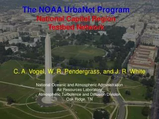
The NOAA UrbaNet Program National Capital Region Testbed Network. C. A. Vogel, W. R. Pendergrass, and J. R. White National Oceanic and Atmospheric Administration Air Resources Laboratory Atmospheric Turbulence and Diffusion Division Oak Ridge, TN. Background.

E N D
The NOAA UrbaNet Program National Capital Region Testbed Network C. A. Vogel, W. R. Pendergrass, and J. R. White National Oceanic and Atmospheric Administration Air Resources Laboratory Atmospheric Turbulence and Diffusion Division Oak Ridge, TN
Background • Immediately after 11 September 2001 Federal Coordinator for Meteorology asked for assessment of current computer modeling capabilities for atmospheric dispersion. • Found 29 modeling systems running 24/7 within Federal system. • 9 systems running nationwide
Background (cont…) • Roughly equally split between military and civilian agencies. • No one “best capability”. • Each model has particular strengths geared toward certain situations.
Issues • Most models have been developed on understanding of atmospheric behavior over rural terrain. Widespread agreement that urban applications of models need improvement. • Very few data sources to improve plume dispersion forecasting and modeling in urban environments. • Often 1 or 2 official weather stations located at airports on the periphery of urban area of interest.
Hazards of using single point (e.g., airport) wind information: Washington, DC wind roses, 3 months of data
Issues (cont…) • Data that is available only provides standard meteorological quantities: • average winds steer plume • atmospheric turbulence dictates plume dilution. • Need both standard meteorological and atmospheric turbulence data near the surface. • Need better spatial resolution to get down to “neighborhood” scales.
Result: NOAA UrbaNet Program • Establish high spatial resolution network of stations generating standard meteorological and atmospheric turbulence data. • Use this data to provide high spatial resolution data for emergency response. • Use data to further develop atmospheric dispersion modeling for urban environments.
NOAA UrbaNet Program (cont.) • Locate stations on rooftops within urban areas. • Plan to conduct intensive experiments at various heights (including within the urban canopy) to better understand atmospheric turbulent flow behavior.
UrbaNet NCR Testbed Network • Current UrbaNet Sites • Potential Additional Military Sites • Ft. McNair • Ft. Myer • Bolling AFB • Navy Yard • Ft. Meade • Ft. Belvoir • Marine Corps Base Quantico • Planned Additional Sites
Current UrbaNet Sites • Potential Additional Military Sites • Planned Additional Sites 2 km
Additional UrbaNet Test Sites • Downtown New York City • Times Square • Department of Homeland Security Facility • Gulfport, MS region (along Rt. 49 evacuation route) • West Wortham Elementary School • Harrison Central High School
Instrument and communications suite • Propeller/Vane anemometer(R. M. Young model 05103) • Sonic anemometer(R. M. Young model 81000) • T and RH sensor – naturally aspirated(Vaisala HMP50) • datalogger(Campbell Scientific CR1000) • CDMA cell phone modem
Calibrations and Maintenance • Propeller/vane anemometers and sonic anemometers calibrated in NOAA/ATDD wind tunnel. • Currently accept manufacturer’s calibrations for T & RH. May rotate into NOAA CRN network calibration protocol. • Sites checked quarterly • Sensors replaced at least yearly. • Although we are currently a research grade network (no guarantee for continuous uptime), we fix sensors and equipment within days. NOAA/ATDD low velocity wind tunnel Oak Ridge, TN
Mostly use 10 meter towers on rooftops: Physics Building, Howard University
Fifteen minute average standard meteorological and turbulence data available 24/7.
Data can be plotted or downloaded for all sites
Using autocorrelation analyses to assess persistence forecasts • raa = autocorrelation coefficient • a = signal • l = jt (lag) • rc = critical autocorrelation coef. • c = confidence level • D = degrees of freedom At a 95% confidence level current winds could be forecast to 2.75 and 3.00 hours for u and v components respectively.
Assessing critical lag times for the wind fields for 14 UrbaNet sites in the NCR from 2007-07-08 to 2007-08-07 Shows persistence a valid forecast approximately 1.0 to 3.0 hours, and on average 2.25 hours.
Characteristics of downtown Washington, DC urban canopy • Height Act of 1910: Building heights cannot exceed visual width of street plus 20 feet. • street widths: 30 – 35 m • building heights: 35 – 40 m • block widths: 150 m x 150 m (?)
Mixed Layer Inertial Sublayer Fluxes ~ constant Possible flux divergence RSL 2h to 5h Roughness Sublayer Raupach et al (1991) Canopy Layer h The Urban Boundary Layer
Goals • Integrate UrbaNet NCR site measurements into existing threat assessment capabilities. • Obtain a wind profiler to look at characteristics of the NCR urban atmospheric boundary layer. At “neighborhood scales” each city is different. • Look at high frequency data regularly to characterize turbulence structure over the DC area. (Need broadband connection). • As we improve capabilities through the UrbaNet NCR testbed, expand to other urban areas of interest.
Important final points • Moving away from establishing the testbed network, and more towards analyzing data and improving dispersion forecast tools. • We maintain sites at no cost to hosts except 110 VAC (at 40W). If there is a desire to locate a site let us know, but we need to act soon if budgets remain the same.