Download
1 / 26
260 likes | 344 Views
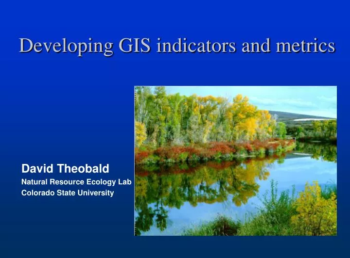
Developing GIS indicators and metrics. David Theobald Natural Resource Ecology Lab Colorado State University. Goals of indicator development. Develop and evaluate landscape-level indicators suitable for spatial and temporal analyses of EMAP data

E N D
Developing GIS indicators and metrics David Theobald Natural Resource Ecology Lab Colorado State University
Goals of indicator development Develop and evaluate landscape-level indicators suitable for spatial and temporal analyses of EMAP data Investigate limitations of currently-available data and offer new, robust methodologies
Current effort • Linkage between watershed and hydrologic networks • Refine surrogates with direct measures of area and discharge • GIS-based tools • RWTools for ArcView • Catchment delineation & discharge in ArcGIS
1. Watershed–hydrological network linkage • “…in every respect, the valley rules the stream.” – Hynes 1975 • Indirect measures based on hydrological properties (e.g., Strahler order, drainage density, etc.)
Distance: • As the crow flies (Euclidean)
Distance: • As the crow flies • As the seed floats (downstream)
Distance: • As the crow flies • As the seed floats • As the fish swims (down & up stream)
Distance: • As the crow flies • As the seed floats • As the fish swims (down & up stream) • Upstream length • mainstem (2) • arbolate (1+2+3+4)
Distance: • As the crow flies • As the seed floats • As the fish swims • Upstream length • Network (dams, fragmentation)
What indicators measure watershed-stream linkage? • Length of stream line • Dam alteration of flow at a downstream gauge? • RWTools extension (ArcView v3.2)
Upstream 66 km Mainstem Upstream 37 km Network 16 km (down) 6 km (up) Downstream 298 km
2. Direct measures of discharge • Surrogates developed, e.g. Strahler order: The usefulness of stream order assumes, with a sufficiently large sample, that order is proportional to stream discharge – Strahler 1957 • Alternatives: • basin area • discharge
Delineate reach catchments • Robust method (no pre-processing) • 1 to 1 relationship NHD reach and catchment • “Grow” watershed from reach line based on flow direction iteratively
Stream discharge • Precipitation D = C * P
20 acft 8 acft 10 acft
R2=0.7282 P-value=3.407e-006
Stream discharge • Encouraging preliminary results • Additional factors (Infiltration, E.T.): • Geology • Land cover • Exposure D = f(C, G, L, E)
3. GIS-based tools • Interactive query and analysis of watersheds (RWTools) (ArcView v3.2) • ArcGIS Geometric network
Plans for next year • Initial release of GIS tools: • RWTools for ArcGIS • Functional-based spatial weights
Spatial weights W = 0 0 0 0 0 0 0 0 0 0 0 0 0 0 0 1 0 1 0 0 0 1 0 1 0 1 1 2 3 5 4
Functional weighting W = 0 0 0 0 0 0 0 0.7 0 0 0 0 0 0 0 0 0 0 0 0 0 0 0 0 0 0 0 0 0 0 0 0.7 0 0 0 0.2 0.8 0 0.2 0.8 0 0 0.1 0.2 1.0 0.1 0.2 1.0 0 1 1 3 2 4 5 7 6 E.g., downstream hydrology
Functional weighting W = 0 1 0 0 0 0 0 1 0 0 0 1 1 0 0 0 0 0 0 0 0 0 0 0 0 1 0 0 0 1 0 1 0 1 0 0 1 0 0 1 0 1 0 0 0 0 0 1 0 1 1 3 2 4 5 7 6 E.g., macroinvertebrates
Plans for next year • Initial release of GIS tools: • Perennial/intermittent frame problem in western US • Development of network fragmentation indices