Line Distance Sampling Method in the Mojave Desert, 2001
250 likes | 362 Views
Explore the successful implementation of Line Distance Sampling method for desert tortoise management in the Mojave Desert in 2001 by various organizations and agencies.

Line Distance Sampling Method in the Mojave Desert, 2001
E N D
Presentation Transcript
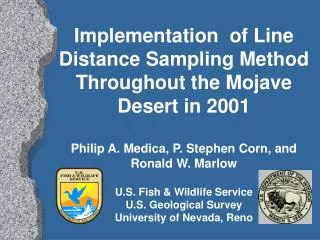
Implementation of Line Distance Sampling Method Throughout the Mojave Desert in 2001Philip A. Medica, P. Stephen Corn, and Ronald W. MarlowU.S. Fish & Wildlife ServiceU.S. Geological SurveyUniversity of Nevada, Reno
Acknowledgements Chambers Group & Kiva Biological Consultants University of Nevada, Reno Utah Division of Wildlife Resources Arizona Game & Fish Department Bureau of Land Management Desert District National Park Service, J.Tree & MNP U.S. Fish & Wildlife Service, Regions 1 & 6 Fort Irwin National Training Center Desert Managers Group Mojave Desert Ecosystem Program Charis Corporation Clark County, NV. Habitat Conservation Plan Washington County, UT. HCP Student Conservation Association
Background • 1990: Desert tortoise listed as threatened • 1994: Critical habitat designated • 1994: Final recovery plan approved • 1998: Comprehensive workshop held on Line Distance Sampling method • 1999: Desert Tortoise MOG accepts Line Distance Sampling methodology
Desert Tortoise Management Oversight Group Signatories • BLM State Directors (CA, AZ, NV, UT) • BLM Washington Office T&E Specialist • State Wildlife Agencies (CA, AZ, NV, UT) • USFWS Field Supervisors (Regions 1,2,6) • USGS- Western Ecological Research Center • National Park Service-Joshaua Tree NP • National Training Center- Fort Irwin • Twentynine Palms Marine Base-MCAGCC
Accomplishments 2000-2001 • Desert Tortoise Coordinator-August 2000 • Implementation meetings rangewide Fall 00 • MOG/TAC Workshop-January 2001 • Field personnel workshop/training Mar. 01 • GSA contract for Line Distance Sampling • All Recovery Units sampled in 2001 using Line Distance method
Expectations for 2001 • Implement LDS in each Recovery Unit • Determine encounter rate for each RU • Support centralized Data Management • Determine g(o) within each Recovery Unit
Results of 2001 Sampling(Encounter Rates) • West Mojave • Fremont/Kramer 0.15 • Superior/Cronese 0.12 • Ord/Rodman 0.18 • Pinto Mountain 0.16 • Joshua Tree Nat. Park 0.11 • Twentynine Palms 0.15
Encounter Rates (cont.) • Eastern Colorado • Chuckwalla 0.12 • CMAGR 0.32 • Northern Colorado • Chemehuevi 0.17 • East Mojave • Mojave National Preserve 0.13 • Shadow Valley 0.05 • Piute/Eldorado 0.07
Encounter Rates (cont.) • Northeast Mojave • combined 0.10 • Beaver Dam Slope 0.06 • Upper Virgin River • City Creek* 0.70 • 2001 Rangewide • Mean Encounter Rate* 0.13
Sampling Methodology 2002 • Conduct Two 2.0 km square transects • Transects use a common point of origin • Buffer point of origin by 700 meters • Two transects sampled during tortoise activity period • Establish additional g(o) locations in NE Mojave-Mormon Mesa, Gold Butte-Pakoon • Initiate modeling of g(o) rangewide
Kilometers needed 2002 • Western Mojave • Fremont/Kramer 517 • Superior/Cronese 654 • Ord/Rodman 421 • Pinto Mountain 148 • Joshua Tree Nat. Park 152 • Twentynine Palms (MCAGCC) 224
Kilometers Needed 2002(cont.) • Eastern Colorado • Chuckwalla 403 • Chocolate Mt.Gunnery Range • Northern Colorado • Chemehuevi 440 • East Mojave • Ivanpah 550 • Fenner-Piute (MNP) 300 • Fenner-Piute (BLM) 200
Kilometers Needed 2002(cont.) • Northeast Mojave • Mormon Mesa 440 • Coyote Springs Valley 200 • Gold Butte-Pakoon (NV) 200 • Gold Butte-Pakoon (AZ) 300 • Beaver Dam Slope (NV) 44 • Beaver Dam Slope (AZ) 44 • Beaver Dam Slope (UT) 40
Training • Training at the Jean, NV March 25-30,2002 • Training lines will be in 3 different locations • 100 m tape technique used • Standardized Data sheets • Data collection using PDAs tested
Preliminary Estimates of Density/km2 in 2001 • Western Mojave • Fremont/Kramer 9.6 + 1.5 • Superior/Cronese 7.6 + 1.4 • Ord/Rodman 11.7 + 1.7 • Pinto Mountain 10.3 + 2.8 • Joshua Tree National Park 7.5 + 1.8 • MCAGCC 9.8 + 2.3
Preliminary Estimates of Density/km2 in 2001 • Eastern Colorado • Chuckwalla & CMAGR 12.3 + 1.9 • Northern Colorado • Chemehuevi 11.1 + 1.7 • East Mojave • Mojave National Preserve 4.7 + 2.4 • Shadow Valley 3.5 + 1.5 • Northeast Mojave 4.1 + 1.1 • Beaver Dam Slope 3.0 + 2.8 • Upper Virgin River
Sampling MethodologyRandom Point Criteria • Include desert tortoise critical habitat and ACECs • Include areas < 1,250 meters elevation, excluding Coleogyne habitat if possible • Include areas < 30% slope • Exclude private land • Exclude non-habitat areas (e.g. playas)