Download
1 / 50
500 likes | 603 Views
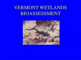
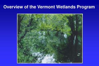
Overview of the Vermont Wetlands Program. Presentation Overview. Vermont Statutory Overview Wetlands Section Overview Staffing and Resources Workload and Project Distribution Project Review Desk Review Field Visits CUD Process Recommendations. Brief History of the Vermont Wetland Rules.

E N D
Presentation Overview • Vermont Statutory Overview • Wetlands Section Overview • Staffing and Resources • Workload and Project Distribution • Project Review • Desk Review • Field Visits • CUD Process • Recommendations
Brief History of the Vermont Wetland Rules • 1986: 10 V.S.A Chapter 37, Section 905(a) (7-9): Established statutory framework for identifying and protecting Vermont’s wetlands • 1990: Vermont Wetland Rules adopted by the Water Resources Board • 2002: Vermont Wetland Rules were updated • 2004: Act 115 of the Vermont General Assembly was passed: Natural Resourced Board was created to succeed the Environmental and Water Resources Boards on February 1, 2005.
Investigations The Panel may open an investigation and issue such orders as it deems necessary to gather information, identify policy issues, and formulate strategies or means for addressing issues within its jurisdiction.
Water Resources Panel Authority 10 VSA 6025[d] Identification & Evaluation of Significant Wetlands The water resources panel may adopt rules, regarding the identification of wetlands which are so significant that they merit protection. Any determination that a particular wetland is significant will result from an evaluation of the enumerated functions which a wetland serves (10 VSA 6025[d(5)]):
Identification & Evaluation of Significant Wetlands The Vermont Wetland Rules recognize that the “statute limits the applicability of these rules to those wetlands which are so significant that they merit protection in this program” (VWR§ 1.1).
Wetland Reclassifications The water resources panel may adopt rules regarding the ability to reclassify wetlands, in general, or on a case-by-case basis (10 VSA § 6025[d][6]). Section 7 of the VWR provides for the Panel, upon receipt of a petition or by its own motion, to determine whether to reclassify any wetland to a higher or lower classification.
Wetland Reclassifications VWR Section 7.5 provides for temporary designation of wetland significance. Such temporary designations shall be for a period of 60 days, unless otherwise specified by the Panel for a good cause.
Wetland Protection Rules The water resources panel may adopt rules protecting wetlands that have been determined to be significant, including rules that provide for the issuance or denial of conditional use determinations by the Department of Environmental Conservation (10 VSA § 6025[d][7]).
Consent of Agency of Agriculture Required The panel shall not adopt rules that restrain agricultural activities without the consent of the Secretary of the Agency of Agriculture, Food & Markets (10 VSA § 6025[d][7]).
Consent of Department of Forests, Parks & Recreation Required The panel shall not adopt rules that restrain silvicultural activities without the consent of the Commissioner of the Department of Forests, Parks & Recreation (10 VSA § 6025[d][7]).
VSWI Maps • VWR § 3.2[b] provides that the VSWI maps denote the approximate location and configuration of significant wetlands. • Actual boundaries of wetlands shown on the VSWI maps shall be determined in the field.
VSWI Maps VWR § 4.5[b] pertains to the “Use and Limitations of VSWI maps.” The VSWI maps should not be relied upon to provide precise information regarding the location or configuration of significant wetlands (see Section 3.2). They are intended to denote the approximate location and configuration of significant wetlands.
VSWI Maps VWR § 4.5[a] provides that the Secretary shall revise the affected VSWI maps annually.
Options for Local Input on VSWI Map Revisions 24 VSA § 4325[4] authorizes municipal planning commissions to undertake capacity studies and make recommendations on matters of wetland protection.
Options for Local Input on VSWI Map Revisions 24 VSA § 4345[6] likewise authorizes regional planning commissions to do the same. A regional plan adopted pursuant to 24 VSA 4348a must include a map and statement of present and prospective land uses which require special consideration for aquifer protection, wetland protection, or for other conservation purposes (24 VSA § 4348a[a][2][A]).
Options for Local Input on VSWI Map Revisions 24 VSA § 4382[a][2] provides a similar requirement for a municipality to adopt a municipal development plan. Some municipalities in Vermont have already mapped the wetlands in their jurisdiction.
VTDEC Authority10 VSA §§ 905[18] and 1272 • Propose to the Panel specific wetlands to be designated as significant wetlands, and; • Implement through existing programs the rules adopted by the Panel governing significant wetlands, including the issuance or denial of conditional use determinations pursuant to 10 VSA § 1272 (10 VSA § 905b[18]). • Conditional Use Determinations: 10 VSA § 1272Regulation of activities causing discharge or affecting significant wetlands.
Challenge to Maps & VWR Rejected by Supreme Court • Sec'y, Agency of Natural Res. v. Irish, 738 A.2d 571 [1999] • Lake Bomoseen Ass'n v. Vermont Water Resources Bd., 886 A.2d 355, [2005]
Wetlands Section Districts • Full Staff is 5 DWE plus Coordinator • Coordinator handles program oversight, plus AOT and Ag projects • Districts have 100+ projects/ year • District Offices located in Barre, Essex and Rutland • Districts change over time and are unique to the Wetlands Program
Wetlands Section Yearly Average Workload (2000-2006) Regulation + Enforcement + Education + Monitoring Education Presentations 30 Enforcement Complaints 68 Violations 41 Office and Field Work Phone Calls 7206 Field Visits 914 Letters 1219 Regulatory CUD Applications 79 CUD Issued 84 On average, work is split up by 5 staff members
2004 Project Overview • 512 New Projects • 98 project carried over • 88 CUDs received • 84 CUDs issued • 1 CUD denied • 1 CUD terminated < 20% of Projects result in a CUD
Clients • Land Owners • Realtors • Businesses • Non Profits • Department of Fish and Wildlife • Department of Forest Park and Rec • VTrans • BGS • Lakes and Ponds Section • Towns • Regional Planning Commissions Wetlands Program Relationships Collaborators • Water Resources Panel • Act 250 Coordinators • Nongame Natural Heritage Program • Fish and Wildlife Biologists • Stormwater Section • Rivers Section • BASS • Lakes and Ponds Section • ANR Planning Section • ANR Enforcement Section • Wastewater Division • Water Supply Division • Towns • Regional Planning Commissions • Department of Forest, Parks and Rec
Project Referrals • Do I have a jurisdictional wetland on my property? • General knowledge of the VT Wetlands Program • Permit Specialists • Referrals from other Regulatory Programs • Complaints • Town Referrals • Consultants and Engineers
Vermont Significant WetlandsInventory Map Aerial Photos National Wetland Inventory Maps GIS Map of VT Significant Wetlands
B A
B A
How are Wetlands Identified in the Field? Manual: 1987 Federal Manual for Identifying and Delineating Jurisdictional Wetlands. To be a wetland, the following three parameters must be present: Hydrology Soils Vegetation
Field Work • Presence or absence of wetland • Jurisdictional determination of wetland class • General location of wetland • Options for avoiding wetland/buffer impacts • Options for minimizing wetland/buffer impacts • Verification of wetland delineations • Determination of function and value of wetland • General information on the importance of that wetland in the landscape
Contiguous Wetlands Contiguous shall mean sharing a boundary or touching and shall include such situations where the water level of the wetland is directly influenced by the water level of the adjacent waterbody or wetland and where a man-made structure (e.g. roadway) divides a wetland, if surface water is able to flow over, under or through that structure. Vermont Wetland Rules, Section 2.07, page 2
Interpretation of Contiguous NOTE: The following guidelines may not pertain to every situation. ANR reserves the right to make contiguous determinations on specific projects within the parameters of the Vermont Wetland Rules and these guidelines. (1) There is a clear continuum of the three wetland parameters between the mapped wetland and the wetland in question. 1a) 1b)
Interpretation of Contiguous (2) A wetland is divided by a man-made structure (e.g. ditch or roadway or other fill), where surface water is able to flow over, under or through that structure.
Vermont Significant Wetland Inventory Maps Limitations • Maps are not supposed to be used in lieu of a delineation • Many Class Three’s not on map but can be significant for many functions • Contiguous issue is confusing to the public Advantages • Gives a general idea of the location of wetlands • Most of the wetlands that are mapped are significant • Creates a jurisdictional threshold
Which Uses Require Conditional Use Determinations (CUD’s)? All uses in the wetland and buffer zone which are not allowed uses, are conditional uses
CUD Evaluation • Use cannot result in undue, adverse impacts on protected wetland functions and values • If there is an undue adverse impact on protected functions it must be mitigated before a CUD could be issued • Cumulative and on-going impacts must also be considered
Cumulative and On-going Impacts • Impacts that are on-going such as stormwater, wastewater, human residence, etc. • Case law suggests “cumulative” can include impacts to a wetland that occurred prior to the Vermont Wetland Rules (February 23, 1990), • Allows a more holistic review of the wetland and previous impacts • May be more important in the future
Mitigation • Avoidance: No practicable upland alternative • Minimization: Reduction in wetland impacts • Restoration: Restore/ replace impacted functions • Creation: Restore/ replace impacted functions through wetland creation
Recommendations • Whether an area is in fact a wetland • Wetland boundary determinations, delineations • Determination of wetland functions and values • Determination of size and configuration of the buffer zone • Contiguity determinations Informal Determinations by ANR become Formal Determinations
Recommendations • The Agency recognizes the utility of the VSWI maps • Rules could allow for ANR Process to update, correct, and improve the maps
Recommendations on Classification • Class One Wetlands through Rule Making • Class Two are presumed “so significant” • Class Three are wetlands found to be not significant after field evaluation • Unmapped wetlands that are significant will become Class Two through an administrative ANR process
Recommendations on Rule Updates • Thorough review and update of the Functions and Values section • Review and update definitions • Develop a clear standard of “Significant” Where do we set the Bar?
General CUD’s and Allowed Uses • To filter out small, minimal impact projects • Routine projects, such as utility line extensions, and highway improvements • Recognize program resources vs. increased jurisdiction
For additional information contact the State Wetlands Program 802-241-3770, www.vtwaterquality.org/wetlands