Download
1 / 36
360 likes | 505 Views
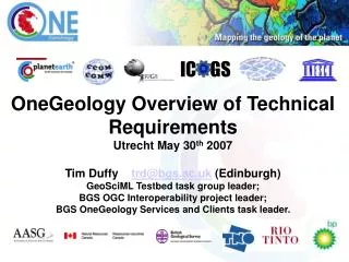
IC GS. Introduction to the Informatics and Data Aspects John Broome ( Canada). J. Broome, Mar. 2007. Contents. Requirements analysis Geological map data Standards/Technology Architectures What are the challenges? Summary. What is OneGeology?.

E N D
IC GS Introduction to the Informatics and Data Aspects John Broome (Canada) J. Broome, Mar. 2007
Contents • Requirements analysis • Geological map data • Standards/Technology • Architectures • What are the challenges? • Summary
What is OneGeology? A project to make web-accessible the best available geological map data worldwide at a scale of about 1:1 million, as a Geological Survey contribution to the International Year of Planet Earth
What is OneGeology? A project to make web-accessible the best available geological map data worldwide at a scale of about 1:1 million, as a Geological Survey contribution to the International Year of Planet Earth
Contents • Requirements analysis • Geological map data • Standards/Technology • Architectures • What are the challenges? • Summary
Requirements Analysis #1 What are the technical requirements of OneGeology? • Receive and integrate diverse geological coverages. • Manage digital map data and metadata • Deliver meaningful and consistent geological map data online.
Requirements Analysis #1 What are the technical requirements of OneGeology? • Access and integrate diverse geological coverages. • Manage digital map data and metadata • Deliver meaningful and consistent geological map data online.
Requirements Analysis #1 What are the technical requirements of OneGeology? • Access and integrate diverse geological coverages. • Manage digital map data and metadata • Deliver meaningful and consistent geological map data online.
Requirements Analysis #1 What are the technical requirements of OneGeology? • Access and integrate diverse geological coverages. • Manage digital map data and metadata • Deliver meaningful and consistent geological map data online.
Requirements Analysis #2 What are other requirements of OneGeology? • Accommodate participants with differing technical capabilities and resources. • Transfer technology and standards know-how. • Be sustainable for the future.
Requirements Analysis #2 What are other requirements of OneGeology? • Accommodate participants with differing technical capabilities and resources. • Transfer technology and standards know-how. • Be sustainable for the future.
Requirements Analysis #2 What are other requirements of OneGeology? • Accommodate participants with differing technical capabilities and resources. • Transfer technology and standards know-how. • Be sustainable for the future.
Requirements Analysis #2 What are other requirements of OneGeology? • Accommodate participants with differing technical capabilities and resources. • Transfer technology and standards know-how. • Be sustainable for the future.
Contents • Requirements analysis • Geological map data • Standards/Technology • Architectures • What are the challenges? • Summary
Geological Map Data How will the data delivered by OneGeology be organized and formatted ? • Image format : • Raster images • paper map scans • Vector Format: • Geological units : polygons & attributes • Faults : vectors/lines & attributes • locations : points & attributes
Workshop Consultation Results What data/maps do workshop participants have ? (accuracy +/- 15%)
Workshop Consultation Results What data/maps do workshop participants have ? (accuracy +/- 15%)
Workshop Consultation Results What data/maps do workshop participants have ? (accuracy +/- 15%)
S Contents • Requirements analysis • Geological map data • Standards/Technology • Architectures • What are the challenges? • Summary
Standards/Technology Formats, models, systems, projections, hardware, software, etc ...? • The technology is available. • standard-based, open vs. commercial • Standards are essential for understanding & interoperability • Geoscience standards: Age?, Lithology?, Stratigraphy? • Data model < = > Conceptual Geology model • Exchange Formats: OGC, GML, GeoSciML? • Online access: WMS, WFS, WCS, etc. • Terminology : multiple languages?
“Schematic interoperability” means: Data in a common data format and structure without harmonizing the content and interpretation between territories. • This approach avoids the requirement to agree upon a single interpretation and legend and will allow delivery of geological coverage for any area of the world. • However: OneGeology will likely contain national "boundary faults" caused by data not being harmonized.
Contents • Requirements analysis • Geological map data • Standards/Technology • Architectures • What are the challenges? • Summary
Architectures Where will the data flow from the source to the user and how will it be managed ? • Some Options : • a) Distributed model • b) Centralized model • c) Hybrid model
Architecture Models: 3 parts Geology Coverage Data Sources OneGeology Data Delivery OneGeology Portal
S S Links and Translation Translation Geology Coverage Data Sources OneGeology Data Access OneGeology Portal = standard OneGeology online data transfer/access
S Access to participant data/maps Translation Geology Coverage Data Sources OneGeology Data Access OneGeology Portal
S Access to Participant Data/Maps How nations provide OneGeology with access to their data will depend on the Architecture model selected. • Options: • a) Scan of paper map • b) Raster map • c) Vector map file (ESRI, Intergraph, etc.) • d) GeoSciML file • e) Online map service (WMS, WFS, etc. ) • f ) ??????????????? Translation (3) Geology Coverage Data Sources (2) OneGeology Data Management (1) OneGeology Data Access
S Data Delivery to Users Translation Geology Coverage Data Sources OneGeology Data Access OneGeology Portal
Translation Geology Coverage Data Sources OneGeology Data Management OneGeology Data Access S Data Delivery to Users How will OneGeology deliver geological information to the world? • Options: • A searchable on-line catalogue of geology maps/data with links to data/images? • Downloadable/viewable images of geology ? • Downloadable/viewable geology vector files ? • Web data services (WMS, WFS) using a standard format/structure ? (GeoSciML?)
S S S S S a) Distributed Architecture Model Participants manage their data locally and make it accessible online for delivery through the OneGeology Web Server WEB SERVER WEB SERVER USER WEB SERVER
S S b) Centralized Architecture Model Participants submit their data for loading into a OneGeology Database which delivers it online through the OneGeology Web Server. 1G DATABASE USER delivery
S S c) Hybrid Architecture Model Data are managed either locally or in the OneGeology Database for delivery via the OneGeology Web Site. 1G DATABASE WEB SERVER USER delivery
Contents • Requirements analysis • Geological map data • Standards/Technology • Architectures • What are the challenges? • Summary
7) What are the technical challenges? What challenges must OneGeology address ? • Participants with a wide range of know-how and resources. • Integration of maps/data with very different format, content, and structure. • Delivering geological information that can be understood by non-specialists from highly technical data. • Establishment of dependable systems that deliver OneGeology data in real time.
Contents • Requirements analysis • Geological map data • Standards/Technology • Architectures • What are the challenges? • Summary
Summary Key points to remember ? • The proposed OneGeology technical approach will: • Accommodate the needs of all participants. • Deliver structurally-consistent geological data online. • NOT require scientific harmonization of geology. • Place importance on the transfer of technology. • Allow participants to provide access to their data in whatever form they have. • Technology is available to meet OneGeology requirements.