Download
1 / 20
200 likes | 314 Views
The ESIP Federation aims to improve Earth science products and services through science-based processes that increase quality and value. Its mission is to enhance the overall quality of life and economic opportunities by ensuring timely access to scientifically sound information. The federation facilitates collaboration among partners to address critical issues, including air quality, and promote efficient data flows. Key strategic goals involve serving as an advisor to the community, enhancing data usability, and educating the public on Earth science and information systems.

E N D
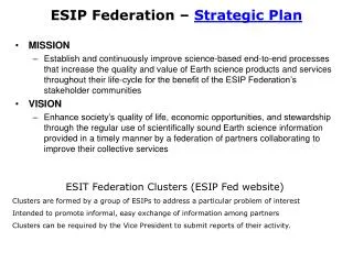
ESIP Federation – Strategic Plan • MISSION • Establish and continuously improve science-based end-to-end processes that increase the quality and value of Earth science products and services throughout their life-cycle for the benefit of the ESIP Federation’s stakeholder communities • VISION • Enhance society’s quality of life, economic opportunities, and stewardship through the regular use of scientifically sound Earth science information provided in a timely manner by a federation of partners collaborating to improve their collective services ESIT Federation Clusters (ESIP Fed website) Clusters are formed by a group of ESIPs to address a particular problem of interest Intended to promote informal, easy exchange of information among partners Clusters can be required by the Vice President to submit reports of their activity.
ESIP Federation Strategic Goals (Tom Yunck slide) 1. Serve as facilitator and advisor tor the Earth science information community. 2. Promote efficient flow of Earth science data from collection to end-use. 3. Improve quality and usability of Earth science data and information systems. 4. Expand the use of Earth science information – get it to the decision-makers. 5. Educate the public about Earth science and science information systems.
Air Quality Data User Agencies Draft ESIP Federation Air Quality Cluster February, 2005
Air Quality – Related Agencies and Organizations Background and Rationale • The ESIP AQ cluster seeks to aid the flow of AQ-related data from the producers to the users • Below is an initial list of agencies dealing with air quality/atmospheric chemistry data • In order to aid the deliberations of the AQ cluster, the following pages summarize the stated AQ-related goals and activities for each agency • Most of these organizations are both producers and users of data, tool and other resources • During its deliberations, the AQ cluster can • Identify the specific activities of these agencies that could benefit from facilitation and advice by the ESIP Federation on information technology • Identify the data, tools and other resources available through ESIPFed • Match the needs and the resources (??) • (In case of mild mismatches, create gateways??)
Air Quality – Related Agencies and Organizations Draft Summary to be completed by the ESIP AQ Cluster EPA – Environmental Protection Agency NPS – National Park Service NOAA – National Oceanic and Atmospheric Administration RPOs – Regional Haze Regional Planning Organizations NASA - National Aeronautics and Space Administration NSF - National Science Foundation WMO/GAW - Global Atmosphere Watch IGAC - International Global Atmospheric Chemistry
EPA (1)J. Bachmann:Air-Related Environmental Challenges for the 21st Century Bachmann AQ Management Challenges • Meeting NAAQ Standards PM/O3/Haze, Toxics NRC Recommendations: • Strengthen technical capacity • Expand multi-state control strategies
EPA (2)NAAMS: National Ambient Air Monitoring Strategy Strategy Implementation emphasis: • Continuous monitoring • Real-time information transfer Application of Monitoring Data:
EPA (3)G. Foley: Data Needs and Priorities of EPA:How the EPA and Federation can work together to reach our common objectives? Goals and Activities: • EPA needs to become a larger user of remotely sensed earth observation data • Define info needs through the use of its decision support tools, the observation and modeling • Seek partnerships with the Earth Observation community
NOAA’s Air Quality Program (1) Forecast Modeling and MonitoringSource: S. Fine: NOAA AQ Program, Sept. 2004 Goals: • Provide information to make well-informed AQ decisions • Provide AQ forecast guidance to better anticipate AQ episodes
NOAA’s Air Quality Program (2) Satellite MonitoringSource: M. Goldberg: NOAA Satellite Operations, Sept. 2004 Goals: • Collaborative with NASA and EPA in support for the AQ forecast program • Help define requirements for satellite-derived AQ products • Help propose new technologies • Help develop AQ products and implement them operationally • *************** Assimilate satellite products **************
Department of InteriorNational Park Service, Air Quality Program IMPROVE Monitoring Program Goals and Activities: ‘To preserve, protect, enhance, and understand air quality … in the National Park System’
Regional Haze Regional Planning Organizations (RPO) • Pollutants that cause regional haze can originate from sources located across broad geographic areas • EPA has encouraged the States to address visibility impairment from a regional perspective • EPA funds five regional planning organizations (RPOs) to address regional haze issues: • evaluate technical information to understand how the States impact Class I areas • develop regional strategies to reduce emissions of PM and causes of regional haze • Mid-Atlantic/Northeast Visibility Union (MANE - VU) • Lake Michigan Air Directors Consortium (LADCO) • Visibility Imp. State & Tribal Assoc. of the Southeast (VISTAS) • Central States Regional Air Partnership (CENRAP). • Western Regional Air Partnership (WRAP) Data analysts working for the RPOs are major consumers of satellite products depicting PM-related parameters
NASA L. Friedl, P. DaCola : Air Quality and Climate Change: Research and Applications Goals and Activities: Research Applications
NASAL. Friedl: NASA Atmospheric Sciences: Research & Applications Goals and Activities:
NSF Atmospheric Sciences/Atmospheric Chemistry Goals and Activities: • Supports research to measure and model the concentration and distribution of gases and aerosols. Supports research on • Chemical reactions in the atmosphere • Sources and sinks of important trace gases and aerosols • Aqueous-phase atmospheric chemistry • Transport of gases and aerosols throughout the atmosphere • Methods for measuring the concentrations of trace species and their fluxes into and out of the atmosphere. • NSF also provides support for participation by the US in international scientific research endeavors, such as the World Climate Research Program.
International Air Quality Programs (1) IGACInternational Global Atmospheric Chemistry Goals and Activities: Coordinated International Projects • To determine the global distributions of atmospheric chemical species and their change over time • To understand controlling processes and their impact on global change and air quality • To improve prediction of atmospheric over the coming decades by integrating atmospheric processes with the response and feedbacks of the Earth System.
International Air Quality Programs (1)GAW - Global Atmospheric Watch The rationale for GAW: • To understand the nature of natural and anthropogenic atmospheric change • Improve the understanding of atmosphere, ocean and biosphere interactions • Provide reliable scientific information for national and international policy makers
Partners • NASA • NOAA • EPA • USGS • DOE • NSF • Industry • Others?? Earth Science Information Partners Vision:“Achieve a sustainable world”by Serving as facilitator and advisor for the Earth science information community Promoting efficient flow of Earth science data from collection to end-use
INFO SYSTEM Links ESIP FED Support of ‘Integrated Solutions’ by ESIP Federation Data Providers Data Users ESIP Federation facilitates the flow of Earth Science data into air quality management systems Air Quality Management System
A Sample of Datasets Accessible through ESIP MediationNear Real Time (~ day) MODIS Reflectance MODIS AOT TOMS Index It has been demonstrated (project FASTNET) that these and other datasets can be accessed, repackaged and delivered by AIRNow through ‘Consoles’ MODIS Fire Pix GOES AOT GOES 1km Reflec NEXTRAD Radar NWS Surf Wind, Bext NRL MODEL