Download
1 / 5
50 likes | 193 Views
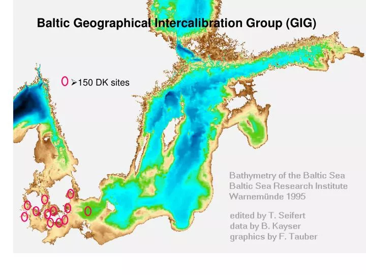
Baltic Geographical Intercalibration Group (GIG). 150 DK sites. CW-B12. (the CW type of LV does not belong here). The term Option 3 was designated for direct comparison of national methods:

E N D
Baltic Geographical Intercalibration Group (GIG) • 150 DK sites
The term Option 3 was designated for direct comparison of national methods: Used where Member States in a Geographical Intercalibration Group (GIG) had already developed national WFD compliant assessment methods, that were technically different, but were applicable to shared types; Class boundary procedure is applied separately by each Member State; National assessment systems are directly applied to a common data set and, subsequently, differences in classification results are evaluated.
Box plot illustrating distribution of EQR values for sites classified by each country as being at High status. Red line represents HG boundary on normalised EQR scale. Solid line represents global mean and dashed lines represent standard deviation of global mean EQR.