Download
1 / 25
250 likes | 325 Views
Explore impact of torrential rains in Central Karakoram using WRF model simulations. Plan to enhance resolution for future climate change research.

E N D
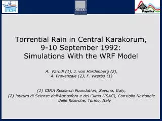
Torrential Rain in Central Karakorum, 9-10 September 1992: Simulations With the WRF Model Parodi (1), J. von Hardenberg (2), A. Provenzale (2), F. Viterbo (1) CIMA Research Foundation, Savona, Italy, (2) Istituto di Scienze dell’Atmosfera e del Clima (ISAC), Consiglio Nazionale delle Ricerche, Torino, Italy
The case study: Severe Rains in Central Karakoram, 9-10 September 1992
Impacts Torrential Rains in Central Karakoram, 9-10 September 1992. Geomorphological Impacts and Implications for Climatic, Kenneth Hewitt, Mountain Research and Development, Vol. 13, No. 4 (Nov., 1993), pp. 371-375.
NUMERICAL MODEL SETTING WRF model 3.3.1 which is a fully compressible, nonhydrostatic, scalar variable-conservings, mesoscale model. Two domains, two-way nesting (IC and BC from ERA-Interim, 08-12 september 1992): Vertical domain size: until to 20 km [~ 60 m near the bottom boundary, ~ 600m near the top one] d01: x =y = 15 km d02: x =y = 5 km Initial and boundary conditions: ERA-Interim Turbulent parameterization: Mesoscale 1D, Yonsei University (YSU) Planetary boundary layer scheme Convection parameterization: Kain-Fritsch scheme Microphysical parameterizations: WSM 6-class scheme and Thompson scheme
9 September 1992: Observed vs predicted (d02, cu1, mp6) daily rainfall depth
9 September 1992: Observed vs predicted (d02, cu2, mp6) daily rainfall depth
9 September 1992: Observed vs predicted (d02, cu1, mp8) daily rainfall depth
9 September 1992: Observed vs predicted (d02, cu2, mp8) daily rainfall depth
10 September 1992: Observed vs predicted (d02, cu1, mp6) daily rainfall depth
10 September 1992: Observed vs predicted (d02, cu2, mp6) daily rainfall depth
10 September 1992: Observed vs predicted (d02, cu1, mp8) daily rainfall depth
10 September 1992: Observed vs predicted (d02, cu2, mp8) daily rainfall depth
Initial conditions uncertainty: water vapor columnar content, 8 september1992
Observed vs predicted: water vapor columnar content, 8 - 11 september1992 (cu2, mp6, 5 km)
H_DIABATIC cross section (lon=72.9, d02, cu2, mp6): 9 september 1992, 15 UTC
W cross section (lon=72.9, d02, cu2, mp6): 9 september 1992, 15 UTC
Single-event case, next steps: finer resolutions? • We are thinking about adding d03 at 1 km, upper limit of the so-called cloud-permitting range: • Most of the assumptions of radiative schemes are breaking-down at this resolution over such very complex-orography regions; • 1 km is also the “gate” for the “terra-incognita” region for the turbulence closure: unclear if we may want to use 1D or 3D/LES approaches • But certainly at 1 km over complex orography the 1D closure scheme fails • Serious impact on the computing time step!
STATION Local (m)
The goal of the project is to characterize the precipitation climatology and potential hydrologic impacts in these areas at very high spatial resolution (up to about 4 Km, corresponding to the “cloud-permitting” range, representing a leading-edge limit for climate change research), for three future time-slices in the periods 2046-2050, 2071-2075 and 2096-2100. We will characterize changes in the amplitude of the probability distribution of precipitation intensities, of the length of dry periods and of the duration of precipitation events. In particular in the framework of the project we will characterize changes in the amplitude probability distribution of precipitation intensities, of the length of dry periods and of the duration of precipitation events.