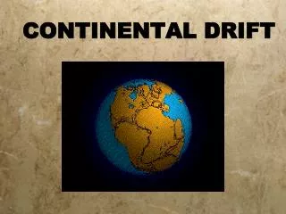
Continental Drift
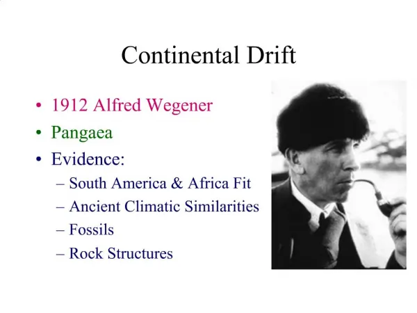
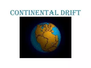
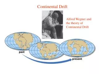
Continental Drift. What do you think that means?. What do you notice about the continents on this map?. Continental Drift…. This theory was proposed by Alfred Wegener , a German scientist about 100 years ago.

Continental Drift
E N D
Presentation Transcript
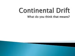
Continental Drift What do you think that means?
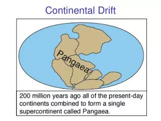
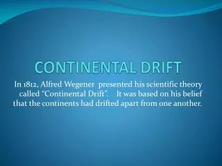
Continental Drift… • This theory was proposed by Alfred Wegener, a German scientist about 100 years ago. • He hypothesized that the continents were not always in the same location that they are today, but that they have “drifted” there over millions of years. • He proposed that millions of years ago – the continents were all attached in one “super-continent” called PANGAEA. • Pan – means “all” and “Gaea” means Earth in Greek.
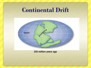
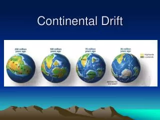
His theory of what happened… • 250 million years ago, was Pangaea • 220 million years ago… it started to drift apart.
How did he come up with this theory? … Evidence. • #1: Alfred Wegener looked at maps of the world and noticed all the continents looked like puzzle pieces that “fit together”. North America Africa South America
Evidence… • #2: He looked at Fossil evidence (mountain ranges, rocks, valleys, fossils, etc…) • Mountain Ranges: He noticed that mountain ranges that began on one continent, ending at the coast-line, seemed to continue on another continent across the Ocean!
a) Rock structures: The types of rocks (and rock layers of the crust) were similar on different continents • Eg. Rocks found in Newfoundland(North America) are the same type and age as rocks found in Greenland and Ireland/Scotland(Europe)
b) Fossils: Similar fossils were found on different continents. • One fossil that intrigued him was Mesosaurus(a sharp-toothed freshwaterreptile). These fossils have only been found in 2 places – Southeastern “South America” and Southwest “Africa”
There were many other fossils where he found the same thing. • Gossopteris (a fern). It’s fossils were found on every continent including Antarctica…It can’t grow in cold temperatures, so Antarctica must have been warmer millions of years ago because it must have been closer to the equator. • CynognathusandLystrosaurus(land dwelling creatures)Fossils found on different continents. They could not have swum that far to get onto different continents …so the continents must have been joined.
Evidence… • #3: Paleoglaciation – the study of ancient glaciers (big masses of ice) and the markings they have left behind.
During ice ages, when glaciers covered the lands, they moved and left marks behind them (large U-shaped valleys and deeply scratched rocks) • Glacier evidence has been found in tropical areas (areas that don’t get cold) • The idea seemed to be that if these areas were closer to the South pole at one point – this would make sense….pointing again to the idea of the continents being connected.
No pattern… A Pattern!
One last Piece of evidence… • #4:Coal deposits were found in Antarctica. • Coal deposits come from once living creatures (usually Tropical swamp material) • Antarctica has not had a tropical climate… so therefore… it must have been warmer and closer to the Equator at some point way back in time.
Summary of Evidence for Continental Drift… • 1) Map show that continents fit together like puzzle pieces • 2) Mountain ranges that seem to be split between 2 distant continents • 3) Fossils/Coal found on different continents • 4) Paleoglaciation pattern that makes sense if continents were once connected.