Download
1 / 16
160 likes | 277 Views
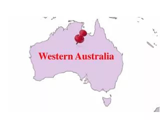
Assessment of Geoid Models off Western Australia Using In-Situ Measurements. X. Deng School of Engineering, The University of Newcastle, Australia R. Coleman School of Geography and Environmental Studies, University of Tasmania , Australia K.R. Ridgway

E N D
Assessment of Geoid Models off Western Australia Using In-Situ Measurements X. Deng School of Engineering, The University of Newcastle, Australia R. Coleman School of Geography and Environmental Studies, University of Tasmania, Australia K.R. Ridgway CSIRO Marine and Atmospheric Research , Australia
Introduction • The Leeuwin Current (LC) in the Indian Ocean off Western Australia flows rapidly poleward. • It is a narrow and meandering current near the continental shelf break from 22°S. • The spatial structure of the mean flow in the LC is influential down to the mesoscale. • A full scale of mean ocean dynamic topography is needed in the LC.
Introduction (cont.) • To understand the ocean water flowing in the LC, it is crucial to know the following fundamental quantities: • Marine geoid – a gravitational potential surface determined by the Earth’s gravity field. • Mean sea surface (MSS) - measured by satellite altimeter sea surface height measurements. • Ocean’s mean dynamic topography (MDT) - the dynamic height difference between the marine geoid and MSS.
A Regional Geoid • A gravimetric geoid model AUSGeoid98 (2'2') exists over the Leeuwin Current. • It was computed using data from • the EGM96 global geopotential model, • the 1996 release of the Australian gravity database (both over land and in marine areas), • a national-wide digital elevation model (DEM), and • satellite altimeter-derived marine gravity anomalies. • The geoid height is related to GRS80 ellipsoid. • Comparisons of AUSGeoid98 with GPS and Australian Height Datum heights across the continent indicate an RMS agreement of ±0.36 m. • However, no comparison results presented over oceans.
Global Geoids • The recently released Earth geoid models from GRACE have reached ~20 cm accuracy at the spatial scale of ~350 km. • The geoid GGM02C can be used to estimate the temporal mean circulation at the spatial scales ~300 Km (Jayne, 2006). • However, we want to know how it works in coastal areas. • EIGEN-GL04S1 (satellite-only and released in 2007)
Objectives • To quantify the accuracy of the geoid, especially the regional geoid in the LC. • To assess the geoid using independent dynamic heights from oceanic in situ data.
Data – Altimeter Measurements • ~9.5 years of TOPEX SSHs from Jan 1993 to Jul 2002 (cycles 11 – 364). • All near coastal data with the Alt-Bad flag setting have been deleted. • 22 tracks are selected.
Data – Geoid, MDT Models and MSS • Geoid models: • The AUSGeoid98 (2'X2') model (Featherstone, 1998). • The GGM02C from GRACE data (to degree and order 200). • MDT models: • The CSIRO OFAM (1992 – 2004) regional MDT. • The CSIRO Atlas of Regional Seas (CARS) (Ridgway et al., 2002). • The Global Ocean Data Assimilation Experiment (GODAE) MDT (Rio and Hernandez, 2004). • CLS01 MSS model (2'X2').
Along-track Comparison among MDTs • An along-track MDT is computed by subtracting the AUSGeoid98 from altimeter derived along-track mean profiles. • Along-track mean sea surface profiles are computed using TOPEX data from cycles 11 – 364. • A procedure of the collinear and outlier detection is used for computing the along-track mean profiles. • The MDT is then compared with existing MDTs. • The MDT at any along-track point is interpolated using the MDT grid. • A filtering procedure was applied to both the MSS and geoid with a filter radius of 333 km (related to degree and order 60).
Along-track Mean Profile Comparisons among MDTs • MSS–AUSGeoid98 • OFAM • Rio’s MDT
Comparisons among MDTs along-track a101. - Biases exist among 3 data sets. - MSS-AUSGeoid98 shows a similar trend to others.
CARS and the MDT Grid Comparison (Mean-Tide System) • MSS CLS01 – AUSGeoid98 • CARS
CARS and the MDT Grid Comparison (Mean-Tide System) • MSS CLS01 – GGM02C • CARS
CARS - (CLS01-AUSGeoid98), • standard deviation:1.86 m • CARS - (CLS01-GGM02C), • standard deviation:1.23 m
Conclusions • When using CARS as an independent MDT around Western Australia, the MDTs computed from the CLS01 MSS and geoids (both regional and global) do not agree well and show larger standard deviations of 1.86 m and 1.23 m, respectively. • The MDT computed from the Topex along-track MSS and AUSGeoid98 shows a larger bias (or systematic error) ~1 m when compared to other MDTs. • The bias also exists between different MDTs. • When using recently geopotential model GGM02C, the omission error caused by the spatial filtering procedure is observed. Therefore, it is important to find an effective filter in coastal oceans. • The filtered geoid GGM02C at the spatial scales of ~330 km is still too coarse to describe the current characteristics of the LC • Further investigation of the accuracy of geoid models over a range of wavelengths, and improvement of the regional geoid are needed.