Download

1 / 10
100 likes | 118 Views
Detailed schedule for DYNAMO research cruise legs, TOGA radar scanning process, staff training plan, and data management instructions. Training by Timothy Lang, Steve Rutledge, Brenda Dolan & Nick Guy.

E N D
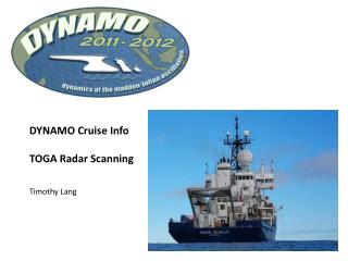
DYNAMO Cruise Info TOGA Radar Scanning Timothy Lang
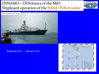
Revelle Ship Schedule DYNAMO Leg 1 23 August Arrive Port Darwin Install TOGA Radar 29 August Depart Darwin, Australia Schedule as of 27 April 2011
Revelle Ship Schedule DYNAMO Leg 1 5 September Arrive/Depart Cocos (Keeling) Islands Staff exchange
Revelle Ship Schedule DYNAMO Leg 1 26 September Arrive Tuticorin, India (aka Thoothukudi)
DYNAMO Leg 2 29 September Depart Tuticorin Park at 80 E (or further east) on Equator 31 October Arrive Tuticorin DYNAMO Leg 3 5 November Depart Tuticorin Park at 80 E (or further east) on Equator 10 December Arrive Tuticorin DYNAMO Leg 4 14 December Depart Tuticorin Pinkel Cruise 5 January Arrive Tuticorin
Major Scan Period - 30 minutes Three minor periods plus single low-PRF 0.5° sweep (300-km range) Minor Scan Period - 10 Minutes 8-10 minutes full 360° PPI volume 0-2 minutes RHIs PPI, then RHI PPI, then RHI PPI, then RHI PPI, then RHI PPI, then Surv PPI, then Surv 0 30 min 60 min Three Scan Types for PPI Volumes (150-km range) Scan A - SHALLOW: 5 minutes emphasize shallow angles, repeat Scan B - FAR: 8-9 minutes, top 15-18 km beyond 30-40 km range, emphasize vertical resolution Scan C – NEAR: 8-9 minutes, top 15-18 km within 30-40 km range, reduced vertical resolution One RHI set Scan D – 1-2 minutes, 2 ° s-1 rate, up to 40° elevation, 3-6 sweeps total
Scan A – Run when there is nothing but sea clutter, or extremely shallow echo Scan B – Default scan for 70-90% of raining periods Scan C – Run when tall convection is very close to ship Progress from Scans A to B to C as highest elevation angle becomes insufficient to top convection. Must anticipate as we change volumes on the 10s, not 5s. Progress from Scans C to B to A as the highest elevation angle of the next shallowest scan becomes sufficient to top convection Scan A will last 5 minutes and repeat (probably run a little shorter than 5 min to allow time for long-range single sweep every 30 minutes) Precip Scans (B & C) will last 8-9 minutes, timing and angles TBD The remaining time before the 10 minute mark will be filled with preset RHI sweeps (Scan D) Every third minor period, RHIs will be replaced by single long-range sweep Will make use of timing capabilities in IRIS scan controller software
Timothy Lang will work with Steve Rutledge, Brenda Dolan, and Nick Guy to design angles and timing for all scans Timothy Lang and Nick Guy will finalize all scans while on Leg 1, and will provide training documents (as well as in-person training to Leg 2 staff) at the end of Leg 1 Leg 2 participants, Nick and Timothy will train you in Tuticorin on 27 September. We leave 28 September, one day before the ship departs. Also recommend Legs 3 and 4 staff work with previous Leg’s staff to set a date for in-person training in Tuticorin. Plan for 8-12 hour shifts, single scientist at a time, 24/7 ops. Scientists will be responsible for calling switches between A, B, & C, and for setting azimuth angles for Scan D. You will take notes in a single word-processing document for the entire cruise, bring a copy of that document, along with data/imagery, with you when you disembark. New Leg starts a new scientific notes document.
Plan for radar imagery 1. Install Texas A&M software on CSU laptop 2. Archive data (UF or Raw) on CSU drives 3. Run software daily to create a set of daily summary images 4. Transfer imagery to Internet-capable computer via thumb drive 5. Upload imagery once per day to DYNAMO servers