Download
1 / 29
290 likes | 416 Views
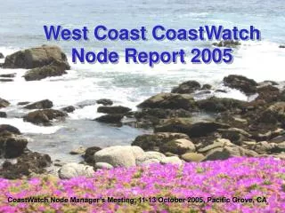
West Coast CoastWatch Node Report 2005. CoastWatch Node Manager’s Meeting, 11-13 October 2005, Pacific Grove, CA. West Coast CoastWatch Node. Environmental Research Division (formerly PFEL) NOAA/NMFS/SWFSC Pacific Grove, CA. Cara Wilson Node Manager Dave Foley Node Coordinator

E N D
West Coast CoastWatchNode Report 2005 CoastWatch Node Manager’s Meeting, 11-13 October 2005, Pacific Grove, CA
West Coast CoastWatchNode Environmental Research Division (formerly PFEL) NOAA/NMFS/SWFSC Pacific Grove, CA Cara Wilson Node Manager Dave Foley Node Coordinator Luke Spence Operations Officer Bob Simons Products Manager Special thanks to Lynn DeWitt and Roy Mendelssohn at NOAA/NMFS/SWFSC/ERD
Outline • Brief history • What’s new in FY05 » OceanWatch Live Access Server » New CoastWatch Data Browser Tool • Project highlights in FY05 • Summary
West Coast Regional Node History 1993 Started operating at NMFS/SWFSC in La Jolla, CA under Mike Laurs Ron Lynn becomes node manager, Rich Grosgvor node coordinator Apr. ‘03 Moved to NMFS/SWFSC/PFEL (now ERD)Dave Foley (coordinator) & Mike Laurs (manager) Jan. ‘05 Mike Laurs retires, Cara Wilson new node manager Jan. ‘05 Bob Simons (Products Manager) andLuke Spence (Operations Officer) join the WCRN team
Ocean Watch LAS http://las.pfeg.noaa.gov/OceanWatch.html Near Real Time Delayed, Science Quality SST AVHRR, 11 km, global AVHRR, 1.25 km, west coast GOES, 5.5 km, West. Hemi. MODIS, 5 km, global Chlorophyll SeaWiFS, 1.25 km, west coast MODIS, 1.25 km, west coast MODIS, 5 km, global Winds QuikSCAT, 0.25°, global SSH JASON, 0.25°, global SST AVHRR Pathfinder, 0.1°, global AVHRR POES, 0.1°, global Chlorophyll SeaWiFS, 0.1°, global MODIS, 0.05°, global OCTS, 0.1°, global Winds ERS-1&2, 1°, global QuikSCAT, 0.5°, global SSH AVISO, 0.25°, global
Live Access Server (LAS) • Allows for one-stop data browsing • Can transparently serve any data set on any other LAS • Can transparently serve any data set that is OpenDAP/DODS enabled • Can output digital data in a variety of formats • Meets preliminary IOOS DMAC “suggestions” http://las.pfeg.noaa.gov/OceanWatch.html Special thanks to Lynn DeWitt and Roy Mendelssohn at NOAA/NMFS/SWFSC/ERD
New CoastWatch Browser • ~ 31 different users per day • ~ 20 web pages served per user • 95% of web pages served in < 2 seconds (including cached web maps and maps generated on-the-fly) http://coastwatch.pfel.noaa.gov/coastwatch/CWBrowser.jsp
New CoastWatch Browser http://coastwatch.pfel.noaa.gov/coastwatch/CWBrowser.jsp
New Browser - Datasets SST, 1 km SST, 11 km SST Pathfinder SST GOES SST NASA Aqua Chl-a OSU Aqua Chl-a SeaWiFS Chl-a Zonal Wind Merid Wind Div Wind Mod Wind Zonal Wind Stress Merid Wind Stress Mod Wind Stress Stress Curl Ekman Upwelling Zonal Ekman Merid Ekman Mod Ekman Front Probability Bolded datasets are all available by OPeNDAP
New Browser - Options… Multiple set map regions or user defined Different units available: Chlorophyll: kg/m3 or mg/m3? Temperature: °C or °F? Wind: m/sec or knots? Upwelling: m/sec or m/day? Divergence: sec-1 or 106 sec-1? Composite data: 1, 3, 8 or 14 days Overlay bathymetry Overlay vector data (wind or ekman current) Change color palette (14 available) Scale can be linear or log Min/max range easily changed
New Browser - File Formats •.asc - ESRI ASCII grid file (portable into GIS) •.grd - GMT .grd file, also a valid NetCDF file •.hdf - Hierarchical Data Format file, works with the CoastWatch Data Analysis Tool (CDAT) •.mat - Matlab binary file •.nc - NetCDF binary file, compliant with COARDS, CF-1.0, THREDDS ACDD and CWHDF metadata specifications •.xyz - tab-separated ASCII file OPeNDAP access for most datasets FGDC - .xml file with FGDC metadata
New Browser - Summary • Demonstrates the viability of accessing data from remote sites, notably via OPeNDAP servers • Distributes data in several formats, not just pretty pictures • User always presented with all, and only, the valid options • Browser options contained on one page • Good quality, instant feedback (a map) given about data • Customizable maps • Works on all browsers and all operating systems • Was built relatively quickly by one person (many kudos to Bob Simons!), using only open-source software • Provides metadata • Is fast!
New Browser - Impacts • Designed to accommodate emerging west coast regional association of IOOS • Gulf of Maine Ocean Observing System (GoMOOS) has asked if they can have the code to implement this system for their region
WCRN Correspondance Statistics Total: 49 (about 1/week) Fishers Unknown Students Private Research
Recent and Near-Future Additions • Primary productivityWilson, R2O • GOES frontal probability indexMavor, CIOSS • Chlorophyll anomaliesKudela (UCSC), Stumpf (NOAA/NOS) • Wind field anomalies (stress, curl etc…)Chelton, CIOSS • Extended 1km SSTStrub, CIOSS
Some Project Highlights • Ghostnet • Marine Protected Areas (MPA) • TOPP (Tagging of Pacific Pelagics) • BloomWatch • Cruise Support
Ghostnet Program - Rationale Minimize navigation hazards Reduce wasteful “Ghost fishing” Protect endangered species Maintain healthy coral reef ecosystems
Ghostnet Approach Satellite data to identify convergence zones • Infer with Ocean Color, SST, vector winds • Observe with specially tasked SAR Aircraft to confirm presence of debris1 • Designating “hot spots” • Deploy drifting buoys to track debris fields2 Interdiction with ships already on station2 • Possible use of helicopter to optimize collection 1D. Foley and L. Spence from WCCW participated in these flights 2Planned for FY06
Using oceanographic data to define Marine Protected Areas • NMFS/SWFSC/ERDF. Schwing, D. Foley, P. Stegmann, S. Bograd, D. Palacios, C. Wilson • NOS/MBNMSH. Price, C. King, J. Pederson • NPS J. Paduan
Marine Protected Areas (MPA) Upwelling: water with T < 12°C Front: gradient > 0.05°C per km Offshore: water with T > 15°C
MPA Characterization Winter Spring Summer Fall
Front Probability July 8-17, 2004 Maps from new browser, Dataset courtesy of Chelton, CIOSS July 8-17, 2005
TOPP Animal track over bathymetry Animal track over GOES SST
Bloom Watch July 10-Sept 16, 2005
Cruise Support (not a complete list…) • Peter Franks (Scripps) HAB cruise in CA bight • Liz Clarke (NOAA/NMFS/NWFSC) Groundfish survey & assessment • Cynthia Tynan (WHOI) Hecata Bank suspected toxin poisoning survey • Rosenfeld, Murphree, Collins (NPS) Quarterly teaching cruises • Rich Charter (NOAA/NMFS/SWFSC) CALCOFI egg counting cruises for stock assessment • Barbara Block (Stanford/HML) Semester-at-sea teaching program • Veerstra (Airborne Technologies Inc.) and NOAA GhostNet aerial surveys of debris in the N. Pacific
Looking Forward… MODIS Aqua 250m “Sediment Loading”
Summary • New & improved data delivery systems, designed to accommodate RA/IOOS requirements, and based on user feedback and requests: » OceanWatch Live Access Server » New CoastWatch Data Browser Tool • Continued responsiveness to user needs through adding new products and supplying customized products in support of fishery-related research cruises • To quote the admiral, “our people are our most valuable assets” – the phenomenal improvements to WCRN services wouldn’t have been possible without Dave Foley, Bob Simons and Luke Spence