Download
1 / 21
210 likes | 328 Views
Explore the DARPA PerceptOR program by Carnegie Mellon University, analyzing autonomous ground mobile robot technologies for enhanced reliability, autonomy, and speed in challenging terrains. The project includes man-machine team systems, performance metrics evaluation, and advanced motion planning architectures.

E N D
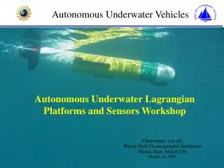
Reliable Off Road Autonomous Vehicles in Challenging Environments DARPA Program Carnegie Mellon University
DARPA Program • DARPA PerceptOR • “Perception for Off Road Navigation” • Followed by LAGR (Learning Applied to Ground Robots) • Outdoor autonomous mobility research • 3 years • 500,000 lines of source code • 30 man years of effort
PerceptOR • Goal • Project : Assess the readiness of technologies for autonomous ground mobile robots • System: Maximize autonomy, reliability, and speed • System • Man-machine team • One (remote) operator • One ground robot - UGV • One air robot - UAV
PerceptOR • Performance • Metrics that quantify performance • # of times of intervention by field personnel • Emergency stops by robot, operator, field personnel • Communication bandwidth • System ability to reach waypoints • Instantaneous and average speeds • Distance • Time • All data is recorded for further analysis
PerceptOR • Blind evaluative testing • Unrehearsed testing • Remote Operator • Only video and data telemetry information • Provided GPS waypoints • Field team • Follow robot in field for robot safety (ESTOP) and data collection • Analysis team • Access to all data, “Situation room” • Assess or correlate among what the robot thinks, operator thinks, and what is really happening,
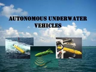
Unmanned Vehicles • Unmanned Aerial Vehicle • - GPS, IMU • Computers • Ladar and stereo sensing • Range and obstacle data • - Ladar • Cameras • Unmanned Ground Vehicle • INU, computers • range image perception, • local/global planning, • video, stereo ranging, • control • Pose Sensors • Mapping, Obstacle Sensors • Teleoperation Sensors
Reactive Planning and Control • Monitor system health and react to danger • Closed coordinated control loops using information from above layers of multi-layer design (vehicle state estimates from estimator – layer above) • Trajectory following • Timeout Exceptions • Collision Exceptions
Perceptive Autonomy • Processing sensor information • Proximal and/or immediately visible environment
Mapping • Process of recording, organizing, transforming, registering, resampling, and fusing multiple sources of information
Motion Planning • Motion planning architecture • Local region planning • High fidelity models of vehicle shape and maneuverability for reliable obstacle avoidance • Online convolution of rectangular vehicle model for a number of continuous paths, derived from terrain map encoding elevation as a continuous variable • Ranger local planner • Global planning • Less detailed models of both vehicle and environment • Heuristic search in an 8-connected grid where the convolution is approximated and pre-computed into a 2D configuration space • D* global planner • Estimated cost of local portion of each alternative is assed to the estimated cost of the global portions, and a penalty is added for any misalignment of the two portions at a point of joining
Motion Planning • Motion planning architecture
Local Motion Planning • Designed for high speeds over barren terrain • High speed motions - constraint • Forward modeling is used to predict response trajectories from a pre-stored set of steering and speed commands, which are intended to span the space of feasible motions more or less uniformly
Global Motion Planning • Required to estimate the remaining path cost from the ends of the local path planner’s candidate paths to the next goal • D* algorithm • Finds optimal (lowest-cost) path between the current location and the goal • Real time • Switched to Field D* • Uses interpolation so paths not need to pass through vertices of the grid • Interpolation-based smoothing during the planning process to select paths much closer to true optimal
Behaviors • The fusion of the local and global planners are used when the system is moving at reasonalbe speed over the terrain • Navigate behavior • If errors in global map, no map, etc., • vehicle will stop. • Prioritized behaviors are utilized to deal with the stopped vehicle • Navigate – moving with planners • Lookaround – scan area • Goaround – reactive backup and turn maneuver (multiple times) • Planaround – nonholonomic motion planner • If fail, ask for operator assistance