Download
1 / 15
150 likes | 252 Views
An in-depth project aimed at identifying a representative conservation network utilizing systematic conservation prioritization principles, vegetation types, and species data. The project establishes conservation targets and identifies critical vegetation types to conserve biodiversity across various habitats. By evaluating existing reserves, candidate sites, and natural habitat remnants, the study determines corridors linking significant areas to account for ecological gradients and climate change impacts. The analysis results in the selection of 261 sites within major corridors and nodes ("biodiversity hubs") to ensure effective biodiversity conservation.

E N D
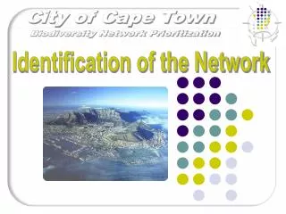
2001/2002 a project aimed at identifying a representative conservation network initiated by the Environmental Management, CCT. • Representative of biodiversity • Scientifically rigorous (Systematic Conservation Prioritization principles) • Approach used similar to that used for the C.A.P.E. and SKEP projects • Established Conservation Targets using vegetation types and species. • Vegetation types identified and used as the primary biodiversity layer. Low 2000 • Vegetation layer was based on the combined use of geology, rainfall and landscape form. • Floral data complemented this from the Protea Atlas and Species and Sites data base (Coastec)
Msh Wsh Mountains Mountain Fynbos Mshk West Coast Renosterveld Koppies Mg Recent Inland Wq Shales Mountains Dune Thicket-Sandplain Fynbos Transition Mgk Granites Wq Koppies Precipitation<700 mm p.a. Precipitation>700 mm p.a. Mq Recent Inland Sandstones Ms Calcareous Substrates Acid Sands Older Inland Si Dc Sand Recent Inland Dune Thicket Sq Sand Plain Fynbos Marine Limestone Dl Sm DS
Mountain Fynbos • on granite • on granite koppies • on Shale • on on Shale >80mm Rainfall • on Sandstone • non-marine derived acid sands
Sand Plain Fynbos • on inland, non- marine-derived (older) acid sands • on marine-derived acid sands • non-marine- derived recent acid sands
Dune Thicket • on calcareoussand • on limestone • transition withdune thicket
Renosterveld • on granite • on shale • inland, non-marine-derived • clay/loam sandy loam
An initial set of 886 remnants were identified from high resolution imagery • This study identified a set of 261 remnants (32 262ha) – C-Plan analysis • This complemented an existing protected areas representing about 54 293 ha • Corridors were then identified, which linked the following significant areas; Zandvlei, Macassar, Gordons Bay, Cape Point, Noordhoek Wetlands, West Coast, Mamre and Paardeberg • Ecological gradients are conserved, and to account for the predicted impacts of global climate change • Nineteen corridors were identified, along with 18 nodes • Nodes were originally seen as areas where the corridors intersect but has been re-interpreted as remnants or groups of remnants (“biodiversity hubs”)
All Natural Habitat Remnants Identified • 886 Sites
Existing Reserves and Floral Core Sites • 186 Sites
Candidate Sites • 738 Sites
221 sites selected from the vegetation types • 5 sites selected from Protea Atlas data • 35 Sites selected from Coastec SaS database 261 Sites identified
Least Resistance pathway based on Cost Surface models which represent biodiversity compatibility • Need a starting POINT • Need a target LINE Use a Bi-directional Pathway
All sites selected by the Biodiversity analysis and within the Major Corridors = 86 sites
Critical Vegetation Types • Initial prioritisation of the selected remnants was based on remnant size and the conservation of three critical vegetation types • Secondary prioritisation on whether the remnants were located in nodes or corridors • 71 sites identified that were larger than 10ha • 97 sites identified conserving at least one of the three critical vegetation types • 69 sites identified to include remaining remnants greater than 10ha • 25 sites left over from the selected set of 261 sites • 86 selected sites in corridors • Sand plain fynbos on inland • Older non-marine derived acid sands, • West coast renosterveld on shale west coast renosterveld on granite