Download
1 / 33
330 likes | 447 Views
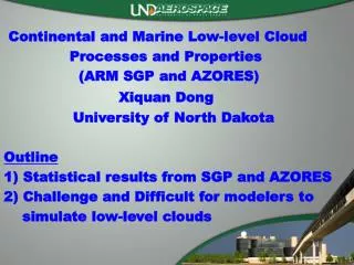
Continental and Marine Low-level C loud Processes and Properties (ARM SGP and AZORES) . Xiquan Dong University of North Dakota Outline 1) Statistical results from SGP and AZORES 2) Challenge and Difficult for modelers to

E N D
Continental and Marine Low-level Cloud Processes and Properties (ARM SGP and AZORES) Xiquan Dong University of North Dakota Outline 1) Statistical results from SGP and AZORES 2) Challenge and Difficult for modelers to simulate low-level clouds
Question to be partially answered What processes determine the formation, persistence and evolution of cumulus, stratocumulus and stratus clouds in both WARMand cold climates? Radiation-turbulence-entrainment-microphysics-drizzle-precipitation interactions Role of large-scale vs. local-scale Impacts of aerosols (AIE, such as CCN vs. cloud re/Nd…..) Similarities and differences between Marine and continental low clouds. Key instruments at SGP, AZORES, NSA …… Relevant focus groups: Entrainment, VV, QUICR….
Similarities and differences between Marine and continental Low clouds Del Genio and Wolf (2000) explained and discussed this topic and concluded that the formation-dissipation processes of marine boundary layer clouds can be mostly applied to continental boundary layer clouds. Dong et al. (2005) documented 6-yr of low-level cloud properties over the ARM SGP site, and also discussed this topic (following DW2000 paper). Marine boundary clouds during ASTEX (June 1992, Albrecht et al. 1995, Miller et al. 1995, Dong et al. 1997). The ARM AMF deployment at AZORES (Wood et al. 2011, 2012) during May 2009-Dec. 2010 provided a great opportunity for us to investigate this topic.
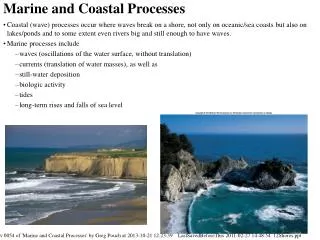
Similarities and differences between Marine and Continental low clouds Over the water, the moisture comes directly from the surface, which also maintains a relatively stable temperature throughout the day. The cloud layer undergoes a coupling and decoupling with the surface air over the diurnal cycle(DW2000) Over land areas, the water vapor is typically advected into the region with an air mass except when the surface is moist. The stratus is often formed as part of a cyclonic system. It is not surprising that the moisture and cloud layer over the SGP can be decoupled from the surface (DW2000)
A conceptual model of midlatitudeMarine Boundary Layer (MBL) Clouds A Based on aircraft in situ data, Paluchand Lenschow(1991) developed a conceptual model of the life cycle of MBL in the midlatitudes. It starts initially as a thin, homogenous layer (A), then grows thick and becomes patchy with time and produces precipitation (B & C). This stage is followed by the formation of small cumuli below (D) and eventually disintegrates, leaving a field of cumuli behind. B C D
19 months of AZORES radar-lidar data A Based on aircraft in situ data, Paluchand Lenschow(1991) developed a conceptual model of the life cycle of MBL in the midlatitudes. It starts initially as a thin, homogenous layer (A), then grows thick and becomes patchy with time and produces precipitation (B & C) . This stage is followed by the formation of small cumuli below (D) and eventually disintegrates, leaving a field of cumuli behind. B Total CF=0.69 Low CF=0.32 Mid CF=0.01 High CF=0.09 More MBL clouds during night and morning than afternoon. Thus solar radiation is a kind of destruction of MBL clouds. C D Del Genio and Wolf (2000) explained and discussed, in detail, the similarities and differences between marine and continental boundary layer clouds, and concluded that the formation, maintenance, and dissipation processes of MBL clouds can be mostly applied to continental boundary layer clouds. Dong et al. 2012
MBL cloud formation process Courtesy: Dr. Dave Stevens, LLNL
A NEW conceptual model of Continental Low-Level clouds (ARM SGP, Dong et al. J Clim 2005) The low stratus cloud amount monotonically increases from midnight to early morning (0930 LT), and remains at a maximum until around local noon, then declines until 1930 LT when it levels off for the remainder of the night. The diurnal cycle during the summer is much stronger than during the winter due to the summertime local convection. A Annual B C Summer D Winter
Low cloud formation process over land Another difference lies in the fast thermal response time of the land surface. When the land surface is moist, the small amount of solar radiation that penetrates through the cloud can be converted almost immediately into sensible and latent heat providing moisture directly to the cloud layer. In the coupled cases, the cloud layer grows in the morning. Generating local convection to have enough turbulence is critical for forming continental low clouds. Thus, the cloud coverage can increase during the morning and be maintained until shortly after noon when the entire cloud layer is lifted due to the increased LCL. During the afternoon, the cloud layer starts to disintegrate because of mixing at the top of the cloud layer and strong solar heating that makes the air parcel buoyant enough to break through the cloud-top inversion layer to form cumulus that is rapidly dissipated. Finally the low-level and overcast continental cloud layer is either dissipated or broken in the late afternoon (~1900 LT).
ARM SGP AZORES Base/top increase from morning to afternoon Cloud base is higher during day Cloud top is lower during day Cloud thickness is thinner during day Dong et al. 2012 Dong et al. 2005
AZORES ARM SGP LWP is lower during day Diurnal cycles are much weaker than MBL Effective radius is higher during day N is lower during day Optical depth is lower during day
Seasonal Variations of CFs During Summer, there are more low-level clouds at Azores than at SGP site AZORES ARM SGP During summer, cloud base-top Heights are lower, and thinner
Seasonal Variations of height/temp ARM SGP AZORES Base Top Thickness Cloud base-top heights are Higher and thicker During summer, cloud base-top Heights are lower, and thinner During summer, cloud base-top Heights are lower, and thinner
Seasonal Variations of LWP/re/N/tau AZORES ARM SGP LWP re N CCN During summer, cloud base-top Heights are lower, and thinner Less CCN from Jan-June, More CCN from July to Oct
Summary of AZORES and SGP clouds Parameter AZORES SGP Total CF 0.69 0.49 Low CF 0.32 0.14 Base height, km 0.72 0.97 Top Height, km 1.49 1.75 Thichness, km 0.77 0.78 LWP, gm-2 124 144 LWC, gm-3 0.19 0.26 re, um 12.2 8.6 N, cm-3 108 226 Tau 15.4 26
What about Arctic Stratus clouds similarities and differences to warm clouds (Dong and Mace 2003, Dong et al. 2010) Arctic stratus clouds tend to last at least a few days, and even more than 10 days because the formation, maintenance, and dissipation processes of Arctic stratus clouds are significantly different from what typically occurs at the SGP site. Arctic stratus clouds are formed very near the sea-ice surface if warm moist air advects over the cold Arctic Ocean (stable inversion layer), or by a convective-type process if cold polar air flows over a warmer sea-ice surface. More clouds from May to October at the ARM NSA site
What about Arctic Stratus clouds similarities and differences to warm clouds (Dong and Mace 2003, Dong et al. 2010) Arctic stratus clouds tend to last at least a few days, and even more than 10 days because the formation, maintenance, and dissipation processes of Arctic stratus clouds are significantly different from what typically occurs at the SGP site. Arctic stratus clouds are formed very near the sea-ice surface if warm moist air advects over the cold Arctic Ocean (stable inversion layer), or by a convective-type process if cold polar air flows over a warmer sea-ice surface.
What about Arctic Stratus clouds similarities and differences to warm clouds (Dong and Mace 2003, Dong et al. 2010) Once Arctic stratus clouds form, they persist. This is the significant difference between the Arctic and midlatitudestratus Clouds because the dissipative mechanisms found in the midlatitudes such as precipitation, convective heating from the surface, absorption of solar radiation, and destruction by synoptic activity are either nonexistent or relatively weak. The persistence of the cloud field occurs in a steady-state situation where dissipative processes are balanced by advection of air masses into a region where the synoptic regimes are suitable for cloud formation and maintenance.
Challenge and Difficult for modelers to simulate low-level clouds • Recent climate modeling results have revealed that the largest disagreement between coupled climate model simulations of present-day climate is found in the Arctic region (Gates et al. 1992; Tao et al. 1996). These results reflect the weakness of our current understanding of the sensitivity of the simulated Arctic climate to different formulations of various physical processes in global models (Randall et al. 1998). • Because various climate models have different representations of cloud microphysical and radiative properties, an intercomparison of 19 GCMs produced a variety of cloud feedback results, ranging from modest negative to strong positive (Cess et al., 1990). • An updated comparison by Cess et al. (1996) showed a more narrow difference with most models producing modest cloud feedback because they changed their cloud optical properties in the models, such as an improper cloud droplet radius.
CF comparison between CERES and GISS AR5 CERES-MODIS = 61.6% Model = 60.6% Model – CERES= -1.0% Although their global CF mean difference is 1%, there are significant differences over some regions. For example, GCM underestimates CFs in the South and North Mid-lat regions (1, 2, 3), mainly MBL clouds. We will investigate the causes leading to these CF discrepancies. Is caused by cloud parameterization issues, or model dynamics, or a combination of the two. WHY?
Global CF: MODEL=60.6% CC =62.6% (for tau>0.3) Global CFs from MODEL and CC are nearly the Same, but • Over the southern mid-lat. • MODEL=54.8% • CC =88.2% • Model largely underestimates cloud fraction by 33.4% when compared to CC. Model = 54.8% CF Cloudsat-CLIPSO = 88.2%
CF comparison between CC and AR5 over Southern Mid-lat. (Region 1) CC vertical distributions are grouped into Model levelsusing maximum overlap within a model layer. Compared to CC, Model underestimates low-level clouds, which may result in 1) lower SWup due to highly reflective low cloud 2) OLR differences should be small because cloud-top temperature is close to sea surface temperature.
If Erica gets other models results, then we can show that other GCMs also underestimate Low-level clouds Comparing to MODIS, Most GCMs underestimated CFs over Southern Middle latitudes
How do ARM/ASR data/results can help Most GCMs require bulk cloud microphysical/optical parameterizations that can be directly used in GCM simulations. The cloud LWC/LWP can be provided by either diagnostic (Cess et al. 1990) or prognostic (Del Genio et al. 1996) schemes. However, even in modern sophisticated climate models the treatment of clouds is overly simplistic (Del Genio et al. 1996). This is partially due to the wide degree of variability in relevant cloud properties at both large and small scales. Processes leading to cloud formation and which determine their interaction with atmospheric radiation cannot be fully resolved in large-scale climate/forecast models. Thus the treatment of clouds must rely on parameterizations that relate the small-scale cloud properties of importance to the large-scale variables those can be handled by the models.
How do ARM/ASR data/results can help AZORES LWP, tau and re increase with cloud thickness, In order to improve the representation of cloud microphysics and the associated heating and other feedbacks in these models, the actual physical processes that lead to cloud formation and maintenance must be physically understood and parameterized so that the modeled hydrological cycle can faithfully represent what is found in nature. Ultimately, improved parameterizations can only result from a combined effort that builds on the synergy of long-term observations, collocated aircraft data, and satellite data coupled with cloud-resolving models (Krueger 1988), single column models (Randall et al. 1996), and full GCMs. re Tau LWP But they are not obvious with cloud temp. In the future, we investigate how these cloud properties relate to large-scale patterns/variables, which should be useful for modelers.
SGP Synoptic Patterns Troughing / LL-Moist Post-Frontal Quiescent/LL-Dry 27 Kennedy et al. 2012
We Keep Enhancing the ARM Cloud Retrieval Ensemble Dataset (ACRED) 11 ARM Ground-Based Cloud Retrievals • ACRED has been updated and the number of retrievals has been increased from 9 to 11 since its initial release (i.e., MIN and DONG’s data were added) Thanks to all relevant PIs!!!
Location of DOE ARM sites AMF-AZORES 39.N, 28° W
PDFs of LWP/re/N/tau ARM SGP AZORES