Download
1 / 39
390 likes | 543 Views
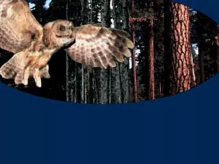
Managing Northern Spotted Owl Habitat in Dry Forest Ecosystems. Presented By Cindy Donegan U. S. Fish and Wildlife Service. Managing Northern Spotted Owl Habitat in Dry Forest Ecosystems. Managing Northern Spotted Owl Habitat in Dry Forest Ecosystems. WORKSHOPS.

E N D
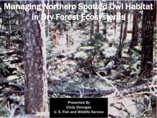
Managing Northern Spotted Owl Habitat in Dry Forest Ecosystems Presented By Cindy Donegan U. S. Fish and Wildlife Service
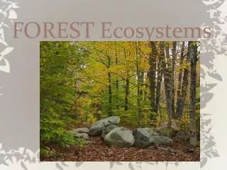
Managing Northern Spotted Owl Habitat in Dry Forest Ecosystems
Managing Northern Spotted Owl Habitat in Dry Forest Ecosystems WORKSHOPS Managing Northern Spotted Owl Habitat in Dry Forest Ecosystems Bend, Oregon 2005 Silvicultural Practices Supporting Northern Spotted Owl Habitat in Dry Forest Ecosystems Ashland, Oregon 2006 2006 Workshop - Priority Next Steps 2005 Workshop - Recommendations • Take it on the road • Produce landscape prioritization maps. Senior Managers Group supported moving forward and established an interagency team to develop and distribute the maps • Action is needed. Federal agencies should work together, utilizing map product developed in #2 for project area ID. • No action is not an option; we must continue to move forward • Convene a recovery team to develop a spotted owl recovery plan • Establish interagency team with the role of setting a provincial context for where fuel reductions would facilitate maintenance and restoration of spotted owl habitat.
Conceptual Model Resource Values Risk Factors One to many One to many Composite Risk Map Composite Values Map Landscape Prioritization Map
Managing Northern Spotted Owl Habitat in Dry Forest Ecosystems Coos Bay Southern Oregon Coastal Basin ( HUC 3 ) Roseburg 8.2 million total acres 41% Federal land Grants Pass Medford Ashland
Crown Fire Potential Wildfire Density Condition Class Fire Risk Composite Map
Critical Habitat Reserved Habitat Habitat Connectivity Owl Presence Habitat Value Composite Map
Combined Composite Map Moderate Fire Risk & Medium Habitat Value High Fire Risk & High Habitat Value Lower Fire Risk & Low Habitat Value High Priority Protection Lower Priority Protection
Amount of Treatment Acres Within Analysis Area
Spectrum of Fire Danger HIGH VERY HIGH MODERATE LOW EXTREME FIRE DANGER LEVELS
Spectrum of Landscape Fire Risk MORE LIKELY LESS LIKELY LARGE WILDFIRE RISK
Where are the large fires happening? area-adjusted frequency of fires >100-ac spectrum of landscape fire risk (less to more likely)
FlamMap 3.0 (M. Finney) A fire behavior mapping and analysis program that computes potential fire behavior characteristics (spread rate, flame length, fireline intensity, etc.) over a landscape under constant weather and fuel moisture conditions. Outputs are to be used for making fire and land management decisions. GRIDS
Crown Fire Activity Index FlamMap output 1 2 3 0 Not applicable – non-forested lands Surface - little or no tree torching will be expected Passive - isolated torching of single or groups of trees will be observed and canopy runs limited to short distances. Active - sustained runs through the canopy will be observed that may be independent of surface fire activity.
3 1 2 2 2 3 3 3 2 3 1 1 1 1 2 1 2 2 3 3 1 2 3 1 2 2 2 2 2 2 1 1 1 3 2 2 1 2 1 2 2 2 1 3 2 3 2 3 1 3 1 1 3 1 2 1 2 2 3 3 3 2 1 3 3 1 1 1 2 2 2 2 2 1 3 3 3 3 2 3 3 1 1 1 0 1 1 2 2 3 1 1 3 2 1 3 3 1 1 1 2 3 3 3 2 3 1 3 2 3 3 2 2 1 1 1 3 3 1 2 1 2 3 3 2 2 3 3 3 1 2 1 2 1 3 2 2 2 2 2 2 2 1 1 2 2 2 3 3 3 3 1 3 2 2 1 2 1 1 3 2 1 2 3 3 1 3 2 2 2 1 1 0 2 3 2 3 1 3 2 3 2 1 2 3 1 2 2 3 1 3 1 1000-ac circle
1000-ac circle 2.0
(FlamMap) (Arc GIS)
Composite landscape fire risk map (2CF+LD+RD)
Composite landscape fire risk map Fires >100-ac since 1970
Composite landscape fire risk map Fires >100-ac from 1936 map
Scale of Use Physiographic Province
Scale of Use State/County
Scale of Use Administrative Unit
Scale of Use HUC 5
Scale of Use project level planning need site-specific, refined modeling
Example Application Cow Creek Project – Umpqua National Forest
Example Application Cow Creek Project – Umpqua National Forest
Example Application Cow Creek Project – Umpqua National Forest
Example Application Cow Creek Project – Umpqua National Forest
Example Application Cow Creek Project – Umpqua National Forest
Example Application Cow Creek Project – Umpqua National Forest Owl habitat
Example Application Cow Creek Project – Umpqua National Forest Owl habitat
Example Application Cow Creek Project – Umpqua National Forest LSRs
Example Application Cow Creek Project – Umpqua National Forest CHUs
Example Application Cow Creek Project – Umpqua National Forest site-specific project planning beginning WUI