Download
1 / 38
380 likes | 411 Views
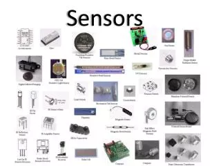
Sensors. Dr. Garver GEO 420. Sensors. So far we have discussed the nature and properties of electromagnetic radiation Sensors - gather and process information detect and measure photons. Most air/space sensors are spectroradiometers

E N D
Sensors Dr. Garver GEO 420
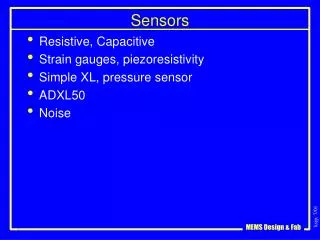
Sensors • So far we have discussed the nature and properties of electromagnetic radiation • Sensors - gather and process information • detect and measure photons. • Most air/space sensors are spectroradiometers • The term spectroradiometer is reserved for sensors that collect the dispersed radiation in bands rather than discrete wavelengths. • Spectroradiometry is the measurement of absolute radiometric quantities in narrow bands of wavelength
All sensors reside on a platform Ground based sensors are used to compare with info collected by satellite sensors.
Sensor Technology EMR is reflectedor emitted from target, through atmosphere, monitored by sensor. Sensors measure photons. Critical component - the detector.
Photoelectric effect (Albert Einstein) The release of electrons that occurs when electromagnetic radiation comes in contact with a metal. Photoelectric effect EMR Plate electrons Signal
Photoelectric effect (Albert Einstein) Emission of electrons when a negatively charged plate of light-sensitive material is subjected to a beam of photons. Electrons flow from plate, collected, and counted as a signal. Magnitude of electric current is proportional to light intensity.
In 20th century physics two ideas stand out as being totally revolutionary: • Relativity and quantum theory. • Although Einstein is best known for his theory of relativity, he also played a major role in developing quantum theory. • His contribution to quantum theory - explaining the photoelectric effect • Nobel Prize in 1921.
Theory of relativity A theory developed by Albert Einstein which says that the way that anything except light moves through time and space depends on the position and movement of someone who is watching Quantum theory A theory in physics based on the principle that matter and energy have the properties of both particles and waves, created to explain the radiation of energy from a blackbody, the photoelectric effect, and the Bohr theory, and now used to account for a wide range of physical phenomena, including the existence of discrete packets of energy and matter, the uncertainty principle, and the exclusion principle.
photoelectric effect • The emission of electrons from a material, such as a metal, as a result of being struck by photons. Some substances, such as selenium, are particularly susceptible to this effect. The photoelectric effect is used in photoelectric and solar cells to create an electric potential.
Radiometer is a general term for any instrument that quantitatively measures EMR. Most sensors are spectroradiometers. radiation collected in narrow spectral bands. Prism or diffraction grating - breaks radiation into discrete wavelengths.
SENSOR SYSTEMS • Platforms - Ground based ,Airborne , Satellite • Sensor Types • Passive, active • Imaging, nonimaging • Passive Sensors • Photographic • spectroradiometers • Passive microwave systems • Visible, infrared, and thermal imaging systems • Active Sensors - Radar, Lidar
Two classes of sensors Passive - radiation received comes from external source, Sun. Active - energy generated from within sensor system, beamed outward, and fraction returned is measured.
Passive Sensors • Sun provides source of energy • reflected (vis, near IR) • absorbed and re-emitted (thermal IR) • Passive sensors can only be used to detect energy when the sun is illuminating the Earth. • thermal infrared - detected day or night.
Active sensors • sensor emits radiation which is directed toward target. • radiation reflected from target is detected and measured by sensor.
Active sensors • Advantage • measurements anytime, regardless of time of day or season. • can be used for examining wavelengths not sufficiently provided by the sun, such as microwaves.
non-imaging - measures radiation and reports result as electrical signal imaging - electrons released are used to excite or ionize a substance like silver (Ag) in film or to drive an image producing device like a TV or computer monitor. Sensors can be
Orbits • path followed by a satellite • orbits are matched to the objective of the sensor(s) they carry.
geostationary orbits • Satellites at very high altitudes • views same portion of Earth's surface at all times • revolves at speed which matches rotation of Earth • observes and collects information continuously over specific areas • weather & communications satellites
near-polar orbits • north-south • covers most of Earth's surface over a period of time. • sun-synchronous • covers each area at the same time of day • consistent illumination conditions • important factor for monitoring changes between images or for mosaicking adjacent images together • Most satellite platforms today are in near-polar orbits
Swath • Area imaged on the ground • Imaging swaths for different sensors vary from tens and hundreds of km wide.
Earth is rotating (from west to east). • satellite swath covers new area with each consecutive pass. • Allows complete coverage of Earth's surface.
Cross Track - oscillating mirror sweeps along a line that is long (km) narrow (m) Whiskbroom Scanning
Along Track mode - line of detectors stacked side by side. Pushbroom scanning
4 types of resolution 1. Spatial Resolution • The detail discernible in an image is dependent on the spatial resolution of the sensor.
Spatial Resolution • Pixel size of satellite images • High spatial resolution: 0.5 - 4 mMedium spatial resolution: 4 - 30 mLow spatial resolution: 30 - > 1000 m • Landsat spatial resolution = 30m
2. Temporal Resolution • Specifies the revisiting frequency of a satellite sensor for a specific location. • High temporal resolution: < 24 hours - 3 daysMedium temporal resolution: 4 - 16 daysLow temporal resolution: > 16 days • Landsat = 16 days
3. Spectral Resolution • Number and position of bands in the electromagnetic spectrum that the sensor measures. • High spectral resolution: - 220 bandsMedium spectral resolution: 3 - 15 bandsLow spectral resolution: - 3 bands • Landsat = 7 bands
4. Radiometric Resolution • The actual information content in an image. • The sensitivity of the sensor to the magnitude of electromagnetic energy determines the radiometric resolution • refers to the smallest change in intensity level that can be detected by the sensing system.
4. Radiometric Resolution • In a digital image, the radiometric resolution is limited by the number of discrete levels used to digitize the continuous intensity value. • Digital Number (DN) - each pixel has a discrete value made by converting the analog signalto digital values of whole numbers over a finite range. • Landsat system range is 28, 0 to 255
Landsat Thematic Mapper • 7 channel sensor mounted on the Landsat platform • sun-synchronous, near-polar orbit • altitude 705 km. • 16 day repeat coverage • 30 m ground resolution across a swath of 185 km • except for thermal data -120 m ground resolution.
Landsat Thematic Mapper • Bands • BLUE(0.45-0.52 µm): water body penetration, coastal water mapping, soil/vegetation discrimination, forest type mapping, cultural feature identification. • GREEN (0.52-0.60 µm): green reflectance peak of veg. for discrimination and vigor assessment, cultural feature identification.
Landsat Thematic Mapper • RED (0.63-0.69 µm): chlorophyll absorption region aiding in plant species differentiation, cultural feature identification. • NEAR INFRARED (0.76-0.90 µm): determining vegetation types, vigor, and biomass content, delineating water bodies, soil moisture discrimination.
Landsat Thematic Mapper • MID-INFRARED (1.55-1.75 µm): vegetation moisture content and soil moisture, differentiation of snow from clouds. • MID-INFRARED(2.08-2.35 µm): discrimination of mineral and rock types, vegetation moisture content. • THERMAL INFRARED(10.4-12.5 µm): vegetation stress analysis, soil moisture discrimination, and thermal mapping applications.