Advancements in Geospatial Science & Technology: Research Focus and Strategic Applications
120 likes | 213 Views
Delve into the rich history and future agendas of geospatial research, algorithm development, and data validation. Explore high-resolution population dynamics, geographic pattern recognition, and energy reliability modeling. Discover the potential in climate change science, disaster risk analysis, and intelligent evacuation planning.

Advancements in Geospatial Science & Technology: Research Focus and Strategic Applications
E N D
Presentation Transcript
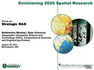
Envisioning 2020 Spatial Research Focus onStrategic R&D BudhendraBhaduri, RajuVatsavaiGeographic Information Science and Technology (GIST), Computational Sciences and Engineering Division. August 25, 2011Minneapolis, MN
ORNL: A pioneer in Geospatial Science and Technology Rich History Spanning 40 years Defining Geospatial Research Agendas Developing New Algorithms, Software, and Data Conducting Verification & Validation Studies
Science and Technology Focus • High Resolution Population and Social Dynamics • Geographic Pattern Recognition • Population-Infrastructure Dependency • Demographic Analysis • Geographic Data Sciences • Feature exploitation and pattern recognition • Unstructured and streaming data analysis • Spatiotemporal data mining, statistics, and uncertainty analysis • Participatory sensing and volunteered geographic information • Geospatial ontology and semantics • Standards and interoperability • Physical and social network analysis • Geocomputation and Visualization • High performance geocomputation • Scalable visualization • Emerging architectures
Programmatic Focus Areas • Population and Critical Infrastructure Modeling • PopulationDistribution in space and time • Socioeconomic Characterization • Event specific population response • Geography of terrorism • Energy Assurance • Energy and water resources assurance and reliability • Modeling and visualizing the “Smart Grid” • Bioenergy and Renewable Energy Integration • Transportation M&S • Multimodal Route Optimization • Intelligent Evacuation Planning • Emergency Preparedness and Response • Time Critical Decision Support • Disaster Risk Analysis • Earth Science Informatics • Real Time Data Integration • Intuitive (HCI) Geospatial Application Development • Climate Change Science • Climate Extremes and Infrastructures • Climate Change and Population Response • Energy and National Security
Science & Technology Objectives • For advancing the state of the art in geospatial intelligence, climate and ecological sciences, and energy resource stewardship, develop the best in class capabilities for: • Multidimensional (XYZ, T) data processing and integration • Spatiotemporal database management • Spatiotemporal statistics and data mining • High Performance geocomputation • Scalable spatiotemporal visualization • Meeting the needs of national priority missions will require • basic advancements leading technology (researchonGIST) • market driven solutions following demand (researchwithGIST) http://www.innovativegis.com/basis/MapAnalysis/Topic27/Topic27.pdf
Cross-disciplinary Approach will foster Innovation Philosophy Geography Landscape Architecture Climate Cognitive Science Geospatial Information Science & Technology Energy Geographic Information Science Applications of GI Science & Technology Mathematics National & Homeland Security Statistics Geospatial Technology Ecology Transportation Homeland Security Computer Science Homeland Security Physics Information Science & Technology Engineering (Modified from GIS&T Body of Knowledge by AAG and UCGIS)
Climate Change Science • Feedbacks among climate, land use, and population distribution • Climate induced hazards and infrastructure impacts • Spatiotemporal translation of regional climate impacts on local decisions
Energy Assurance • Spatiotemporal assessment of renewable energy potential • Bioresource monitoring for energy security • Geographically scalable spatiotemporal optimization for energy supply chain
(b) (a) National & Homeland Security • On demand and just-in-time delivery of geospatial intelligence for time critical decision support • Image and video based object recognition and tracking for nuclear nonproliferation • Multimodal data fusion for landscape process characterization • Extraction and integration of voluntary geographic information for rapid response and recovery
Environmental Science • Accurate spatiotemporal assessment of biomass resources with 3D data • Photorealistic visualization for ecological response models • Habitat analysis with multisensor and multimodal data
Transportation • Dynamic tracking of fleet movement from multi-sensor data • Travel behavior modeling for congestion and safety • Spatiotemporal data mining and visualization for improved operations and communication