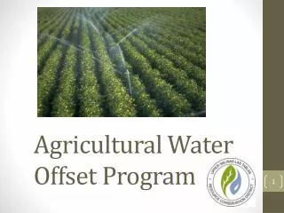
Agricultural Water Offset Program
Agricultural Water Offset Program. Background. County Planning Department contracted the RCD to design a water use offset program for agriculture users in Paso Basin. developed in response to the urgency ordinance which requires NEW irrigated Ag to offset their total projected water use.

Agricultural Water Offset Program
E N D
Presentation Transcript
Background County Planning Department contracted the RCD to design a water use offset program for agriculture users in Paso Basin. • developed in response to the urgency ordinance which requires NEW irrigated Ag to offset their total projected water use.
More Background 1. Reason for ordinance: Severe Decline 2. What is considered “new irrigated Ag?” * • Crop conversions • Increased crop density • New installations on previously un-irrigated lands *Per urgency ordinance language SLO
Phase I – Technical Analysis • RCD assembled a multidisciplinary project team • Hydrogeologist • Hydrologic engineer • UC Cooperative Extension staff • Cal Poly ITRC department faculty • NRCS Conservationist • GIS specialist • Agricultural manager • Biological Expertise • Analysis of potential for offset credits within regional areas • GIS mapping and verification of crop layer data • Data and methodology review of water use by crop type • Master Water Report • UC Extension input
Draft program Standards • Framework Provisions • Crop Conversions • New irrigated acreage • Increased crop density • Rootstock conversions • Rural groundwater uses not included in domestic program
Flow of Program Determine amount of Water Credit (current crop acreage x water use factor) Determine Potential Acres of New Crop (water credit amount / water use factor) Same Property, Same Well Same Property, Different Well Contiguous Parcel Non-contiguous Parcel
Master Water Report http://www.slocountywater.org
Crop Water Calculations where: ETc = crop evapotranspiration = ETo x Kc ETo = reference evapotranspiration Kc = crop coefficient ER = effective rainfall FP = frost protection LR = leaching requirement IE = irrigation efficiency
Flow of Program Determine amount of Water Credit (current crop acreage x water use factor) Determine Potential Acres of New Crop (water credit amount / water use factor) Same Property, Same Well Same Property, Different Well Contiguous Parcel Non-contiguous Parcel
Same Property, Same Well Same Property, Different Well ContiguousParcel Non-contiguous Parcel Proximity Analysis Meets Standard Neighboring Well Impact analysis Meets Standard Deed Restriction Recorded & Well Meter Installed Annual Verification (3rd Party reporting)
Neighboring Well Criteria • Applicant must identify one domestic and one ag well adjacent to property • Increased pumping cannot significantly impact neighboring irrigation and domestic wells • Domestic wells – 15 feet additional drawdown • Irrigation wells – 30 feet additional drawdown • Simple calculator is used to compute water level drawdown at various distances • Notice sent to well owners so well-specific information can be considered
Proximity of Credit • Must define acceptable distance where credit will likely offset the impact • Simple Calculator is used to determine this distance • Must be similar water bearing zone and depth
Same Property, Same Well Same Property, Different Well ContiguousParcel Non-contiguous Parcel Proximity Analysis Meets Standard Neighboring Well Impact analysis Meets Standard Deed Restriction Recorded & Well Meter Installed Annual Verification (3rd Party reporting)
Decline Map Sample – Paso Basin Credit cannot be used to increase pumping within severe groundwater level decline area as defined by SLO County • Proposed 50’ water decline level • Reviewed annually • Annual map of decline published
Phase II – Public Outreach RCD collaborating with local stakeholders • Paso Robles Wine Alliance • Ag Liaison Committee • Farm Bureau • Cattlemans Association • Vineyard Team • Olive Growers Association • Pro Water Equity • Town Hall meetings
Conclusion • Groundwater basin(s) are natural features that change over time and the program is designed with flexibility and adaptation in mind. • Issue is complex in nature, and program tries to encompass multiple layers of operational complexity. • Program designed to be flexibly tiered, simplified, and user-friendly.
Questions? Thank You