Download
1 / 20
200 likes | 283 Views
Monterey Bay Experiment Plan. COAST. Monterey Experiment to Collect Simulated HES-CW data. There are no existing data sets that include all the key attributes of HES-CW data: Spectral coverage (.38 – 1.0 m m)

E N D
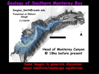
Monterey Experiment to Collect Simulated HES-CW data • There are no existing data sets that include all the key attributes of HES-CW data: • Spectral coverage (.38 – 1.0 mm) • High signal-to-noise ratio (>300:1 prefer >900:1, for ocean radiances for 300 m binned data) • High spatial resolution (<150 m, bin to 300 m) • Hourly or better revisit • Propose field experiments in FY2006-2008 to develop the required data sets for HES-CW algorithm and model development. • Airborne system: • Hyperspectral imager that can be binned to the HES-CW bands • Flown at high altitude for minimum of 10 km swath • Endurance to collect repeat flight lines every half hour for up to 6 hours • SAMSON • Proposed experimental site: • August-September 2006 Monterey Bay (coastal upwelling, HABs)
Monterey Experiment to collect simulated HES-CW data • Experimental Design • Choose sites with IOOS or other long term monitoring and modeling activities • Intensive effort for 2 weeks to assure that all essential parameters are measured: • Supplement standard measurements at the site with shipboard or mooring measurements of water-leaving radiance, optical properties and products expected from HES-CW algorithms, • Additional atmospheric measurements as needed to validate atmospheric correction parameters, • As needed, enhance modeling efforts to include bio-optical models that will utilize HES-CW data. • Aircraft overflights for at least three clear days and one partially cloudy day (to evaluate cloud clearing) during the two week period. • High altitude to include 90% or more of the atmosphere • 30 min repeat flight lines for up to 6 hours to provide a time series for models and to evaluate changes with time of day (illumination, phytoplankton physiology, etc.) • All data to be processed and then distributed over the Web for all users to test and evaluate algorithms and models.
Experiment Resources • Aircraft for 6 flight days 6 hrs per day. • R/V John Martin 7 ship days? • Small boats for the entire two weeks? • Lab space (14C, HPLC, pad absorptions, instrument prep, etc. • Space for basing the gliders? • Space for instrument repair and calibration. • Space for basing the aircraft? • Space for daily group meeting in evening to review data and plan next day experiment? • Lodging, motels or rent a house or some of both
One Day in the Experiment • Assume clear morning and sunrise at 0700 • Aircraft takes off at 0700 • First data at 0730 • Repeat 20 km square (approximately ½ of the Bay) every 30 min • 0730, 0800, 0830, 0900 • Skip one repeat and do staked collection • 1000,1030,1100,1130,1200 • Additional measurements for atmospheric correction, etc. • Land at 1300 • R/V Martin • Occupy one Station for profiles for each overflight? • Alternatively underway data collection or combination of stations every other overflight and underway in between. • Glider collecting underway data. • Mooring data • Seagrass beds should be part of the overflight area. • Data processed and in data system in 48? Hrs. Models later.
Atmospheric Measurements • NRL Monterey lidar, etc. • UCSC • Sun Photometers on ship • Aircraft staked measurements • Other sensors on aircraft?
Airborne Measurements • Paul Bissett (FERI, 2 people on plane) • SAMSON • Cover 20 x 20 km area (roughly ½ the Bay) in 28 min. • 6 hr flight, repeat every 30 min, except for special staked imaging, or other for atmospheric correction. • Data binned to 10 m spatial and 10 nm spectral resolution (or HES-CW channels. • Data geolocated • Data calibrated • Data atmospherically corrected using Tafkaa (Marcos Montes, NRL ) • Airport for plane? • lab space for processing system including two operators (FERI) and 1 NRL (for atmospheric correction) for data processing and analysis?
Gliders • Oscar Schofield (launch from a small boat) • Particle Glider
In-Water Optics • Bob Arnone (NRL group, 2 people on ship) • POWR IOP profiling package • Filtered and unfiltered a-c9s • a-cS • Hydroscatt-6 • CTD • Water bottles • fluorometer • CDOM fluorometer • Above water remote sensing reflectance • Water samples are available for HPLC, etc. but NRL will not be doing those measurements. • Ken Voss (1) NURADS • Mike Ondrusek (1) AOPs
Chlorophyll, fluorescence and productivity • Ricardo Letelier (2) • Heidi Sosik (1) • On the R/V John Martin: • FRRF (flow thru mode) and PAM (discrete mode) • FLH • Imaging flow system • Water samples collected, filtered and frozen for: • HPLC pigments • Chlorophyll fluorometry • Filter absorption pads • POC? • Nutrients (Kudela) • 14C productivity, P vs. I curves?
Benthic productivity • Heidi Dierssen • Independent in Small Boat • Seagrass productivity • Kelp?
Coastal Carbon Budget • Pete Strutton • One person on R/V Martin • Flow though PCO2 system • one on shore
R/V John Martin • NRL (2 people) • IOP profiling package • Above Water Rrs • Water samples for Chl, Pad absorptions productivity, etc. • Voss (1 person) NURADS • Ondrusek (1 person) AOPs • Sosik (1 person) • Imaging flow system • Letelier (1 person) • 14C productivity • FRRF underway, FLH, chlorophyll fluorometry, • Strutton (1 person) • Underway PCO2 (maintain underway system) • Kudela (1 person) • Underway system • Nutrients from bottles (shore lab) • Chief Scientist? • Total 8-9
R/V John Martin Wire Time • POWR package and water retrieval (15 min) • Can operate as a free fall package or on a wire • NURADS floats away from the ship (2 min to deploy and recover) • HTSRB floats away from the ship (2 min to deploy and recover) • APO profiler (10 min?) • Others?
R/V John Martin Water For each bottle sample depth need water for: • HPLC (50 mls) • Fluorometric Chlorophyll (50 mls) • Filter pad absorptions (200 mls) • POC (500 mls) • Suspended Sediments (500 mls) • Nutrients (50 mls) • Microscopy (50 mls) • 14C productivity (200 mls)
Additional Small Boats • Dierssen • Seagrasses and kelp • Schofield • Gliders • Others??
Lab Requirements Space to store and process samples for: • Pigments • Fluorometric • HPLC • 14C productivity • Nutrients • Pad absorptions • POC • Suspended Sediments • Flow Cytometer • Others?? • Ship instrument preparation and service • Glider preparations and service. • Space for data analysis and processing ship, and aircraft data. • Where will we have lab space?
Bio-Optical Models • John Kindle (NRL) • Others??
Demo Data System • Paul BIssett (FERI) to host, OSU (Letelier) to have mirror site • SAMSON data • Geolocated • Calibrated • Atmospherically corrected • binned to 10 m GSD and 10 nm spectral (or HES-CW channels) • In-water data • All types • Geolocated to the images • Atmospheric data • Links to associated data from existing moorings, models, etc.
HABs • Identify HABs during experiment and link to the experimental data. • Look for unique signature, algorithm to identify HABs from the data collected • Feed into the development of HAB models