MODIS Direct Acquisition, Processing and Applications @ CRISP
CRISP Centre for Remote Imaging, Sensing and Processing. MODIS Direct Acquisition, Processing and Applications @ CRISP. KWOH, Leong Keong Director, CRISP E-mail : lkkwoh@nus.edu.sg APEIS Capacity Building Workshop on Integrated Environmental Monitoring of the Asia-Pacific Region


MODIS Direct Acquisition, Processing and Applications @ CRISP
E N D
Presentation Transcript
CRISPCentre for Remote Imaging, Sensing and Processing MODIS Direct Acquisition, Processing and Applications @ CRISP KWOH, Leong Keong Director, CRISP E-mail : lkkwoh@nus.edu.sg APEIS Capacity Building Workshop on Integrated Environmental Monitoring of the Asia-Pacific Region 20-21 September 2002, Beijing, China
Overview • Introduction • Processing Levels • Level-0 Processing • Browsed Image Generation • CRISP’s MODIS Web Cataloging System • Level-1 Processing • NASA software Vs. IMAPP • MODIS Georectification • Recent Application • Conclusion and Future Developments
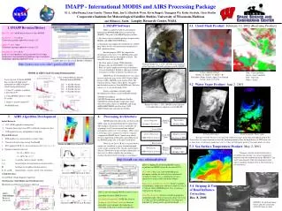
CRISPCentre for Remote Imaging, Sensing and Processing • Status of CRISP MODIS Data Reception • First Reception of TERRA MODIS – 3 March 2001 • First Reception of AQUA MODIS – 15 July 2002 • Processing system currently used – IMAPP v 1.4 (beta) • Computing Platform – PC running LINUX
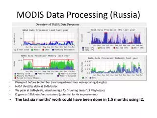
6 metre X band Antenna 13 metre X band Antenna TERRA / AQUA data received if either one of the antenna is available. Either antenna can be used.
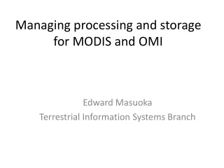
The first MODIS captured by CRISP on 3/3/2001
First MODIS image received and processed by CRISP – 3 March 2001)
Processing Levels • Two main levels • Level-0 Processing • Frame Formatting Software developed by CRISP • Catalogue Software • RAW data archived on DLT • Level-1 Processing • NASA GSFC level 1 processing software • InternationalMODIS/AIRS Processing Package (IMAPP) by University of Wisconsin • Higher level processing • Georectification developed in CRISP
Level 0 Processing TERRA / AQUA Downlinked Raw format MODIS CCSDS Packets FrameSync & Reformat with RS correction Recorded on Hard disk (Datron DIS) GBAD Packets (AQUA only) Browse Image Demodulator (Alcatel Omnisat) X-Band Antenna
Generate Browse Image • A program is written to generate browse images directly from the MODIS PDS file. • The program incorporate some simple geometry to “flatten’ the image and remove “bowtie” effect. • The browse images is then fed into on our web catalogue system. • The acquisition, archival, browse image generation and catalogue updating are performed automatically.
Before Flattening After Flattening Image Captured on 4 July 2001(SWIR, NIR, RED)
Level 1 Processing • Two versions of level-1 processing has been used • InternationalMODIS/AIRS Processing Package (IMAPP) • NASA GSFC MODIS level 1 Processing Software
Construction records MOD01 MOD02 MOD03 NASA Software PDS File Level 1a Level 1b GBAD File Geolocation IMAPP (AQUA Only)
Hot Spots Derived from MODIS image Terra MODIS image on 4 July 2001
MODIS Hot Spots validated with SPOT fires2001-05-23 MODIS Hot Spots 2.8387N 111.9912E 2.8373N 112.0008E 2.8295N 111.9899E 2.8281N 111.9995E SPOT Fire Locations A 2.8328N 111.9922E B 2.8344N 111.9994E C 2.8308N 111.9997E
MODIS Hot Spots validated with SPOT fires2001-05-23 MODIS Hot Spots 2.5642N 111.9143E 2.5628N 111.9239E 2.5563N 111.9034E 2.5549N 111.9130E 2.5535N 111.9226E 2.5521N 111.9322E 2.5508N 111.9417E 2.5456N 111.9117E 2.5443N 111.9213E SPOT Fires D 2.5633N 111.9192E E 2.5528N 111.9158E F 2.5533N 111.9211E G 2.5550N 111.9258E H 2.5531N 111.9303E
Conclusion and Future Developments • CRISP has implemented an end to end MODIS DB reception, archival and processing system. • Automatic processing, from level 0 processing, catalogue updating to level 1 processing and further georectification are performed. • We are currently developing numerous applications for MODIS such as Cloud Mask, 8-days Cloud Free Composite, Fires detection and Ocean applications.