Download
1 / 29
350 likes | 1.16k Views
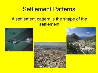
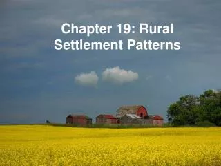
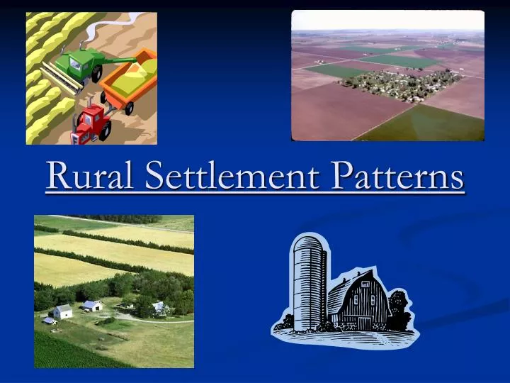
Rural Settlement Patterns. A settlement pattern is the distribution of homes, farms, villages, towns, and cities in an area. In Canada, these patterns vary enormously from place to place. Population Distribution. A pattern showing where people live in an area.

E N D
A settlement pattern is the distribution of homes, farms, villages, towns, and cities in an area. • In Canada, these patterns vary enormously from place to place.
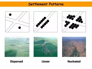
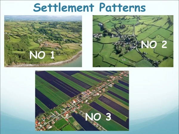
Population Distribution • A pattern showing where people live in an area. • People tend to live in one of three settlement patterns: • Dispersed • Concentrated • Linear
Dispersed Typical of areas with an agricultural base People tend to live on farms
Concentrated occur where other natural resources are present these resources cause people to settle near them.
Linear Occurs in a line that stretches out for some distance over the landscape. Settlement near a highway or the coast.
Population Density The number of people living in a square kilometre.
Factors affecting Population Density and Distribution • Flat Land: For Agriculture and buildings • Adequate precipitation: For drinking and agriculture • Fresh Water Supplies: For manufacturing and agriculture • Transportation: For goods and people • Moderate Winters: For comfort
Factors affecting Population Density and Distribution • Availability of Power: For electricity • Resource Availability: For Industry • Good Soil: For agriculture • History: An area settled previously will encourage more people.
Rural Settlement Patterns • Rural settlement occurs where people live outside of cities and towns. • It is characterized by a dispersed population distribution pattern.
3 key factors affect the pattern of rural settlement in any area: • The kind of resources found in the area: • Most important factor • SW Ontario is very different from Canadian Shield • The transportation methods available at the time of settlement: • Before 1800, settlement was near water • After 1800, settlement was near roads
The role played by the government policy: • In some areas the government planned how, where, and when settlements would occur. • The government used a survey system, which is a pattern of land division used in an area.
Settlement patterns in Canada Three different systems were used in different areas of Canada.
1. Long Lots of Southern Quebec • Long lots stretched back from a river because it was the only means of transportation. • Taxes were based upon the width of the lots so they became very long and thin. • When all the suitable riverfront areas had been used, roads were built parallel to the river and back a distance.
Lots along the road Road Lots along the road Property line Lots along the river River
Lake 2. Concession System of Southern Ontario • Surveyors started at the shoreline and then, spaced approx. 2km apart, a series of parallel lines was surveyed. These later became concession roads. • The resulting squares, about 2km by 2km are known as concessions, and portions of these were given to settlers to clear and farm.
Look at how the roads intersect. This is where the concessions came togetherbecause of the shoreline curving.
3. Section System of the Southern Prairies • Western Canada was surveyed before there was any large scale settlement for three reasons: • The government was afraid that the U.S. might take over the Canadian west if there was no sign of occupation. • The population was growing in Ontario and there was a demand for more land.
The government wished to avoid the kind of land disputes that occurred in the U.S. when their west was settled (lawlessness, etc.).
The baseline was the 49th Parallel and sections were made that were 36 miles2. • These were subdivided into 36 one-mile2 blocks. Those blocks were then divided into quarter-sections which were then given to settlers or reserved for churches, schools, etc.
These squares were subdivided into 36 sections, each 1 mile by 1 mile. survey lines were 6 miles apart Baseline - 49th parallel
each “section” was 1 mile by 1 mile each section was sub-divided into 4 “quarter-sections”, which were given to settlers, or reserved for churches, schools, the railways, the Hudson Bay Company, etc
Resource Based Settlement A urban place that relies on a natural resource for its existence. For Example: Sudbury (Nickel)
Service Based Settlement This is an urban place that owes its existence to a service industry. For example Gander NF (Airport & Gas stations) & Yellowknife (Gov’t)
Homework Read Chapter 19 Define the Key Terms Answer P. 233 # 1a – 3,