Download
1 / 29
290 likes | 429 Views
The U.S. Integrated Ocean Observing System. Worth D. Nowlin, Jr. Texas A&M University NOAA Coastal Services Center NOAA National Data Buoy Center GCOOS Stakeholders Meeting January 24, 2005. Outline. What is the Global Ocean Observing System? What is the Ocean.US Enterprise?

E N D
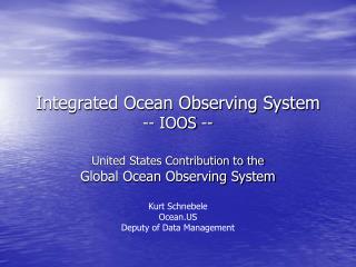
The U.S.Integrated Ocean Observing System Worth D. Nowlin, Jr. Texas A&M University NOAA Coastal Services Center NOAA National Data Buoy Center GCOOS Stakeholders Meeting January 24, 2005
Outline • What is the Global Ocean Observing System? • What is the Ocean.US Enterprise? • What is the U.S. Integrated Ocean Observing System (IOOS)? • What is the status of the IOOS?
Global Ocean Observing System(GOOS) • GOOS is being coordinated by U.N. agencies with the participation of some 100 ocean nations. • GOOS is an end-to-end system of observations, data management, and production and delivery of products/services. • GOOS, along with the World Weather Watch, Global Atmospheric Watch, Global Climate Observing System and Global Terrestrial Observing System, is an element of the Global Earth Observing System of Systems
The GOOS Modules The Global Ocean Observing System (GOOS) is being designed and implemented in two modules: • A global module designed to monitor, predict, and understand marine surface conditions and climate variability; and • A coastal module designed to sustain healthy marine ecosystems, ensure human health, promote safe and efficient marine transportation, enhance national security, and predict and mitigate against coastal hazards.
Commission on Ocean Policy • Implement an Integrated Ocean Observing System • Implement ecosystem–based management • Strengthen regional approach
National Oceanographic Partnership Program Executive Administrator, National Oceanic and Atmospheric Administration Secretary of the Navy Director, National Science Foundation Administrator, National Aeronautics and Space Administration Deputy Secretary, Department of Energy Administrator, Environmental Protection Agency Commandant, United States Coast Guard Director, United States Geological Survey Director, Minerals Management Service Deputy Assistant Secretary of the Army (Corps of Engineers) Director, Defense Advanced Research Projects Agency Director, Office of Science and Technology Policy Director, Office of Management and Budget Assistant Secretary, Department of State Undersecretary, Department of Homeland Security
NOPP Organizational Chart National Ocean Research Leadership Council (NORLC) • Ocean.US EXCOM Interagency Working Group (IWG) Ocean Research Advisory Panel (ORAP) Federal Oceanographic Facilities Committee (FOFC) U.S. GOOS Steering Committee Ocean.US Office Program Office (NOPPO) [currently managed by CORE*]
National Oceanographic Partnership Program (NOPP) Ten–Year Strategic Plan for the NOPP • Achieve & sustain an Integrated Ocean Observing System (IOOS) • Promote lifelong ocean education • Modernize ocean infrastructure & enhance technology development • Foster interagency partnerships to increase & apply scientific knowledge
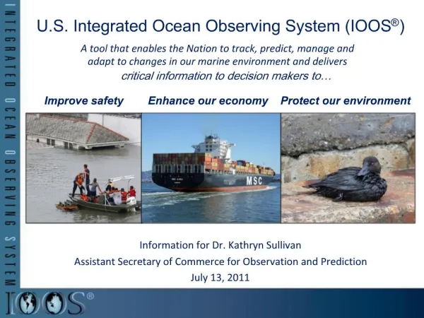
At the request of the U.S. Congress, the federal agencies of the NOPP are planning and developing a U.S. Integrated Ocean Observing System focused on: • Detecting and Forecasting Oceanic Components of Climate Variability • Facilitating Safe and Efficient Marine Operations • Ensuring National Security • Managing Marine Resources • Preserving and Restoring Healthy Marine Ecosystems • Mitigating Natural Hazards • Ensuring Public Health
The National Office for Integrated and Sustained Ocean Observing and Predictionhttp://www.ocean.us Dr. Jack Kaye Chair, Executive Committee Thomas Malone Director, Ocean.US Office
U.S. IOOSTwo Interdependent Components Global Ocean Climate Component GOOS/GCOS Coastal Ocean Component GLs GoA NE NW MAB Regional Observing Systems SE H Isl C Cal Go Mex S Cal Carrib National Backbone Low Resolution High
Coastal Component National Backbone • Operated by Federal • Agencies • EEZ & Great Lakes • Core variables required • by regions & Federal Agencies • Networks of sentinel & • reference stations • Standards/Protocols Regional COOSs • Operated by Regional • Associations • Involve private & public • sectors • Inform Federal Agencies • of user needs • Enhance the backbone • based on user needs • Incorporate Sub–regional • systems
1st Annual IOOS Development Plan 2004 IOOS Development Plan • Part I – Structure and Governance • Vision & IOOS design principles • Planning Implementing Bodies & Process • Part II – Fiscal Years 2005-2006 – Integrating Existing Assets • Integrate existing observing subsystem assets across agencies • Data management & communications • Coordinated regional development • Part III – Improving the IOOS Through Enhancements and Research • Enhance the initial IOOS • R&D priorities
Part I IOOS Governance NORLC Establish Policies & Procedures Federal Agencies Develop & Operate the Global Component & National Backbone Interagency Working Group NFRA Represent & Coordinate ORAP Advise Executive Committee Approve Plans Provide Resources RAs Develop & Operate RCOOSs USGSC User Input & Performance OceanUS Plan & Coordinate
Functions of Ocean.US Plan & Coordinate • Develop & maintain strategic plan • Ensure incorporation of elements into an integrated system • Recommend enhancements • Recommend R&D priorities • Promote collaboration among participating NOPP Agencies & Regional Associations • Report regularly to the EXCOM which • Provides policy guidance, Ensures sustained agency support, & approves implementing documents
Four Stages of IOOS Elements 1. Research New Knowledge & Technologies 2. Pilot Projects Demonstrate Feasibility (community acceptance; standards & protocols) 3. Pre-Operational Projects Proof of Concept (value added, cost-effective) 4. Operational System (routine, sustained)
Part IIIOOS Global Component • Part of an intergovernmental, cooperative system • Designed to observe and predict global, ocean-influenced phenomena (such as El Niños, extreme weather, or global warming) • Nearing operational, sustained status.
Global Ocean-Climate ComponentRequirements for In Situ Observations • Full implementation • Argo • Water level network • Global ocean time series observatories • Successful completion • GODAE • Optimize the global network of observations • Enhance ocean time series observatories • key biological & chemical sensors
Milestones 2001 2002 2000 2003 2004 2005 2006 2007 2008 2009 2010 Operational GPS/DORIS Stations 86 86 86 86 86 43 Tide Gauges 39 37 37 34 34 1250 1250 1250 1250 1250 1250 779 810 807 671 Number of buoys 1050 Surface Drifting Buoys 100 115 115 89 85 82 Number of moorings 79 79 79 77 77 Tropical Moored Buoys High resolution and frequently repeated lines occupied 45 45 45 45 45 Ships of Opportunity 36 29 26 26 24 23 3000 3000 3000 3000 3000 2300 544 200 310 Argo Floats Number of floats 1500 923 29 29 29 10 10 24 1 6 6 2 Reference Stations Number of flux moorings 16 105 105 105 Moorings with climate sensors 60 Coastal Moorings 20 Number of flux sites/lines, One inventory per 10 years 31 31 31 31 29 Ocean Carbon Network 1 27 24 24 830 830 830 730 Dedicated Ship Time 640 Days at sea (NOAA contribution) 497 497 531 370 340 370 7 7 Product evaluation and feedback loops implemented 7 7 7 3 System Evaluation 0 1 1 2 4 Initial Ocean Observing System Milestones including international contributions 99 100 94 88 77 45 40 34 30 Total System System % Complete 53 48 2001 2002 2000 2003 2004 2005 2006 2007 2008 2009 2010
Physical Sea surface winds Sea surface waves Sea surface currents Sea level Stream flows Temperature, Salinity High Res Bathymetry Ice distribution Multidisciplinary Optical properties Bottom character/Benthic habitats Chemical Dissolved inorganic nutrient Contaminants Dissolved oxygen Biological Fish species, abundance Zooplankton species, abundance Phytoplankton species, biomass (ocean color) Pathogens Part IINational Backbone Core Variables
Part II: The Initial IOOSFY 05 – 06 Highest Priorities • DMAC • Establish RAs & the NFRA • Coordinated Development of Global & Coastal
Part II – Coastal ComponentThe Initial IOOS • Extend the global ocean component to the shoreline with higher resolution for • improved regional weather & climate predictions, • more efficient and safer marine operations in coastal waters, • more accurate forecasts of natural hazards & their effects, & • improved homeland security. • Develop an integrated approach to water quality monitoring & living resource assessments through more timely provision of • Surface & interior fields • nutrients & dissolved oxygen • phytoplankton biomass (Chl) & macrozooplankton abundance • Extent and condition of benthic habitats; • Abundance and distribution of living marine resources (including protected species); & • Land-sea freshwater flows & associated transports of sediments, nutrients & contaminants.
Part III – Enhancement Categories • Global Ocean – Climate Component • DMAC • Regional Coastal Ocean Observing Systems • National Backbone Operational Observing Subsystem • Increase density of measurements • Incorporate additional sensors • Education
Part III – Enhancement CategoriesResearch & Pilot Projects • Product–Driven (end–to–end systems) • Surface current maps • Near shore bathy-topography maps • Target Specific Elements of the IOOS • Modeling – Close gap between operational models for • marine meteorology & physical oceanography & • those that require biological & chemical data • Benthic habitat mapping • In situ sensors for biological & chemical variables • Glider technologies • Improve spectral, spatial & temporal resolution of space–based remote sensing of coastal systems
Thank You http://www.ocean.us