Download
1 / 36
370 likes | 581 Views
The Nature and Significance of Political Boundaries And Types of States. AP Human Geography 2010. Nation. Nation : geographic area that is dominated by a large population that shares a common history and culture, ie. Kurds and Palestinians. State.

E N D
The Nature and Significance of Political BoundariesAnd Types of States AP Human Geography 2010
Nation • Nation: geographic area that is dominated by a large population that shares a common history and culture, ie. Kurds and Palestinians.
State • State: sovereign (implies a state's lawful control over it's territory generally to the exclusion of other states, authority to govern in that territory, and authority to apply law there.) political entity that maintains status as an independent country.
Nation-State • Nation-State: political unit comprising a clearly delineated territory where the population shares a common history and culture, ie. Japan.
Definitions: • State = country • Territory = area controlled by a state • Nation = cultural group • people with a common ancestry, culture, language, religion, history • Nation state = clearly defined cultural group (a nation) occupying a spatially defined territory (a state)
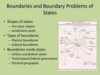
Boundaries • Boundary - something that indicates bounds or limits. • Boundary Dispute - when two or more states disagree about the demarcation of a political boundary.
Boundaries Boundaries are: • Lines that establish the limit of each jurisdiction & authority • Jurisdiction administers laws; collects taxes; provides defense, education, training; enforces legal code, etc. • 3-dimensional: flat, deep, high
Political Boundaries • Political boundaries represent the spatial limit of the political organization of territory • They exist at different scales: • Supra-national-scale organizations, such as UN • State-scale • Intra-state scale; boundaries used for the many sub-divisions of territory within the state
May be a source of friction between competing political entities (flashpoints) May serve as peaceful reminders of contrasting but accepted differences
Boundaries & state cohesiveness • Centripetal forces • A clearly bounded territory promotes unity/national stability • Centrifugal forces • The more boundaries possessed by a state, the greater is the likelihood of conflict which disrupts unity/national stability
Possible centrifugal forces: internal divisions in language, religion lack of a long history in common state boundaries that are subject to dispute Possible centripetal forces: clear and well accepted state identity long state history boundaries that are clearly delimited and well-accepted
Disputes for regional autonomy • Separatism or autonomous nationalism • Canada’s secessionist movement in Quebec: 1995 referendum 49% yes, 51% no. • Other separatist movements: • Basques in Spain; • Bretons in France, • Palestinians in Israel, • Sikhs in India, etc.
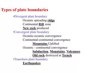
Boundary Types • Physical Boundary: major physical features such as a desert, mountain ranges, and/or water bodies that serves as a means of separation, ie. Great Lakes, Pyrenees Mountains, and Sahara desert.
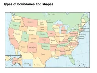
Boundary Types • Geometric Boundary: straight lines that serve as political boundaries that are unrelated to physical and /or cultural differences, ie. 1300 mile United States/Canadian border.
AOZOU STRIP Chad-Libya Boundary is a straight line drawn across the desert in 1899 by the French and British to set the northern limits to the French colonies in Africa. 1912-Italy seized Libya and demanded that the French in Chad move the boundary south. 1935-France agreed to move the boundary 60 miles to the south, but Italy wasn't satisfied. 1973-Libya seized it and eventually Chad won it back
Boundary Types • Cultural Political Boundary: political boundary that separates different cultures, ie. former Yugoslavia.
Boundary Types • Religious Boundary: boundary that separates different religions, ie. Northern Ireland/Ireland.
Boundary Types • Language Boundary: boundary that separates different language speakers, ie. traditionally many countries in Europe such as England, France, Spain, and Portugal.
Boundary Types • Antecedent Boundary: boundary that was created before the present day cultural landscape developed, ie. Malaysia/Indonesia on the island of Borneo. The northern section is part of Malaysia and the majority of the landscape in the south is part of Indonesia. The boundary passes through a mountainous, sparsely inhabited rainforest where there is a break in settlement.
SUBSEQUENT BOUNDARIES are those that make some attempt to separate into two different states the people of the various nations that live in an already settled region. The eastern boundary of the Netherlands, for example, was drawn up so as to place Dutch people on the west side, and Germans on the east. Subsequent boundaries would seem to be the ideal type, but populations near the boundary are usually so mixed up that some minorities are always found on the wrong side of the boundary. Most of the modern boundaries of Europe are subsequent, because Europe was settled long before any boundaries were established, and it was not until after the First World War that the peace treaties made an attempt to create nation-states in Europe with their appropriate boundaries. In other cases the population were simply expelled to justify the boundary.
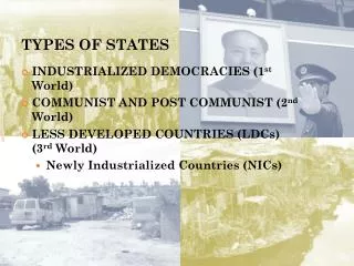
Types of States • Unitary State – centralized power • For example, Cuba, former Soviet Union, • North Korea • Federal State – de-centralized power • For example, U.S., Nigeria, India
Boundary Types • Super Imposed Boundary: • N & S Vietnam • MOST OF AFRICA! a boundary imposed on the territory of one nation that divides the members of the nation into two different states. Such boundaries are always unstable.
Boundary Types • Relict Boundary: boundary that ceases to exist, however the imprint of the boundary still remains on the cultural landscape, ie. north/south Vietnam.
Boundary Types • Fortified Boundary: when a state constructs physical barriers along a boundary to either keep people in or out of their territory, ie. Great Wall of China, Berlin Wall, Earth berms along the Morocco/Spanish Sahara border.
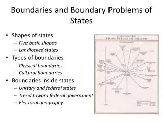
Shapes of States • Compact State: the distance from the geographic center of the area to any point on the boundary does not vary greatly, ie. Hungary.
Shapes of States • Elongated State: state that is geographically long and narrow, ie. Chile.
Shapes of States • Enclave: portion of a state that is totally surrounded by another state, ie. Armenia.
Shapes of States • Exclave: small portion of land that is separated from the main state, ie. Kaliningrad/Russia. • Russia's smallest oblast (region) of Kaliningrad is an exclave located 200 miles away from the border of Russia proper. Kaliningrad was a spoil of World War II, allocated from Germany to the Soviet Union at the Potsdam Conference that divided Europe between the allied powers in 1945. The oblast is a wedge-shaped piece of land along the Baltic Sea between Poland and Lithuania, approximately one-half the size of Belgium, 5,830 mi2 (15,100 km2). The oblast's primary and port city is also known as Kaliningrad. • Known as Konigsberg prior to Soviet occupation, the city was founded in 1255 near the mouth of the Pregolya River. The philosopher Immanuel Kant was born in Konigsberg in 1724. The capital of German East Prussia, Konigsberg was the home to a grand Prussian Royal Castle, destroyed along with much of the city in World War II.
Shapes of States • Fragmented State: state split into many pieces, ie. Philippines and Indonesia.
Shapes of States • Landlocked State: state not having direct access to an ocean, ie. Bolivia.
Shapes of States • Microstate: state that is extremely small, ie. San Marino.
Shapes of States • Perforated State: state that totally surrounds another state, ie. South Africa.
Shapes of States • Prorupt State: state having a portion of territory that is elongated, ie. Thailand.
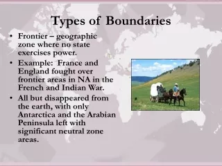
Shapes of States • Frontier - zone where no state exercises political control, ie. Antarctica and Portions of Saudi Arabia.