Download
1 / 8
80 likes | 171 Views
This project focuses on characterizing volcanic and seismic areas, identifying natural resources, buried targets, and mitigating environmental hazards. Using advanced airborne geophysical platforms and sensors, the aim is to contribute to treaty verification and secure environmental safety.

E N D
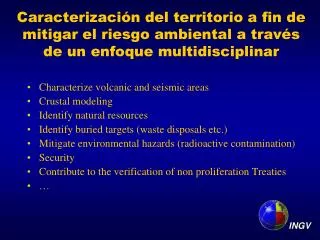
Caracterización del territorio a fin de mitigar el riesgo ambiental a través de un enfoque multidisciplinar • Characterize volcanic and seismic areas • Crustal modeling • Identify natural resources • Identify buried targets (waste disposals etc.) • Mitigate environmental hazards (radioactive contamination) • Security • Contribute to the verification of non proliferation Treaties • … INGV
Airborne geophysical platform • Magnetometer sensors (H & V gradiometer) • Precise positioning (dynamic DGPS) • Laser altimetry • Barometric altimetry • Flight path video recording spherical camera • Real-time data visualization • Infrared sensor • Gamma ray spectrometry (low- and high-resolution) • Gravity sensor
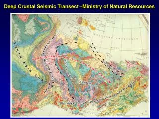
Ggggggggggggggggggggg Ffffffffffffffffffffffffffffffff Recursos naturales: petróleo, uranio, agua, etc. a Crustal imaging and modeling: Tecniche analitiche specializzate sviluppate ad hoc A’ A a A’ A
DIGITAL ELEVATION MODEL QUENCA NEQUINA BOUGUE ANOMALY MAP & DRILLINGS QUENCA NEQUINA TOTAL INTENSITY MAGNETIC ANOMALY MAP Análisis BASEMENT TOP FROM BOUGUER DATA
N CATEOS SOLICITADOS (2007-actualidad) Exploración de uranio Cateos Miguelito I-II-III-IV LAS MINAS AGOTADAS DE URANIO EN ARGENTINA SON OBJETO DE UN PLAN DE REMEDIACIÓN FINANCIADO MEDIANTE FONDOS DEL BANCO MUNDIAL • LA MINERIA DEL URANIO TIENE 5 ETAPAS: • Prospección (3 años) • Exploración (3 años) • Evaluación (2 años) • Extracción (15-20 años) • Cierre y Remediación (5-10 años) • ARGENTINA NECESITA ANUALMENTE 120 tn DE URANIO • HASTA LA DÉCADA DEL 90 EL URANIO SE PRODUJO EN EL PAÍS PERO HOY SE IMPORTA • PARA PRODUCIR 120 tn de URANIO SE UTILIZA LA MISMA CANTIDAD DE AGUA QUE PARA REGAR UNA QUINTA DE FRUTALES DE 11 HECTAREAS • LA MINERÍA DEL URANIO EN ARGENTINA ES DE PEQUEÑA ESCALA Cateos Donato I-II-III-IV-V Cateo El Gallo Cateos Noya I-II-III HOY PARA INICIAR UNA ACTIVIDAD EXTRACTIVA DE URANIO EN ARGENTINA ES NECESARIA UNA LICENCIA DE LA AUTORIDAD REGULATORIA NUCLEAR Se han solicitado a la Provincia 13 cateos (100.000 km2) de los cuales 8 han sido otorgados. El Gallo Donato I-II-III-IV- Noya I-II-III
COOPERACIONES ACTIVAS Y CONVENIOS • EN AMÉRICA LATINA • Ministerio del Poder Popular para Ciencia, Tecnología e Industrias • Intermedias de la República Bolivariana de Venezuela • Agencia bolivariana para actividades espaciales (ABAE) • YPF Repsol • Agencia de Medio Ambiente • Universidad Nacional de La Plata • Comisión Nacional de Energía Atómica (CNEA)