Download
1 / 58
590 likes | 828 Views
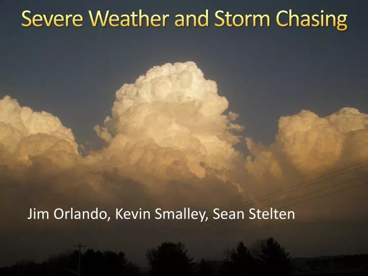
Severe Weather and Storm Chasing. Jim Orlando, Kevin Smalley, Sean Stelten. Severe Weather Basics. What causes a storm, severe parameters, tools, etc. The Basics. Thunderstorms need three things to develop: Moisture Instability Some sort of trigger

E N D
Severe Weather and Storm Chasing Jim Orlando, Kevin Smalley, Sean Stelten
Severe Weather Basics What causes a storm, severe parameters, tools, etc.
The Basics • Thunderstorms need three things to develop: • Moisture • Instability • Some sort of trigger • Front, dryline, small scale pressure trough, gravity wave, etc. • Severe storms need one more ingredient: • Wind shear (both directional and speed)
Storm Types • Single cell • “Popcorn” storms • Usually not severe and fairly short-lived
Storm Types • Multi-cell • Group of cells moving together • Some severe potential • Low tornado potential 4 cells
Storm Types • Squall lines • Now called Quasi-Linear Convective Systems (QCLS) • A line of storms • Severe potential mainly includes high winds and hail, but there is some tornado potential
Storm Types • Supercell • Storm with a rotating updraft • VERY high severe potential • Main tornado producing storm
CAPE • Convective Available Potential Energy • The ability that a parcel has to rise • Large CAPE usually means large vertical velocities • Different types • Surface-based • Mixed-layer • Most unstable • 0-3 km • “Skinny” and “Fat” CAPE • Skinny = weaker updrafts • Fat = stronger updrafts
“Fat” CAPE CAPE! “Skinny” CAPE CAPE!
CAPE • Thresholds (in J/kg) • 1 – 1,000: Marginally unstable • 1,000 – 2,500: Moderately unstable • 2,500 – 3,500: Very unstable • 3,500+: Extremely unstable • For 0 – 3 km CAPE, 100+ J/kg is considered a favorable environment for tornadoes
CIN (CINH) • Convective Inhibition • “Negative CAPE” • The result of a “capping inversion”, which can prevent instability from being realized • Ways to overcome CIN: • Heating (daytime or warm air advection) • Added moisture • Lift
CIN (CINH) • Thresholds (in J/kg) • 0 – 50: Weak cap • 50 – 200: Moderate cap • 200+: Strong cap • These values are negative on most model and mesoanalysis charts
CAPE and CIN: May 24th, 2011 Mixed-layer Surface-based
Bulk Shear • Change in wind direction and speed with height, all in one number • Most useful values are 0 – 1 km and “Effective” • Effective accounts for storm depth (inflow base to equilibrium level) • Thresholds • 0 – 1 km: 15 – 20+ kts supportive of tornadoes • Effective: 25 – 40+ kts supportive of supercells
Bulk Shear: April 27th, 2011 Effective 0–1 km
Storm-Relative Helicity (SRH) • Measure of the potential for a rotating updraft in a supercell • Higher numbers are associated with a higher potential for tornadoes • Three types: • 0 – 1 km, 0 – 3 km, Effective • Effective is the most useful in discriminating between tornadic and non-tornadic storms
Storm-Relative Helicity (SRH) • Thresholds (in m2/s2) • 0 – 1 km: 100+ • 0 – 3 km: 250+ • Effective: 100+ 27 April 2011 24 May 2011
Storm-Relative Helicity (SRH) • You can also get a good idea of helicity by looking at a chart called a hodograph • Looping/hook shaped hodographs are indicative of high helicity values Greensburg EF5 Parkersburg EF5
Energy Helicity Index (EHI) • Combination of CAPE and SRH • Two types: 0 – 1 km, 0 – 3 km • Thresholds • >2.5: Favorable for tornadoes • Storms must develop in order for this to be useful • Can be skewed by high CAPE values
Other Parameters • LCL Heights • Lower heights (<1 km) help with tornado formation, but tornadoes can still form with higher LCLs
LCL = 1500m LCL = 750m
Other Parameters • Lifted Index (LI) • Another stability index (taken at 500mb) • The lower the number (more negative), the more unstable the atmosphere • Supercell Composite • Significant Tornado Parameter • For these, let’s play a game!
BUT FIRST MATH!!!!!!!!!! • Not scary Chen math, unfortunately……
The point of STP & SCP • These are best when used to pinpoint a region that severe weather could occur on a given day • They should never be used to make any other decisions without actually analyzing the environment
More things to look at! • Jet Stream • Increases shear • Separates downdraft from updraft • Creates longer-lived storms • Low-level Jet (LLJ) • Brings in moisture and warmer temperatures • Increases shear and helicity • Usually kicks in at sunset • Upper-level Jet Streaks • Increased shear and upward motion • Upward motions in right entrance and left exit
Upper Level Jet Streak Left Exit Right Exit Left Entrance Right Entrance
Moar things to look at! • Frontal boundaries • Cold/warm/stationary fronts, drylines • Can enhance shear and helicity • Source of lift • Surface observations • Gives an idea of what’s going on at this moment • Look for mesoscale features • Satellite imagery • Look for clearing early and robust CU fields closer to initiation
MORE THINGS TO LOOK AT! • Water vapor imagery • Shows drying and moistening in the mid – upper levels • See where fronts/shortwaves are located • Moisture • Storms won’t form without it • Td > 60F best • 700mb temps • Good indicator of cap strength • < 12C in the spring w/o a strong lifting mechanism • Can be slightly higher during the summer or with strong lift
More things to look at! • Theta-E • Measure of heat and moisture in the atmosphere • Look for theta-e advection/ridges • A sign of increased instability and convergence • Could be an area of convective development • Storm Motion • Calculated average direction and speed of stomrs • Gives an idea of how storms will move
Where do you find this stuff? • SPC Mesoanalysis • Twisterdata • COD Analysis • AMS Model Animator • WPC • RAP Weather
Storm Chasing Basics How to chase safely and effectively
The Basics • South/Southeast of the “hook echo”/storm is the safest place to be • Watch for right turning!! • Avoid core punching • Unless you have a death wish for all of your car windows • Avoid rain-wrapped messes • Pull off on side roads, not main roads.
What NOT to expect • To see a tornado on your first time out • Or second • Or third • Good chasers usually tend to see a tornado about once every seven chases • Don’t let this deter you from chasing, you can’t wind the game if you don’t play!
What to expect • LONG car rides • Sitting, waiting, wishing….. • Footballs and Frisbees are your friends! • Lots of gas station/fast food meals • Sketchy dirt roads • Few bathroom breaks • Awesome tunes • The wonder of nature, baby! • THE TIME OF YOUR LIFE! AND MEMORIES!
Tips • Wear REAL shoes or boots • Stay away from sandals, especially flip flops • Watch the skies, not just the computer • Only your eyes can tell you what’s actually happening • Try to learn something, not just watch
Storm Chasing Safely So we’re not held liable if you act stupid. Just kidding. But seriously.
Safety Tips • CHASE WITH SOMEONE WHO HAS CHASED BEFORE • Chase with a partner • Stay in the car if there’s lightning nearby • Have an escape route • Try to head south if you feel that you’re in danger • If that’s not possible, head east until you can go south
Don’t get close on big days! • Don’t tempt fate just to get that perfect shot • Safety should ALWAYS be your number one concern • Give strong/violent tornadoes (especially wedges) their space • Keep an eye on the radar AND the tornado • Watch out for power poles!