Download
1 / 12
120 likes | 291 Views
Antarctic Permafrost and Soils (ANTPAS). (IPY #33). AIM: ”To collect and integrate existing and new data on the distribution, thickness, age, history and physical and geochemical properties of permafrost, soils and the active-layer on the Antarctic continent and sub-Antarctic islands .”.

E N D
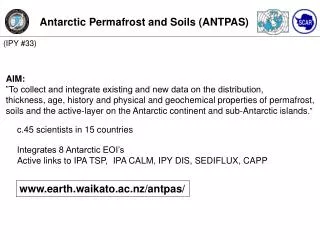
Antarctic Permafrost and Soils (ANTPAS) (IPY #33) AIM: ”To collect and integrate existing and new data on the distribution, thickness, age, history and physical and geochemical properties of permafrost, soils and the active-layer on the Antarctic continent and sub-Antarctic islands.” c.45 scientists in 15 countries Integrates 8 Antarctic EOI’s Active links to IPA TSP, IPA CALM, IPY DIS, SEDIFLUX, CAPP www.earth.waikato.ac.nz/antpas/
Antarctic Permafrost and Soils (ANTPAS) • Integrate existing datasets and create a repository for new data • in a common, web-accessible, database system. • (EOI 125, IPY DIS EOI 49) • Central database system - where? funding proposal for manager • Data rescue • Monitoring data to existing databases (CALM, NSIDC) • Enforcement of IPY data policy
Antarctic Permafrost and Soils (ANTPAS) • Antarctic permafrost and soils maps (EOI 191,228, 816).
Antarctic Permafrost and Soils (ANTPAS) • Monitoring network along regional environmental gradients • (IPA TSP EOI 125): • Boreholes (GTN-P) • Active-layer (CALM-S, EOI 439) • Periglacial processes (link to SEDIFLUX EOI 816) • Protocols/manual for data collection (and submission!) • Monitoring network • Soils observations (link to CAPP)
Marion Island 191 824 228, 191, 492 CALM/GTN-P 316 ANTPAGE (357) P’frost properties Periglacial proc. 65 ? 816 Sediflux?
Antarctic Permafrost and Soils (ANTPAS) • Develop dating techniques and search for the • oldest permafrost on Earth (ANTPAGE EOI 357). • Utilize non-invasive imaging methods including • remote sensing/GIS/geophysical techniques. • Paleorecords of climate change in past and present • permafrost environments. • Deep borehole drilling, sampling and analyses in the • ice-free areas.
Antarctic Permafrost and Soils (ANTPAS) • Outreach & Education • Web-based public information outputs • IPA PhD courses with Antarctic input • Field courses in Antarctica logistically unlikely • ANTPAS-IPY project management/coordination resources • Tracking national projects within IPY framework
Antarctic Permafrost and Soils (ANTPAS) • Discussion points • Central database system - where? funding proposal for manager • Data rescue • Monitoring data to existing databases (CALM, NSIDC) • Enforcement of IPY data policy • New project development to fill monitoring and observation gaps • Outreach & Education • Web-based general information outputs • IPA PhD courses with Antarctic input • Field courses in Antarctica logistically unlikely • ANTPAS-IPY project management/coordination resources • Tracking national projects within IPY framework
Antarctic Permafrost and Soils (ANTPAS) • Meetings • 2006 July 12-14, 29th SCAR Open Science Conference, Hobart, Tasmania. • 2007 August 26 – September 1, SCAR ISAES Santa Barbara, California • 2008 June 29 - 3 July , 9th Int. Conf. On Permafrost, Fairbanks, Alaska
Marion Island 191 824 228, 191, 492 CALM/GTN-P 316 ANTPAGE (357) P’frost properties Periglacial proc. 65 ? 816 Sediflux?
Objectives • Integrate existing datasets and repository for new data in a common, web-accessible, • database system (EOI 125, NSIDC EOI 49). • Produce a set of thematic maps on Antarctic permafrost and soils (EOI 191,228, 816). • Monitoring network along regional environmental gradients (IPA EOI 125): • Boreholes (GTN-P) • Active-layer (CALM-S, EOI 439) • Periglacial processes (link to SEDIFLUX EOI 816) • Soils observations network (link to CAPP) • Protocols/manual for data collection (and submission!) • Develop dating techniques and search for the oldest permafrost on Earth • (ANTPAGE EOI 357). • Utilize non-invasive imaging methods including remote sensing/GIS/geophysical • techniques. • Paleorecords of climate change in past and present permafrost environments. • Deep borehole drilling, sampling and analyses in the ice-free areas.