Download
1 / 33
330 likes | 399 Views
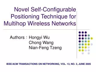
Novel Self-Configurable Positioning Technique for Multi-hop Wireless Networks. Hongyi Wu, Chong Wang,and Nian-Feng Tzeng IEEE/ACM TRANSACTIONS ON NETWORKING, VOL. 13, NO. 3, JUNE 2005. Outline. Introduction Proposed self-configurable positioning technique Euclidean distance estimation

E N D
Novel Self-Configurable Positioning Technique for Multi-hop Wireless Networks Hongyi Wu, Chong Wang,and Nian-Feng Tzeng IEEE/ACM TRANSACTIONS ON NETWORKING, VOL. 13, NO. 3, JUNE 2005
Outline • Introduction • Proposed self-configurable positioning technique • Euclidean distance estimation • Coordinates system establishment • Simulation • Conclusion
Introduction • Many application are need to know node location • Target tracking, routing… • We propose a self-configurable positioning technique • Euclidean distance estimation model • Coordinates system establishment • Range-based • GPS-free A B
Proposed self-configurable positioning technique –Euclidean distance estimation This can be done off-line by each node or a central controller
Euclidean distance estimation • Assume the node distribution is uniform • Euclidean distance d is given (0,0) (d,0)
Euclidean distance estimation • The distance between node D and node i (within S’s transmission range) (0,0) (d,0)
Euclidean distance estimation • where Xiand Yi are random variables with a uniform distribution (0,0) (d,0)
Euclidean distance estimation • Accordingly, we can derive the density function of Zi (0,0) (d,0)
Euclidean distance estimation • Assume a node has the shortest Euclidean distance to D
Euclidean distance estimation • Consequently, we can derive the pdf of Z • And obtain its mean value
Euclidean distance estimation • We draw an arc ACB with node D as the center and as the radius
Euclidean distance estimation • Assuming node is uniformly distributed along AC (or BC) • We can obtain the first hop along the shortest path from S to D
Euclidean distance estimation • Recursively applying the above method, we can obtain the shortest path
Euclidean distance estimation This can be done off-line by each node or a central controller r=0.25, network=1*1
How to use the Euclidead distance estimation model • Estimate the distance between A and B 0.12 0.1 0.18 0.2 0.17 A 1 2 3 4 B Control Packet 0 Control Packet 0.17 Control Packet 0.29 Control Packet 0.39 Control Packet 0.57 Control Packet 0.77 Include a route length field Assume the control packet follow the shortest path DAB= 0.77
How to use the Euclidead distance DAB= 0.77
Coordinates system establishment : Localize landmarks • Each landmark flooding a control packet to every one of all other landmarks • In order to learn the Euclidean distance
Coordinates system establishment: Localize landmarks • The landmark with the lowest ID : (0, 0) • The landmark with the second lowest ID : (X, 0) • The landmark with the third lowest ID: negative Y (LacCos , - LacSin ) (LAB, 0) (0, 0)
Minimize the errors of the landmark’s coordination Minimize the error function: Lij can be learned through the Euclidean distance estimation model (LacCos , - LacSin ) (LAB, 0) (0, 0)
Coordinates system establishment : Localize regular nodes • Landmarks flooding control packet that include their coordinates and length field
Minimize the errors of the regular node’s coordination Minimize the error function: Lip can be learned through the Euclidean distance estimation model
Locations of landmarks • The more the landmarks, the higher the accuracy • But computational complexity increases exponentially • Simulation show that typical # of landmark vary from 4 to 7 • Locations of landmarks • We consider 4 landmarks in a 1*1 area • Assume 4 landmark located at the vertices of a square and has an edge of G
(Xc,Yc) Locations of landmarks 1 0.5 1 G = 0.5
Locations of landmarks 1 0.7 G = 0.9 G = 0.7 1 G = 0.7
Selection of landmarks • :a set of all landmark candidates • If the node is stability and power are high • Each candidate node discovers the shortest path to all other candidate nodes 1 2 3 4 • Ci: Candidacydegree of nodei. • Lower value of C, higher probability to be selected as landmark • Si,j : the length of the shortest path from i to j 5
Simulation parameters • Use Matlab • Assume a number (N=50 to 400) of nodes • 1 * 1 unit area • R=0.25 unit • An average of about 10 to 80 neighbors
Simulation: Node density V.S Euclidean distance estimation Euclidean distance Shortest path length N = 50 N = 400 N = 100
Simulation: Node density V.S Coordinates system N = 50 N = 100 N = 400
Conclusion • We have proposed a self-configurable positioning technique • Do not depend on GPS • Accuracy • We plan to implement the technique in real world