Download
1 / 18
180 likes | 297 Views
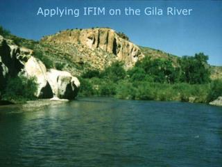
TRAVEL MANAGEMENT - PROCESS ON THE GILA NATIONAL FOREST. What is the purpose of the Process?. To designate a system of roads, trails, and areas that will be open to motor vehicle use on the Gila NF. What approach has the Gila taken?. A single, Forest-wide approach This provides consistency:

E N D
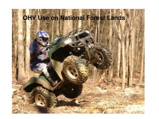
What is the purpose of the Process? • To designate a system of roads, trails, and areas that will be open to motor vehicle use on the Gila NF
What approach has the Gila taken? • A single, Forest-wide approach • This provides consistency: Internally Externally Maps
Focus of the Gila’s Process • Analysis will be limited to existing roads and trails. • Only roads/trails shown on current FS map and those roads added by the public will be considered for possible designation.
All motorized vehicle types will be considered for use on roads (e.g. full size vehicles, SUV’s, ATV’s, motorcycles, etc.) • Trails designated for motorized use will be limited to use by: • Motor vehicles less than 50” or to single track (motorcycle) use • Seasonal restrictions may be considered on a case by case basis
Road closures / decommissioning of non-designated roads may be considered. • New road/trail construction requests may be considered on a case by case basis or analyzed in the future under a separate NEPA process. • Non-motorized types of uses will not be considered at this time
Routes were assessed using: • Resource Concerns or “Coarse Filter” • Public Input • Fine Filter
Resource Concerns • The Forest developed a “coarse filter” • A GIS model that prioritized roads for field verification based on input by resource specialists. Inputs included: • NMED 303(d) list of Impaired Surface Waters • ESA aquatic and terrestrial species; critical habitat; or habitat specified in recovery plans • NMED identified public (community) water supply source • Large drainages that flow into any of the previous 3 points • Perennial channels with non-listed fish species
Resource Concerns (cont.) • Maps and tables have been developed for: • Road densities by 5th and 6th code watersheds • Road density by section in relationship to wildlife species and habitat including Threatened, Endangered, and Sensitive
Public Input • From November 2005 into 2007 the Districts had: • Met with all 4 County Commissioners • Held 46 public meetings / open houses with over 900 attendees • Met with over 380 individuals including range permittees, landowner, outfitter guides, etc. • Received hundreds of route specific information.
Other Agencies • Worked with other agencies: • A-S National Forest • US Fish and Wildlife Service • New Mexico Department Game and Fish • State Historic Preservation Office
Fine Filter • Public input • Priority 1&2 roads (coarse filter) • LRMP Standards and Guides • Escape routes / access to safety zones • Current road status • Rights of Ways (granted / acquired) • Permitted uses (range, utilities) • Current recreation uses & opportunities
Fine Filter (cont.) • Current erosion processes • Steep slopes / sensitive soils • Cultural resources • TES habitat & other wildlife resources • Road densities (Coarse filter) • Relation to stream channels • Road overlap trail (e.g. CDT) • Parallel or duplicate (goes to same location) routes • Road position on slope
Locations for Motorized Dispersed Camping was assessed using: • Public Input • Criteria Filter
Criteria • Proximity to Private Land • Fire hazards • Fuels conditions • Vegetation type • Prevailing wind direction • Threatened, Endangered, & Sensitive species habitat • Riparian values • Relation to stream channels
Criteria (cont.) • Steep slopes • Sensitive soils • Known sensitive cultural resource sites • Maintenance level of road • Speed / traffic levels • Public safety • Current dispersed use pattern • Road jurisdiction