Download
1 / 14
140 likes | 305 Views
Assessment of Spatial Metrics to Determine Rangeland Degradation. Riaz Hedayati Mentor: Chandra Holifield Collins USDA-ARS SWRC The University of Arizona April 17, 2010. Background.

E N D
Assessment of Spatial Metrics to Determine Rangeland Degradation Riaz HedayatiMentor: Chandra Holifield CollinsUSDA-ARS SWRC The University of Arizona April 17, 2010
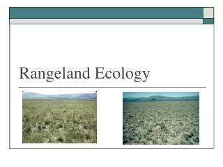
Background • Soil erosion is a major cause of degradation in rangelands. If erosion patterns can be predicted, rangeland degradation can be more easily prevented. • Traditionally, erosion potential is assessed using one of two ground-based measurements on a 2m x 6m plot: Transect Data (fetch:patch ratio) Point Data
Hypothesis • Accounting for the spatial distribution of vegetation cover will be an improvement over traditional ground-based data for predicting erosion potential.
Study Sites • Data was collected from 5 different field sites within southeastern Arizona. • Each field site had 4 plots, and each plot measured 2m x 6m.
Methods • A rainfall simulator was used on each plot to simulate erosion patterns and collect sediment yield (SYR) data.
SYR Point Interspace Area Methods Point Interspace Area
SYR Fetch:Patch Ratio Methods Fetch:Patch Ratio
Photographs were digitally classified into vegetation and non-vegetation areas. SYR Interspace FPI Methods Interspace FPI
Conclusions • Interspace FPI showed a slightly stronger relationship to sediment yield data than the point data or the fetch:patch ratio. • Because it explicitly accounts for the spatial distribution of interspace areas, interspace FPI shows great promise as a tool for assessing degradation of ecological sites in semi-arid rangelands.
Acknowledgements This Project would not have been possible without help from: Dr. Chandra Holifield Collins Dr. Jeffry Stone Rae-Landa Gomez-Pond Leonard Cratic III Jason Wong