Download
1 / 31
320 likes | 593 Views
INTERNATIONAL SOCIETY FOR SOIL MECHANICS AND GEOTECHNICAL ENGINEERING HUNGARIAN NATIONAL COMMITTEE. Geotechnical investigation and risk assessment at Budapest metro line 4. Dr. Tibor Horváth Geovil Ltd. 24th -25th September 2010 , Budapest ISSMGE TC 302.

E N D
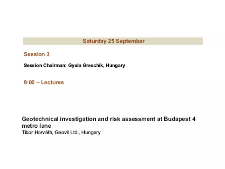
INTERNATIONAL SOCIETY FOR SOIL MECHANICS AND GEOTECHNICAL ENGINEERING HUNGARIAN NATIONAL COMMITTEE Geotechnical investigation and risk assessment at Budapest metro line 4 Dr. Tibor Horváth Geovil Ltd. 24th -25th September 2010, Budapest ISSMGE TC 302 “Failures, Disputes, Causes and Solutions in Geotechnics”
MAIN FEATURES OF METRO LINE 4 Length of line: 12.7 km Phase I: 7.4 km Phase II: 3.2 km Phase III: 2.1 km Number of stations: 16 Phase I: 10 stations Phase II: 4 stations Phase III: 2 stations Extensions: Phase II currently holds licences from both railway and environmental authorities as far as Bosnyák tér, while the planned Phase III would extend as far as the Budaörs Flower Market.
The route proceeds at a relatively shallow depth, at a rail-top level of 16-22 metres below the surface on average, the depth of 32-34 metres under the Danube, passing beneath an almost entirely built-up area and through extremely varied geological strata. • Buda section Danube Pest section
Enginner geological profile of Buda side Kiscelli marly clay stone, weathered Kiscelli marly clay stone, fissured
Engineering geological profile of Pest side Pleisztocene, river sediments Miocéne, litoralfacies of of a mediterrain sea
Risk Classification by Likelihood „L „ Risk Classification by Severity „S „
Risk Assessment Classification Matrix ”RI” (Risk Index) Risk Index, Classification and Marking • After determining the likelihood and severity of the risk we determined the risk index by means of the assessment • matrix. • Risk index = Likelihood of occurrence x Severity of risk • RI = L x S • The risk index has been calculated for the “starting/initial” cases and the cases yet remaining despite the efforts • made to alleviate severity of the risks involved.
Elements of Risk AssessmentArise from Geology, Hydrogeology and Geotechnical features • General risk from the level of geotechnical investigation, • Personal risk • Third party risk • Environmental risk • Risk of equipments • Risk of program and delay
Geotechnical general risk from the level of geotechnical investigation, at Buda side After additional investigation and monitoring At the time of GBR
Geotechnical General Risk from the Level of Geotechnical Investigation,at Danube River Crossing
Geotechnical General Risk from the Level of Geotechnical Investigation at Pest side
Total Volume of the Investigation at the End of Construction Work
Length of boring versus length of tunnel (stations with SCL method)
Length of boring versus boring length / tunnell length Length of boring (m)
Length of boring versus length of tunnell Recommended rate of USTNC/TT=1,2 * * U.S. National Committe on Tunnelling Technology, 2005
Cost of geotechnical investigation / cost construction at SCL tunnells
Budapest metro 4 Fővám station Due to the detailed investigationand monitoring the tunneling work has been safe and successful in very dangerous – difficult geotechnical conditions.
Budapest metro4 Rákóczi station SCL tunnell collapse – wash out
Budapest metro4 Rákóczi station SCL tunnell collapse – wash out
Budapest metro 4Rákóczi station SCL tunnell collapse – wash out
Budapest metro 4Rákóczi station SCL tunnell collapse – wash out
Budapest metro 4 Rákóczi station SCL tunnel collapse – wash out
Conclusions and recommendations • The Geotechnical Risk Assessment comes from a suitable site investigation and the consequent building of an appropriate and coherent Engineering Geological model. • It is desirable to create an international standard for the Geotechnical Risk Assessment, and to agree the parameters and guidelines for these recommendations. • The Geotechnical Risk Assessment has a relationship to the quantity of meters of site investigation holes bored and the excavated length of tunnel. For the SCL tunnel ( soft tunneling at shallow depth ) the ratio of site investigation / excavated tunnel length should be1.2 . • For the Budapest metro 4 project, the recommended ratio was followed. This resulted in a project which was very safe, in geological, geotechnical terms alsothe project had very few disputes relatedto the geotechnical risk clauses