Download
1 / 15
150 likes | 266 Views
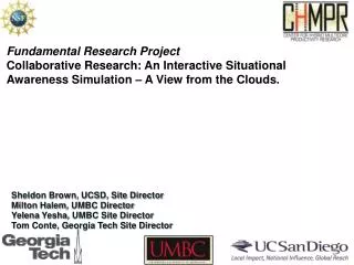
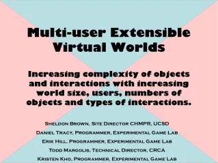
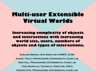
Fundamental Research Project Collaborative Research: An Interactive Situational Awareness Simulation – A View from the Clouds. Sheldon Brown, UCSD, Site Director Milton Halem , UMBC Director Yelena Yesha , UMBC Site Director Tom Conte, Georgia Tech Site Director. Summary.

E N D
Fundamental Research Project Collaborative Research: An Interactive Situational Awareness Simulation – A View from the Clouds. Sheldon Brown, UCSD, Site Director Milton Halem, UMBC Director Yelena Yesha, UMBC Site Director Tom Conte, Georgia Tech Site Director
Summary. We will create a virtual world simulation, distributed across a heterogeneous compute infrastructure, to facilitate dynamic analysis of complex situations. The virtual world will be built from a variety of data sources; including high fidelity, well correlated data sources to data mining of internet feeds and many-user updates with commodity devices such as cell phones and digital cameras. Integrating heterogeneous computing resources to enable applications that can provide robust representations of dynamic situations, including those with tragic human and environmental impact, with data derived from a multitude of sources in a timely manner for decision makers and for citizens at large.
The virtual world simulation has five interrelated operations: • It provides the scheme to correlate the various pieces of data • A collaborative tool in which data elements are improved and verified • An experiential tool to enable understanding of how the different components of a complicated scenario unfold • Facilitates short term planning activities at the real site • A platform to simulate scenario forecasting for purposes such as long-term planning or future incident mitigation.
Distributed computation User participation, extensibility and coherency Distributed Multi-Media Data Base Management Network Analysis Asset Analysis, Integration and Computation Mobile Devices
Currently undertaking: Quarter 1: Establish an Ad Hoc CHMPR member industry planning and evaluation team. Quarter 1: Implement a Distributed Heterogeneous Cloud Computing system based on the open Apache provided Hadoop system consisting of their File system, H base system for large image data base querrying and the MapReduce algorithm for content search and query. Quarter 1 Milestone: Import large volumes of Haiti earthquake data for storage in the H base system Quarter 2 – 3: Extend the virtual scalable city world with real world data. Quarter 2 Milestone: Visualize Haitian data static data from distributed cloud Next steps: Quarter 3 Milestone:Distribute visualization to simultaneous multiple users. Quarter 4: Demonstration scenario with advanced GPS equipped multi-media mobile devices Quarter 4 Milestone: Test quality control features on human acquired event data. Quarter 4: Test uploading of streaming data from variety of devices Quarter 4: Implement user data refinement annotations within virtual world Quarter 4 Milestone: Compare user refined and unrefined models through external analysis. Quarter 4: Run simulation extraction scenarios for initial demonstration of proof of concept. Road re-devlopment as initial test case.
Geo-located media • Initial example of using location based media from the web, with little or no post processing, into the interactive virtual environment
Disaster in Japan • Streamlined process for importing world elevation data • Markers for locations of interest
Disaster in Japan • Media streams from youtube, etc.
Spill data integration • Spilled oil location data mined by UMBC integrated into virtual enviroment
Improved Elevation Data • NOAA Global Land One-km Elevation Project • 1 km sample resolution and meter height resolution • Big improvement over ArcGIS • No longer confined to image based data • Not limited to 0 – 255 grayscale range • Height data in actual meters • Negative numbers for water below sea level • No need to stitch image tiles together • No compression artifacts
Multi-User Experience • Situational Awareness server allows for multiple users to experience the virtual space • Further exploration needed for: • User avatars • interactions between users
FRP: Future Work for virtual environment • Incorporate wind & water current data mined by UMBC • Dynamic landscape geometry resolution • Controlled by areas of interest • Highly detailed landscape in locations with a lot of data streams • Low detail in areas with little to no data streams • Multi-user interaction • Downloadable client