Download
1 / 15
150 likes | 303 Views
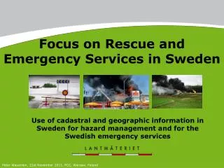
Focus on Rescue and Emergency Services in Sweden. Use of cadastral and geographic information in Sweden for hazard management and for the Swedish emergency services. Peter Wasström, 21st November 2011, PCC, Warsaw , Poland. Rescue and emergency services need data.

E N D
Focus on Rescue and Emergency Services in Sweden Use of cadastral and geographic information in Sweden for hazard management and for the Swedish emergency services Peter Wasström, 21st November 2011, PCC, Warsaw, Poland
Rescue and emergency services need data The ready availability of current and reliable maps and cadastral information is of vital importance for these services 21st November 2011 2
Picture from a publication of FIG Working Group 8.4 (2006) The need of surveying methods and applications for disaster risk management Important survey information manners: • GPS • Geodesy • Maps • Images • Cadastre
What is Emergency servicesin this context (Lantmäteriet)? • SOS Alarm Ltd. – a company in Sweden that have by an appointment with the Swedish Government the responsibility for handling 112 emergency calls and coordinating the rescue work • Municipalities rescue - incl. rescue unions with several municipalities • Ambulance - county councils • The Swedish Police – central authority • Police - county authorities • State emergency - flight, mountain & sea rescues • Swedish Civil Contingencies Agency
How is Lantmäteriet dealing with this? • Gather representatives for a dialogue with national focus • Take advantage of existing knowledge and experience • Increase own and actors insight on access, need and demand • Obtain the evidence and the knowledge needed to Lantmäteriet, actors and the market to take actions Lantmäteriet started a user group for actors in emergency services in November 2009
User group – Emergency services Lantmäteriet - chairman and secretary Participants: • SOS Alarm Ltd. • Swedish Police • Swedish Civil Contingencies Agency • Swedish Association of Local Authorities and Regions • Swedish Transport Administration • Representatives from municipalities and ambulance
Common goals for the user group • Increase the common understanding about the demand and supply of cadastral (land) and geographic information (Geodata) The emergency rescues must on easy way "find the correct place“ • Create a platform for continuous dialogue about common problems and development needs for the national supply of geodata for the emergency operations • Obtain the relevant data and knowledge in order to discuss solutions to the identified needs • Suggest relevant policies of different actors both state authorities and the private sector (market actors)
Geodata supply – Emergency services- General description of the problems and needs
Investigation of the emergency services (blue-lights) needs The investigation had about 40 different activities. • Needs (find the right way, perform and plan the operation, the whole process, future wishes) • Kind of information • Frequent of actuality and up-dating • Content (cartographic, land register, geodetic, attributes, images, others) • Source (government authorities and private sector) • Cooperative users (eg. ambulance, fire units, police) • Cooperative producers • Comments • Emergency services priority of the data and up-dating
What has been done? • An action plan has been developed during 2010 • Emergency services have started to talk to each other • Geodata Cooperation Agreement has been developed in Sweden 2011 (www.geodata.se):- 16 producers of Geodata- 4 authorities has signed the agreement and have access- 21 municipalities has signed the agreement and have access
Exchange of cross-border data for crisis management in the Nordic countriesEmergency services
Cross-border data for crisis management The definition of public safety operators are different in different countries. Each countries NMA along with the emergency management authorities decides the interpretation of emergency service (blue-light) actors. --------------------------------------------------------- What is important is that there should not be an obstacle to fire, ambulance and police cars to find the right place when they help with work in neighbouring countries and not that the availability of data is an obstacle in saving lives and preventing property damages.
Agreement - Content of data • Map data, addresses and place names in the neighbouring Nordic countries • Standard map series in vector and raster formats as well as addresses and place names • Coordinate systems and data delivery format agreed upon individually between mapping agencies in connection with the delivery to the respective map series • The emergency service actors can choose which data they wish to use ----------------------------------------------------------------- The delivery of data to the actors can be either: • direct Frequently from mapping agencies, or • through the Emergency Management Agencies by individualagreements in each country.
Agreement - Content of data (continue) • The Nordic mapping agencies provides access rights (right of use). The right of use includes use in preparedness and response for each countries public safety partners (emergency services, ambulance, police, or similar) and for each countries preparedness actors (such as civil defence and other security features). • Area covers a 100 km zone into the neighbouring country. • A joint agreement between the Nordic mapping agencies thereof. • Each country is responsible for the necessary agreements on the use of trans border data over public safety and emergency operators. • The purpose of the agreement is to give the right to use the data for the blue-light operators to find their way in the neighbouring country, when they need to make efforts in the neighbouring country.
Pytania?Questions? Dziękuję za uwagę!Thank you for your attention? Contact: Peter Wasström Product Marketing Manager Lantmäteriet, Sweden E-mail: peter.wasstrom@lm.se