Download
1 / 23
230 likes | 436 Views
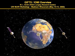
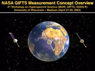
NASA GIFTS Measurement Concept Overview 4 th Workshop on Hyperspectral Science (MURI, GIFTS, GOES-R) University of Wisconsin – Madison (April 27-28, 2004). 20/20 Vision (Weather in Our Palm).

E N D
NASA GIFTS Measurement Concept Overview4th Workshop on Hyperspectral Science (MURI, GIFTS, GOES-R)University of Wisconsin – Madison (April 27-28, 2004)
20/20 Vision (Weather in Our Palm) By the year 2020, mankind will have the technology (observations and models) to digitize the earth’s surface and its atmosphere with a resolution of 1 km and 1 minute And Every individual on earth will have personal and timely access to weather observations and accurate weather forecasts through a “palm” computer/display unit.
2020 Vision Strategy Surface-based Remotely Sensed Integrated Data Products
Environmental Satellites FY POLAR (China) FY GEO (China) ENVISAT (Europe) EOS (USA) ADEOS (Japan) NPOESS (USA) METOP (Europe)
Hyperspectral Atmospheric Sounder Evolution Aircraft NAST-I / SHIS (1995 - ) Nimbus 3 & 4 IRIS/SIRS (1969-1972) Nimbus 5/ITPR ITOS/VTPR Nimbus 6/NOAA HIRS GOES/VAS & HIRS (1972-2009) High Resolution Interferometer Sounder (HIS) (1985- ) Hyperspectral Resolution Hyperspectral Resolution Imagery First Satellite Sounders High Horizontal Resolution NMP GIFTS GOES-HES (20??- ) NPP/NPOESS/CrIS (2006- ) ADEOS IMG (1996-1997) Aqua AIRS (2002- ) METOP-IASI (2005- ) FTS Grating European Hyperspectral Resolution Sounder Geostationary Imaging 4-d T,q,“V” Sounder First Satellite Hyperspectral Resolution Sounding Spectrometers US Hyperspectral Resolution Sounder
Hyperspectral Atmospheric Sounding The Infrared Radiance Spectrum
Hyperspectral Imaging Images from Two Single Spectral Samples (Left) And Spectra from Two Different Spatial Samples (Below) Observed With a 128 x 128 Imaging FTS 2129 cm-1 (4.7 µm) Spectrum for Pixel (37,64) on face 2314 cm-1 (4.3µm) Spectrum for Pixel (90,63) in breath 2314cm-1 (high gain) 4.3 µm (2314 cm-1) CO2 Absorption Band (3.0 µm) (5.0 µm)
GeostationaryImagingFourierTransformSpectrometer New Technology for Atmospheric Temperature, Moisture, Chemistry, & Winds EO-3 “GIFTS” 4-d Digital Camera: Horizontal: Large area format Focal Plane detector Arrays Vertical: Fourier Transform Spectrometer Time: Geostationary Satellite
GIFTS Sampling Characteristics • Two 128x 128 Infrared focal plane detector arrays with 4 km footprint size • Two 512 x 512 Visible focal plane detector arrays with 1 km footprint size • Field of Regard 512 km x 512 km at satellite sub-point • Ten second full spectral resolution integration time per Field of Regard • ~ 80,000 Atmospheric Soundings every minute
GIFTS IR Measurements and Products (8.8 to 14.6 microns) (4.4 to 6.1 microns) Products: Water vapor (soundings, fluxes, winds) Temperature (sounding, stability) Carbon monoxide concentration (2 Layers) Ozone concentration (4 Layers) Surface Temperature and emissivity Clouds (altitude, optical depth, microphysical properties, winds) Aerosol Concentration and Depth
NAST-I Validates GIFTS Concept • Instrument Characteristics • infrared Michelson interferometer • (9000 spectral channels) • 3.5 – 16 microns @ 0.25 cm-1 • Aircraft Accommodation • ER-2 Super pod & Proteus Underbelly pod • Radiative Measurement Capability • calibrated radiances with • 0.5 K absolute accuracy, 0.1 K precision Spatial Resolution 130m/km flight alt. (2.6 km from 20km) Swath Width 2 km /km flight alt. (40 km from 20 km) Temperature (K) Water Vapor Mixing Ratio( Uncorrected) Relative humidity (%) Tracks over ARM-site
Wind Measurement δt~35 min NAST-I Water Vapor Tracking Demonstrates GIFTS Wind Profiling Technique 60 km x 40 km
ER-2 NAST H2O Vs Twin Otter Doppler LIDAR Winds Direction (Degrees) 270 360 90 180 0 700 February 11, 2003 36N, 121.6W Off California Coast 800 GOES - IR Pressure (mb) 900 X 1000 0 4 8 12 16 20 Speed (mps)
Geostationary Hyperspectral Measurements • Observation Capability Will Revolutionize • Weather Forecasting • Hurricane landfall (steering wind profiles) • Tornadic storms (stability change monitoring) • Nowcasting (rapid measurement update) • Numerical prediction (initial p,T,q,V data) • Air quality forecasts (O3 and CO transport)
Cloud Effects on Retrieval Non-opaque Clouds Non-opaque Clouds Opaque Clouds NAST I-HOP June 12, 2002 Over Oklahoma Cloud Tops Cloud Tops Moist Layers PBL Ht
Cirrus Cloud “Venetian Blind Effect” Depressions due to Cloud Attenuation 16.0 UTC 13.8 Temperature (K) 14.9 Log10{VMR (g/Kg)} These retrievals, uncorrected for cloud attenuation, demonstrate the ability of a high spatial resolution sounder to sense the spatial structure of moisture below a scattered and semi-transparent cirrus cloud cover
Basis for Cloud Training Algorithm! Radiance Spectra Carry Information on Cloud Phase and MicrophysicalProperties Wavenumber (cm-1)
Cloud Retrieval Training ! • Perform a realistic simulation of clouds for synthetic EOF radiance training • Diagnose cloud layer from radiosonde relative humidity profile • A single cloud layer (either ice or liquid) is inserted for the highest level of cloud diagnosed from the input radiosonde profile. If a second cloud layer exists it is represented as an opaque cloud. • Use parameterization of Heymsfeld’s* balloon and aircraft cloud microphysical data base (2003) to specify cloud effective particle radius, re, and cloud optical depth, , (i.e.,re= a / [ - b]) . • Different habitats can be specified (Hexagonal columns assumed here) • Different clouds microphysical properties simulated for same radiosonde using random number generator to specify visible cloud optical depth within a pre-specified range. 10 % random error added to parameterized effective radius to account for real data scatter. • Use UW/Texas A&M “lookup table” for cloud radiative properties • Spectral transmittance and reflectance for ice and liquid clouds interpolated from multi- dimensional look-up table based on DISORT multiple scattering calculations for the (wavenumber range 500 – 2500 cm-1, zenith angle 0 – 80 deg., Deff (Ice: 10 – 157 um, Liquid: 2 – 100 um), OD(vis) (Ice: 0.04 - 100, Liquid 0.06 – 150) • Compute EOFs and Regressions from cloudy radiance data base • Regress cloud properties (i.e., p, , re) and profile against Radiance EOFs • For small optical depth, output entire profile • For large optical depth, output profile above the cloud level • Heymsfield, A. J., S. Matrosov, and B. A. Baum: Ice water path-optical depth relationships for cirrus and precipitating cloud layers. J. Appl. Meteor. October 2003
MHX MHX December 5, 2003
The GIFTS hyperspectral measurement concept for observing temperature, water vapor flux, and wind profiles has a solid theoretical and airborne validated foundation. • Clouds should not severely limit the utility of the GIFTS measurement concept • The next generation operational GOES-R sounding system is benefiting from the scientific research and technology development conducted under the GIFTS program • Although the completion of a space qualified GIFTS instrument for space validation of the GIFTS measurement concept awaits funding from a space flight geostationary satellite mission opportunity, the research and development will continue in support of the world’s next generation global observing system. Conclusions