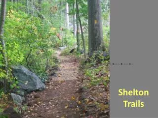
Shelton Trails
800 likes | 1.07k Views
Shelton Trails. All levels of difficulty. From very easy…. …to challenging. ~ Happy Trails ~. Multi-Use Paths. Pedestrians Street Bikes Baby Carriages Wheelchairs Paved or crushed stone. Shelton Riverwalk 0.3 miles. 0.3 miles long (0.6 mi. loop).

Shelton Trails
E N D
Presentation Transcript
All levels of difficulty From very easy…
Multi-Use Paths • Pedestrians • Street Bikes • Baby Carriages • Wheelchairs • Paved or crushed stone
Shelton Riverwalk 0.3 miles 0.3 miles long (0.6 mi. loop)
Shelton Lakes Recreation Path4.5 miles – under construction
Downtown Shelton to Huntington Center4.5 miles in various stages of completion Rec Path
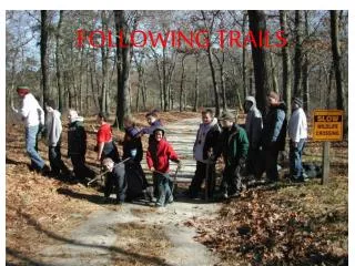
Walking TrailsEasy to Moderate • Hiking • Mountain Biking • Footing often uneven, but not too steep
10 miles of trails Oak Valley Trail Dominick Trail Rec Path Turkey Trot Trail Nells Rock Trail Shelton Lakes Greenway
Riverview Park Trail(0.6 mi. one way) Shelton’s Oldest Park
History • Scenic Views • Playground
Fishing Picnic Bench Historic Mill Dam Gristmill Trail (0.3 miles)
Gristmill Trail Gristmill Trail
BoehmPond Trails (loop and spur 1 mi.)
Boehm Pond Trail West Shelton – FAR Mill Street (not Mill Street)
Nicholdale Farm(Loops totaling about 2 miles) • Shelton Land Conservation Trust • Fields & Forest • Youth camp. • Maintained for wildlife • Cattle Underpass
NicholdaleFarm White Hills, Route 110
Challenging Hiking Trails • Not for everyone! • Harder to find the trail • Terrain steeper • Possible scrambling over rock • Better wildlife viewing
Birchbank Trail Red Trillium Dutchman’s Breeches
Tahmore Loop (0.9 mi.) • Easy access to Paugussett Trail overlook • Ups and downs • Shelton Land Trust • Inner loops 0.5 mile
Paugussett Trail (8.7 mi.) • “Blue Dot” Trail • Historic – 1930’s CCC project. • East Village, Monroe to Indian Well State Park, Shelton • Historically went to Roosevelt Forest in Stratford. • CFPA 800+mile system
CFPA Connecticut Forest and Parks Association Maps: “Connecticut Walk Book” No bikes
Finding Your Way • Bring a map!!! • Pay attention to trail blazes. • Waymarkers at Shelton Lakes
Trail Maps • Online: • sheltonconservation.org • sheltontrails.org • Community Center • City Hall
Trail Blazes • Rectangles of color-coded paint on trees, rocks, or pavement. • Blue – Paugussett “Blue Dot” Trail • Blue with yellow dot – Paugussett access trail or loop • Yellow – Shelton Lakes Recreation Path • Orange – Dominick Trail • White – all other trails
Crackingthe Code Watch out for TURNS. The “trail” may turn unexpectedly off of the pathway, especially around old woods roads or ATV trails.