Download
1 / 11
110 likes | 1.69k Views
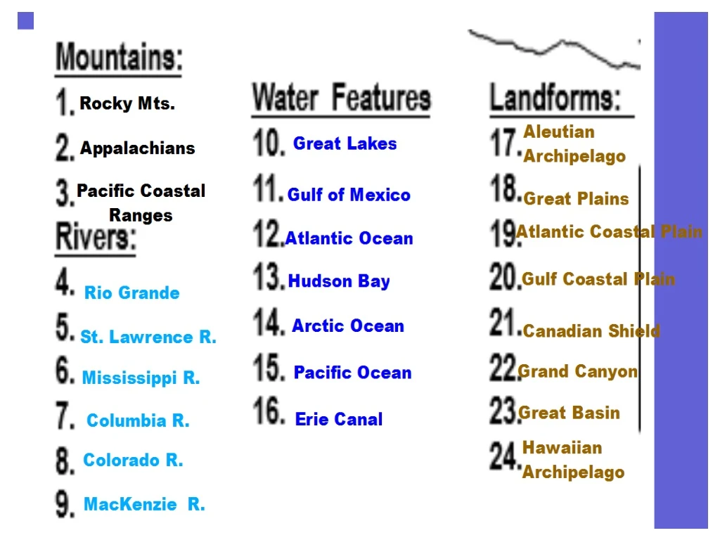
#17 on HW. Continental Divide: Sits along the edge of the Rocky Mountains. Point at which fallen precipitation seeps into rivers that flow toward opposite sides of the continent; into either the Atlantic or Pacific Oceans. #10 on HW. Erie Canal :

E N D
#17 on HW Continental Divide: Sits along the edge of the Rocky Mountains. Point at which fallen precipitation seeps into rivers that flow toward opposite sides of the continent; into either the Atlantic or Pacific Oceans.
Erie Canal : Manmade waterway that connects Lake Erie with the Hudson River in New York. The purpose of the Canal is to provide a trade route. (SOL WG.2b)
#1 on HW Colorado River: Eroded land over time to create the Grand Canyon. Water from the Colorado river is being diverted for irrigation to fields in southwest U.S. (SOL WG.2b)
Rocky Mountains: Create rain shadows on the leeward slope of the mountains.
Rio Grande River: Serves as part of the boundary between the United States and Mexico.
The climates found in this region vary from very hot to very cold. Climates: A) # 24 on HW Northern Canada into Alaska – tundra climate(vegetation consisting of small bushes & lichens but few or no trees; has permafrost) B) Central Canada – subarctic climate(vegetation consisting of taiga)
C) Northwest U.S. – Washington & Oregon States Marine West Coast Climate with vegetation consisting of mixed forests. D) Great Plains and Northeast U.S.- Humid Continental Climate
E) Southeastern U.S. – Humid Subtropical Climate with mixed forests. F) Hawaii – Tropical Wet (rainforest) Climate and Vegetation G) Southwest U.S. – Arid consisting of desert and steppe climates