Download
1 / 10
100 likes | 170 Views
Explore the evolution of remote sensing applications, from national mapping tools to LiDAR for individual tree species classification. Discover the significance of monitoring, verification, and validation in assessing carbon stocks and land cover change. Dive into uncertainty analyses and see how high-precision GPS receivers enhance data accuracy.

E N D
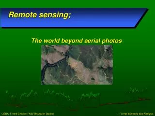
Remote sensing; The world beyond aerial photos
In the beginning:Invention New applications from large to small proliferate Small: LiDAR for Harvest unit profiles 1990’s Large: National mapping and estimation tools for carbon
National AssessmentsMonitoring Change, Carbon Assessments, land use, land cover • North American Forest Dynamics (NAFD) • mapping forest disturbance and cause • Monitoring, Reporting, and Verification (MRV) accounting system • current and historic baseline carbon stocks and trends • Landscape Change Monitoring System (LCMS) • land use and land cover change mapping • National Land Cover Dataset (NLCD) – Tree Canopy Cover • this 30 meter nationwide (CONUS) map depicts tree canopy cover in 2011. • Image-based Change Estimation (ICE) • land use and land cover change information
LiDARindividual tree species classification Brown: Hardwood Green: Conifer Small Scale applications
What is next? • Validation • Consolidation • Applications • Integration
Uncertainty Analyses: Compare biomass estimates and precision from different frameworks and input datasets • Design-based with (1) inventory plots alone (current US NGHGI), (2) plots and LiDAR, and (3) plots, LiDAR, and Landsat • Model-based with (4) plots and Landsat, and (5) plots, LiDAR, and Landsat • (6) Current v. (7) high-precision georeferenced plot locations Validation USFS (Cohen – PI, Andersen, Healey, Moisen, Schroeder, Woodall, Domke), OSU (Yang), SUNY (Stehman), BU (Kennedy, Woodcock, Zhu), USGS (Vogelmann, Steinwand), UMD (Huang)
Consolidation FROM: • Purpose • Purpose • ProcessData Product 1 • ProcessData Product 2 TO: Product 1 • Process • Data Purpose Product 2 Purpose
Acquiring accurate FIA plot locations using survey-grade GPS receiver on Kenai Peninsula (August, 2008) Courtesy: Ray Koleser Application2014 Tanana Pilot: High-accuracy GPS • Accurate plot locations are critical for matching high-res remote sensing & field data • In 2-phase sampling designs, error in plot locations directly influences the precision of parameter estimates • Dual-frequency GPS+GLONASS receivers can acquire coordinates with < 1 m error in all boreal forest conditions


