Download
1 / 27
270 likes | 387 Views
This piece explores the concepts of functional regions, geographic situation, and the mathematical descriptions used by geographers to analyze space effectively. Functional regions are characterized by even distribution, node centrality, and cultural neutrality. This work also delves into the importance of understanding a location’s situation in relation to other places and the elements that contribute to its significance. Furthermore, it discusses the necessity of map projection for accurately representing Earth's spherical surface in two-dimensional formats.

E N D
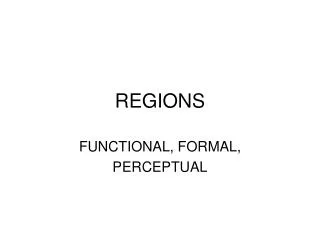
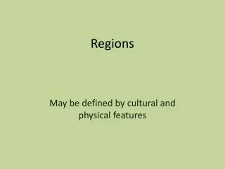
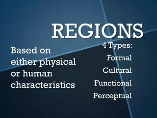
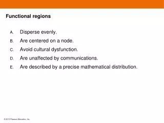
Functional regions • Disperse evenly. • Are centered on a node. • Avoid cultural dysfunction. • Are unaffected by communications. • Are described by a precise mathematical distribution.
Functional regions • Disperse evenly. • Are centered on a node. • Avoid cultural dysfunction. • Are unaffected by communications. • Are described by a precise mathematical distribution.
In addition to describing a location by its place name, geographers use the terms site and situation. Which of the following is true about a location’s situation? • It helps us to understand a place relative to other places. • Situation describes the climate and weather of a place. • It combines physical features of a place with accessibility. • Situation factors help explain why certain places were chosen as good settlement places. • Situation does not help us understand the importance of a place.
In addition to describing a location by its place name, geographers use the terms site and situation. Which of the following is true about a location’s situation? • It helps us to understand a place relative to other places. • Situation describes the climate and weather of a place. • It combines physical features of a place with accessibility. • Situation factors help explain why certain places were chosen as good settlement places. • Situation does not help us understand the importance of a place.
Maps require projection because • A spherical surface is represented on a two-dimensional plane. • It is good practice to draw maps with both straight and curved lines. • Distortion is eliminated when a map is projected. • Otherwise places would lack a situation. • Meridians need to remain parallel.
Maps require projection because • A spherical surface is represented on a two-dimensional plane. • It is good practice to draw maps with both straight and curved lines. • Distortion is eliminated when a map is projected. • Otherwise places would lack a situation. • Meridians need to remain parallel.
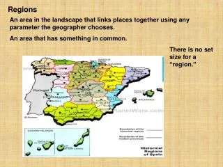
The previous figure is an example of • Vernacular regions. • Functional regions. • Formal regions. • Azimuthal regions. • Characteristic regions.
The previous figure is an example of • Vernacular regions. • Functional regions. • Formal regions. • Azimuthal regions. • Characteristic regions.
Global positioning satellites • Draw the maps used in a GIS. • Receive signals from GPS units. • Have been placed around Earth in predetermined orbits. • Determine the hydrology of layers. • Substantiate the distribution of layers.
Global positioning satellites • Draw the maps used in a GIS. • Receive signals from GPS units. • Have been placed around Earth in predetermined orbits. • Determine the hydrology of layers. • Substantiate the distribution of layers.
Referring to the figure on the previous slide, choose the most accurate statement. • Scale changes as houses become closer. • Distribution density remains even despite clustering in bottom image. • The three plans are equally concentrated. • It is important to consider both the number and pattern of houses. • The lowest plan allows for more houses than the other two plans.
Referring to the figure on the previous slide, choose the most accurate statement. • Scale changes as houses become closer. • Distribution density remains even despite clustering in bottom image. • The three plans are equally concentrated. • It is important to consider both the number and pattern of houses. • The lowest plan allows for more houses than the other two plans.
The distribution of baseball teams in the figure on the previous slide • Is initially concentrated in the east, then dispersed westward. • Is concentrated in a grid pattern. • May be expressed symmetrically. • Favors rural locations. • Remained constant even though teams relocated.
The distribution of baseball teams in the figure on the previous slide • Is initially concentrated in the east, then dispersed westward. • Is concentrated in a grid pattern. • May be expressed symmetrically. • Favors rural locations. • Remained constant even though teams relocated.
The geographer’s role in discerning changing gender roles • Tasks over space to family members. • Ignores issues of cultural sensitivity. • Records and notes changes over space. • Focuses on the evolving female importance. • Dictates where men and women work.
The geographer’s role in discerning changing gender roles • Tasks over space to family members. • Ignores issues of cultural sensitivity. • Records and notes changes over space. • Focuses on the evolving female importance. • Dictates where men and women work.
Geographic scale on a map is NOT represented by • Scale bar. • A ratio. • A fraction. • A picture. • A statement such as 1” on the map equals 24,000 feet on Earth.
Geographic scale on a map is NOT represented by • Scale bar. • A ratio. • A fraction. • A picture. • A statement such as 1” on the map equals 24,000 feet on Earth.
The spread of an idea from persons or nodes of authority or power to other places or people is an example of • Diffusion. • Expansion diffusion. • Hierarchical diffusion. • Integral diffusion. • Contagious diffusion.
The spread of an idea from persons or nodes of authority or power to other places or people is an example of • Diffusion. • Expansion diffusion. • Hierarchical diffusion. • Integral diffusion. • Contagious diffusion.
Which of the following best describes the process of relocation diffusion? • Ideas spread through physical movement of people from one place to another place. • Ideas spread from places or persons of authority or power to other persons or places. • The spread of an underlying principle even if a characteristic fails to diffuse • Widespread diffusion of an idea or characteristic throughout a population similar to a contagious disease • Ideas moving from a hearth to other places
Which of the following best describes the process of relocation diffusion? • Ideas spread through physical movement of people from one place to another place. • Ideas spread from places or persons of authority or power to other persons or places. • The spread of an underlying principle even if a characteristic fails to diffuse • Widespread diffusion of an idea or characteristic throughout a population similar to a contagious disease • Ideas moving from a hearth to other places
Longitude refers to • Parallel lines meeting at the equator. • Uniform slices of Earth approximately 69 miles (111 kilometers) thick. • The way elevation is measured. • The longest line intersecting the prime meridian at Greenwich England. • Arcs circling the globe through both poles.
Longitude refers to • Parallel lines meeting at the equator. • Uniform slices of Earth approximately 69 miles (111 kilometers) thick. • The way elevation is measured. • The longest line intersecting the prime meridian at Greenwich England. • Arcs circling the globe through both poles.