Download
1 / 23
230 likes | 347 Views
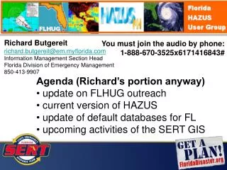
Richard Butgereit richard.butgereit@em.myflorida.com Information Management Section Head Florida Division of Emergency Management 850-413-9907. 2013 Hurricane Season Preparedness. FL HAZUS User Group. http://www.usehazus.com/flhug Google Group

E N D
Richard Butgereit richard.butgereit@em.myflorida.com Information Management Section Head Florida Division of Emergency Management 850-413-9907 2013 Hurricane Season Preparedness
FL HAZUS User Group • http://www.usehazus.com/flhug Google Group • https://groups.google.com/forum/#!forum/flhug LinkedIn Group • http://www.linkedin.com/groups/Florida-HAZUS-User-Group-4310690
Current version of HAZUS FDEM now using HAZUS 2.1 • with updated data • some of which is only updated to tract (so suitable for wind and surge models, but not flood nor earthquake)
Update of default databases • As a component of the State Hazard Mitigation Plan, statewide default databases updated for HAZUS • Demographics • Essential Facilities • Aggregate Building Stock
Demographics • Updated courtesy of FEMA Region IV Challenges • Fitting 2010 numbers to 2000 geography • Data elements needed for block group based models (earthquake and flood) not yet available
Essential Facilities • FDEM maintains “living” critical facilities inventory – • data model based upon operational needs of the FL State Emergency Operation Center • updated via annual data call to county emergency management programs (in support of EMPA) • additionally updated by self-serving of data from county GIS data download websites & some state agencies • partnership with Florida GeoPlan Center • tweaks made to data model to accommodate HAZUS (short names)
Essential Facilities • Exports from critical facilities inventory taken to update essential facilities within HAZUS • Not a priority to update other datasets, due to lack of analysis with hurricane wind model • High potential loss facilities • Transportation facilities
Aggregate Building Stock • Update based upon 2011 parcels • Crosswalk between DOR use codes and HAZUS land use types (LUT) created • RS Means used to derive estimated replacement cost (RPC) per square foot per land use type • Spatial view created to join, calculate – Sqft x RPC/sqft for LUT = Total RPC • Contents calculated as 50%** of RPC ** Citizens Property Insurance provided estimate
Aggregate Building Stock • Parcel centroids derived • Centroids spatially joined to tracts • Centroids summed for each tract • Resultant tables uploaded using CDMS
Download of data Please contact richard.butgereit@em.myflorida.com for credentials to access the FTP site.
DHS GeoCONOPS • FDEM contacted by HiFLD to the Regions program regarding potential opportunities to “exercise the GeoCONOPS” • DHS Geospatial Management Office later contacted FDEM • Planning underway • DHS GMO • FEMA HQ/R4/NESC • NGA • AFNORTH
FEMA support National Exercise and Simulation Center • Sandia National Laboratory • SUMMIT • provides a state-of-the-art facility to serve the all-hazards preparedness and response mission through pooling resources, maximizing efficiency and providing sustained exercise and training support to all stakeholders Modeling Taskforce – MOTF • FEMA effort to support modeling during response
SUMMIT https://dhs-summit.us
Portals and Applications • EM Constellation – statewide emergency management platform • Real-world - https://seoc.floridadisaster.org/emc • Exercises - https://seoc.floridadisaster.org/emcx • SERT GATOR embedded in each • FloridaDisaster.org GATOR - common operation picture • Real-world - http://map.floridadisater.org/gator • Exercises -http://map.floridadisater.org/gatorx • FloridaDisaster.org GeoPortal – ArcGIS Online for Organizations portal • https://floridadisaster.maps.arcgis.com • FDEM ArcGIS REST- http://map.floridadisaster.org/gis/rest • FDEM KML - http://map.floridadisaster.org/gis/kml
Portals and Applications • FEMA GeoPlatform - https://floridadisaster.maps.arcgis.com • FEMA providing geospatial data and analytics in support of emergency management
New data – storm surge inundation depths http://map.floridadisaster.org/GIS/rest/services/Hazards/Storm_Surge_Depth_Analysis/MapServer
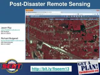
Other Resources Post-disaster remote sensing • http://www.floridadisaster.org/gis/documents/2012_11_post-disaster_remote_sensing.pptx Hurricane related data for GIS • http://www.floridadisaster.org/gis/documents/2012_09_cfgis_emdata.pptx