Learning
Learn about the importance of sustained action to reduce risk to human life and property from natural hazards. This includes buying, elevating, and moving flood-prone structures as part of emergency management.

Learning
E N D
Presentation Transcript
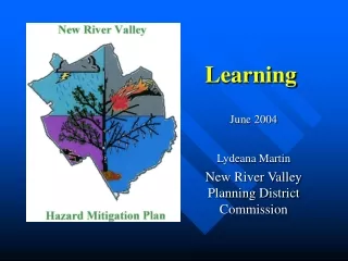
Learning June 2004 Lydeana Martin New River Valley Planning District Commission
Mitigation • “Sustained action taken to reduce or eliminate long-term risk to human life and property from natural hazards and their effect.” • National Flood Insurance Program (esp. ordinance component) • Buying, elevating and/or moving flood-prone structures • Part of Emergency Management • Not emergency preparedness & response
Why We’re Doing This • Meet Federal eligibility for FEMA assistance, Disaster Mitigation Act 2000 (local plans by 11/1/04) • Scenarios for funding: • Pre-disaster mitigation ($250,000 state) • Post-disaster mitigation (up to 7.5% of total response & recovery assistance); following Presidentially-declared disaster • Other federal collaborations in the future? • Each locality: list of priority mitigation projects • It makes sense: Save lives, property, protect resources
Regional Hazard Mitigation Planning • Public participation • Hazards • Risk Assessment and Vulnerability • Existing Mitigation • Additional Mitigation options • “Local Plans,” implementation and project list(s) • Plan Maintenance • Adoption
Virginia DEM Guidance, November 2003 • Which towns must actively participate • Review Process: • VDEM and FEMA for pre-approval • Localities for adoption • VDEM and FEMA for final approval
How We’re Doing This • Public Planning Process • Monthly meetings began June, 2002 • Some special meetings in Towns as requested • Special Local Government Planners meetings and Admin’s and Managers • Participate in regional conferences
SUMMARY of HAZARDS Based on 125-year history Based on 125 years
FLOODS: History WORST (Recent) CASE: Date: February 22, 2003 Severity: rain on ice/snow accum;Presidential-disaster declaration in Montgomery Co. Location: NRV Damages: one person died, a few homes flooded, several small bridges lost N Fk Roanoke R. Photo from The Roanoke Times Photo by Scott Stewart Allegheny Springs
Flood, 2003 • Town of Pulaski Downtown Pulaski Rt 99 Pulaski Dora Hwy Pulaski
Flood, 2003 • Floyd and Giles Co. • State road damage ($200,000 in Floyd County), private bridges, small stream flooding Beside 460 in Giles Co. RU Dedmon clean-up Rt. 8, Floyd Co.
July, 2002 • “greater Pembroke” & Giles Co. • 4-5” rain in 4 hours • $400,000 in damage to homes & bldgs Pembroke area
FLOODING: Risks SPECIAL HAZARD AREAS: Montgomery Co: Blacksburg : Stroubles Creek Christiansburg: College Ave. Shawsville/Ellison/Lafayette/Allegheny Springs; N & S Roanoke & Brake Br Plum Creek Giles Co. (NR, Doe Creek, Kow Camp) Pembroke (460, Castlerock, Cascade) Narrows (NR & Wolf Cr) Pearisburg(Wenonah Ave, Clifford, Chestnut) Pulaski County: Town of Pulaski (Downtown, Dora Highway and Kersey’s Bottom) NRV
North Fork of Roanoke River FLOOD: WHAT’s at High Risk?
FLOOD: WHAT’s at High Risk? Three assumptions when drive into water: • That water isn’t strong enough to sweep you away (just takes a few inches of swift) • That the road/bridge is still there • That road/bridge is still strong
Existing FLOOD Mitigation • Preventative/legal/policy: Zoning/floodplain management • Property Protection: Acquisition,Relocating, elevating, retrofitting, insurance • Emergency Services: Monitoring, Warning, etc. • Structures: channels, floodwalls, dry hydrant, drainage system maintenance, etc. • Natural Resource Protection: wetlands, setbacks, BMP’s, E&S • Public Information: newsletter, library resources, maps, technical assistance, environmental education
FLOODING: Existing Mitigation Emergency Services: IFLOWS Automated Rain Gauges • Updated every 15 minutes • www.afws.net Giles Co NE Floyd Co E Montgomery Co W Pulaski Co
FLOODING: Additional Mitigation • Preventative/legal/policy • Integrate hazard mitigation planning into Comprehensive Plan • Better enforcement and/or tightening of Floodplain regulations • Forest Conservation: • 1 AC Trees=5,000+cubic ft water retention • 1 AC Trees=$10,000+ on 1-time storm water restructure Source: American Forests, June, 2002 • Storm water management ordinance • Community Rating System
FLOODING: Existing Mitigation • Enhanced stormdrain maintenance (routine, before and after storms)—Pulaski, Pembroke • “Farm fences” Farm Fence in Floyd Co
FLOODING: Additional Mitigation • Emergency Services: • Work toward compatible communication systems across NRV (Homeland Security) • Reverse-911 or other electronic notification • Develop swift-water rescue capacity in NRV
DROUGHT • "drought" means a moisture deficit bad enough to have social, environmental or economic effects (Drought Mitigation Center) • Unlike other natural disasters, the “event” can last for years—no rushing sirens Mountain Lake, October, 2002
DROUGHT: History • WORST (Recent) CASE: • Date:1998-2002 • Severity: D3 “Extreme Drought” • Location: eastern US; all NRV • Damages:$10 millAgri. Loss; extreme fire danger; widespread water shortages or restrictions
DROUGHT: Risk • FREQUENCY: • Some level most every ten years; most recent probably 50-year event? • SPECIAL HAZARD AREAS: • Agricultural areas; • Floyd County (limited central water) • Eco-tourism sites dependent on water • Damages: • Wells, springs, lakes go dry • Wildfires NRV Well Permits, July-Sept, 2002
DROUGHT: Mitigation • EXISTING • Growth management tools: zoning, storm • B’burg Zoning to protect groundwater recharge • VA Emergency Declaration; new water planning requirements • USDA alternative water source program
DROUGHT: Mitigation OTHER MITIGATION • Conservation programs • Education • Low-use appliances • Protect Groundwater, esp. recharge • Agricultural techniques • Forest Conservation • Stormwater management: low-impact development • Alternative water supplies • Improve efficiency storage and transport • Additional public sources • Interconnecting, creating regional system • Rain catchment systems • Alternative sources for agriculture needs • Contingency plans
WILDFIRE WORST (Recent) CASEs: Date: From January to Mid-Oct, 2002, Severity: 1,629 wildfires that burned 13,195 acres Location:Virginia Damages: Impact to wildlife, watersheds, threatens homes April 16-19, 2003 142 AC on Draper Mtn; 100 AC on Poor Mountain
WILDFIRE: Risks • FREQUENCY:Drought, other weather factors, (such as lightning, wind, temperature, relative humidity and atmospheric stability) SEE INDEX • Human activity • It’s not a matter of if but when wildfires of the [massive] magnitude . . Will occur in the Southern Appalachians where our forests are less open and fuels are far greater. . . Adding to building up is Southern pine beetle outbreak and hemlock woolly adelgid” A Univ. of TN fire ecologist warned, July 8, 2002
WILDFIRE: Risks • SPECIAL HAZARD AREAS: • Intrusion of residential development into woodland • Based on Slope and Fuels: • Giles County: 76% woodland • Giles, Montgomery, Pulaski and Radford: steeply sloped (generally 20%+) • Logging, sawmill, or tire piles Photo by US Forest Service Hot Shots
WILDFIRE: Risks • SPECIAL HAZARD AREAS (cont’d): • Brush Mountain in Montgomery Co; • Slate Mountain in Floyd Co. • Camp Powhatan in Pulaski Co. Brush Mountain Brush Mountain Slate Mountain
WILDFIRE: Mitigation EXISTING VA Forestry Smokey the Bear, Fire Risk Index, Burn laws, Dry Hydrant and cross-training fire-fighting New River Highlands RC&D Woodland home/mitigation demo site(s) Firewise/VA Forestry resources available for home-builders, home-buyers, government officials Federal Wildland Fire Policy, US Forest Service community initiatives
WILDFIRE: Mitigation OTHER MITIGATION: Zoning, Subdivision Ord.’s • Slope (where we build) • Level if possible, or 30 set back • Fuel (building design, material, maintenance, and landscaping) Roof & exterior walls: fire resistive materials Keep flammable vegetation, wood piles, and debris away from the walls. Screen your chimneys, exterior attic and underfloor vents with noncombustible wire mesh screening, no larger than 1/2 inch Eliminate ladder fuels and keep Trees and shrubs 30 feet from large windows • Create fire breaks/ defensible open space
WILDFIRE: Mitigation OTHER MITIGATION • Involve Forester in Subdivision plat review • Fire-fighting (access and resources) • Educate home-builders and home-buyers • Additional dry-hydrants • Adequate water resources
EARTHQUAKE: Risks SPECIAL HAZARD AREA: 30 km around Pearisburg (Dr. Chapman)—not surface faults POTENTIAL IMPACT: Old brick or block construction (most deaths and injuries from structures) Fire house doors and hospital equipment rendered inoperable
EARTHQUAKE: Mitigation EXISTING MITIGATION: Virginia Building Code International Building Code; more stringent in building strength/flexibility; 1 in 2,500-year event MITIGATION OPPORTUNITIES: Be aware of high danger areas: such as gas pipelines near dense population Be sure that new hospitals and firehouses are properly designed “Seismic strengthening/flexibility” of critical facilities Beware deep soils in risk areas, particularly with bridges
NRV Plan Mission: • Minimize the loss of life and property caused by natural hazards by focusing on likely events, high-risk areas, and cost-effective mitigation opportunities.
Lessons Learned: Challenges • Newness: lack of knowledge & guidance • Timing and Coordination: little benefit of centralized resources • Lack of Data: Infrastructure and Past Damage • Variety of Input Needed (i.e. Pembroke) • Language Barriers (i.e. 100-year flood) • Tools needed (HAZUS, and risk terminology for non-floods) • Priorities and Opportunities (concrete benefit?, post-disaster by other Fed’s)
Successes • Variety of Input: informative, hopeful, real • Local gov’t managers, planners, building officials, zoning officials, emergency personnel • Citizens groups, Amer. Red Cross, RAAP, Rainwater Harvesting, Inc. • State and Fed agencies, including Virginia Tech
Successes • Data to Information: • Past weather events • Flood maps and tax parcel • Well replacement points mapped in FC • New Processes: • VA Dept. of Health GPS/GIS
NRV MITIGATION THEMES/GOALS • Opportunities to mitigate : • Pursue mitigation opportunities with State and Feds: which include detailed studies, acquisition, structural projects, demonstration projects • Review and update ordinances • Develop/integrate information • GIS layers: floodplains, slopes, tree cover, modeling • Educate citizens regarding hazards and mitigation, such as flood insurance, retrofitting, natural resource protection, easements • Regional Telecommunications capacity and early warning mechanisms • Consider Regional Swift Water Rescue, Damage-Assessment , Regional Water Supply
NRV Hazard Mitigation Plan • www.nrvpdc.org/HazardMitigationPlan/HazardMitigationPlan.htm • Lydeana Martin lmartin@nrvdc.org, 540 639-9313