NVS
NVS. New Zealand National Vegetation Survey. What is NVS?. NVS (National Vegetation Survey) – New Zealand’s largest archive facility for plot-based vegetation data NVS is both a physical (field data sheets, maps, photographs) and electronic archive (database). NVS - coverage.

NVS
E N D
Presentation Transcript
NVS New Zealand National Vegetation Survey
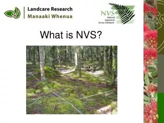
What is NVS? • NVS (National Vegetation Survey) – New Zealand’s largest archive facility for plot-based vegetation data • NVS is both a physical (field data sheets, maps, photographs) and electronic archive (database)
NVS - coverage • Best in grassland and indigenous forest • Collection intensity has varied over 50+ years • 14 000 permanent and 52 000 relevé plots
Who uses NVS? Four main types of user: • biodiversity management practitioners, • researchers, • database-to-database, • users and policy developers and IT-level users.
How is NVS used? Users rely on NVS as an archive and as a primary source of quantitative vegetation biodiversity data Traditional uses • monitoring environmental change • assessing and monitoring impacts of introduced animals • inventory and description of plant communities New activities • guiding the design of national-level biodiversity inventory and monitoring programmes • providing empirical data for validating predictive models • deriving carbon storage estimates.
NVS data management • NVS database consists of two distinct parts:
NVS data management • NVS database consists of two distinct parts: 1. Metadata for projects and datasets (>3000) • Databank organisation and management • Search and locate datasets • Assess suitability for use • Constraints- Permissions • Xml Schema – Web delivery
NVS data management • NVS database consists of two distinct parts: 1. Metadata for projects and datasets (> 3000) 2. Plot-based vegetation survey data • Mainly standardised survey’s (20x20m plots) • Plot/site descriptors • Relevé, Repeat measures of individual trees, Understory composition • Also a wide range of other data types collected by various means (ranks, CWD, browse, etc) • Relational database – Desktop management system (new system currently being developed)
Future uses • What do users want to do in the future: • Use NVS data in concert with Land Environments New Zealand classification (LENZ) toidentify priority sites forconservation management • Comparative analysis of vegetation communities in different regions of New Zealand • Address monitoring requirements supporting a number of national and internationalreporting objectives, e.g. NZ Carbon Monitoring System, Montreal Process Indicatorreporting, Natural Heritage AssetManagement reporting • Large-scale ecological analyses using pooled data at both national and global scales • What they require: • Tools for entering data into a format suitable for NVS-specific analysis packages • Formalised and automatic mechanism for uploading data into NVS and returning data corrections and additions to datasets already stored in NVS • An unrestrictive format to handle data collected using non-standard methods or miscellaneous associated data
Future plans • Complete new system • Database loaded with historic data • Standard data exchange format • Analysis tools
Goals for this workshop • Draft vegetation schema is developed • Ensure that our specific requirements fit into a schema that is usable for all • Our effort is aligned with that of the larger vegetation science community
What LCR can offer • Experience in management and recording of individual tree data • Users protocols, end-users • New tools being developed • TDWG/GBiF, TCS, LSID expertise
Funded by NZ Foundation for Research Science & Technology - FRST NZ Department of Conservation - Terrestrial & Freshwater Biodiversity Information System - TFBIS
LCR requirements • Snapshot/single dataset oriented schema • Link to project and dataset level metadata • Capture methods, units, constraints for data • A format for transferring data between end-users and NVS • A portable format that is easily read by humans, but also suitable for machine processing
Design requirements (LCR) • Meet best accepted approach for schema design and naming conventions • Modular approach to enable flexibility and reuse • Probably a plot centric view • Developed as a standard export format • A portable format that can be consumed by other tools • Design that enables large scale data analysis • Possibly a schema that can be used in either a simple or complex way