Download
1 / 14
140 likes | 348 Views
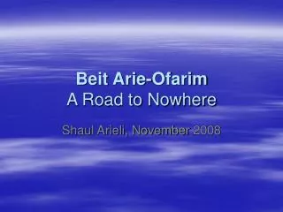
Beit Arie-Ofarim A Road to Nowhere. Shaul Arieli, November 2008. Beit Arie and Ofarim.

E N D
Beit Arie-OfarimA Road to Nowhere Shaul Arieli, November 2008
Beit Arie and Ofarim Beit Arie was established in 1981 in Western Samaria by Beitar activists, most of which were employees of Israel’s Air Force Industries. It became a local municipality in 1989, the same year Ofarim was established. In 2004 Ofarim was administratively moved from the Mate Binyamin Regional Council to become a neighborhood of Beit Arie. The municipality stretches over 8,500 dunams (3.3 sq. miles, or 2,100 acres), out of which 2,500 dunams are green areas and 148 dunams are nature preserves. Today, approximately 3,700 people live in Beit Arie-Ofarim in 910 residential units.
The Barrier In the routes approved by the Israeli government in 2003-2005, the settlements and the two roads leading to them – Road 465 and 446 – were designated to remain on the “Israeli” side of the ‘Seam Zone’. This was part of plan to maintain the large settlement blocks under Israeli sovereignty (despite the official governmental position which claims the barrier was for security purposes only). Above all other areas (except for maybe E-1), the United States opposed the barrier in this greater Ariel area the most. On April 30, 2006, Olmert’s transitional government, with participation of only four ministers, approved a new, revised, route with a meaningful change in this area. In May 2006, the Israeli High Court of Justice rejected petitions filed by the residents of Abud and Beit Arie-Ofarim against the new route. The Ministry of Defense subsequently initiated construction under two projects: the Seam Zone and the Patterns of Livelihood.
The Plan Behind the Plan Careful examination shows that behind the guise of the barrier in this are, the Israeli government plans to: Construct a continuous Jewish urban area connecting Beit Arie-Ofarim to the 1967 Line through the Shiloh River and the military fire zone there by adding 5,000 residential units to the settlements. The construction of an additional transportation and residential corridor from Beit Arie-Ofarim, via Pedu’el and Alei Zahav, all the way to Road 5 (known as ‘Trans Sameria Road’) and Ariel! Separate the road system between Beit Arie and Modi’in Illit (Road 446): one designated for Israelis and another for Palestinians.
Current Status All work has been halted in November 2007 after an investment of NIS 250,000! The new roads and fences stand unfinished as the settlements do not enjoy a completed security barrier in the context of a special security zone. The Palestinians vigorously object to the annexation of the area into Israel in the context of a final status agreement.
The new Road 465 whose construction has been halted. Main fence infrastructure Patrol road Erasure/markings road East-West View in the Shilo River area The Patrol road, the erasure road, and the main fence infrastructure make up the barrier in the Shilo area. Construction has been frozen there.
The prospective barrier route in the northern slope of Shilo River (has not been constructed yet) DeirBalut Shilo River A View Toward the North
Barrier – construction halted New BeitArie-Ofarim road – construction halted. Existing Road 446 New Road 446 for Palestinian use – construction halted. A View Toward the South The scope of the construction in this area is evident to any observer.
BeitArie Pedu’el New BeitArie-Ofarim road – construction halted. A View Toward the Northeast
A View Toward the South Beit Arie-Ofarim Road. Construction has been halted.
A View Toward the Southwest The intersection seen here is on the new Road 446 south of Ofarim, designated for Palestinian use, whose construction has been halted
Conclusion Many resources have been poured into unused infrastructure while populated towns in Israel lack adequate infrastructure that can improve movement and access, as well as minimize accidents. The Israeli government continues to execute its plans vis-à-vis the West Bank as if it does not negotiate seriously. It realigns its assets in a way that consolidates its hold throughout the West Bank under an assumption of a continuous conflict. This realignment is being carried out in a manner that undermines the ability to reach a final status agreement rather than in a way that focuses on guaranteeing the patterns of livelihood for current Israeli settlers there until political decisions are being made. On the one hand – Israel is negotiating over final status, learning the limited window for agreement on the core issues. On the other hand – it is investing heavily in creating reality that eliminates the ability to reach such an agreement. Either the government is knowingly wasting the taxpayer’s money, or is purposefully undermining the ability to conclude a final status agreement.