Download
1 / 17
180 likes | 386 Views
Data input 1: - Online data sources -Map scanning and digitizing . GIS 4103 Spring 06 Adina Racoviteanu. Data entry. = operation of encoding data for inclusion into a database - time-consuming part of GIS!. Methods of data entry. 1. transfer of data from existing digital sources

E N D
Data input 1:- Online data sources-Map scanning and digitizing GIS 4103 Spring 06 Adina Racoviteanu
Data entry = operation of encoding data for inclusion into a database - time-consuming part of GIS!
Methods of data entry 1. transfer of data from existing digital sources 2. manual digitizing and scanning of maps • 3. image data input and conversion to a GIS(aerial photography, satellite imagery) • 4. direct data entry: GPS
1. Transfer data from existing digital sources • Online data sources? • ESRI's web page (http://www.esri.com) • GIS data depot • Etc etc…
Issues with transferring data: data quality • meta-data = data about the data • How old are the data? • Where did they come from? • Areal coverage? • Map scale? • Projection, coordinate system, and datum? • How accurate are positional and attribute features? • Is the data relevant to the project at hand? • Format of the data? • Has the data been checked? • Why was the data compiled? • What is the reliability of the provider?
Issues with transferring data:data formats Common data transfer formats include: • USGS's digital line graphs (DLG) • coding information drawn from the USGS's conventional paper quadrangle sheet maps. • Spatial Data Transfer Standard (SDTS) • JPEG files
Common data formats • ArcInfo • .e00 - Import/Export format • .shp, .shx, .dbf – Shapefiles • Digital Line Graphs (DLG) • – USGS vector data transfer format • Spatial Data Transfer System (SDTS) • - U.S. Government transfer format • Digital Elevation Model (.DEM) • –USGS elevation data in raster form
Common data formats • Digital Raster Graphic (DRG) – digital USGS topographic Maps • Tiger (Topologically Integrated Geographic • Encoding and Referencing Files) • -US Census Bureau base map data
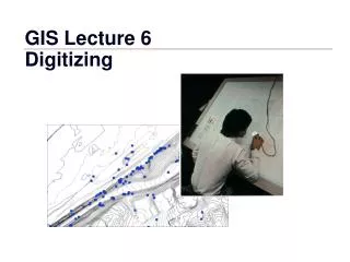
2. Digitizing = transformation of information from paper map to digital format, so that it can be stored and displayed with a computer • manual • semi-automated (automatically recorded while manually following a line), • fully automated (line following).
Manual digitizing • tracing map features in the form of points, lines or polygons with a mouse (puck) • coordinate of each sample point stored in the computer • Tools: • - digitizing table (or tablet): (heads-down digitizing). • digitizing table has a fine grid of wires embedded • in it that acts as a Cartesian coordinate system • - OR: computer screen (heads-up digitizing).
Two modes of digitizing • point-mode • stream-mode You select and encode those points deemed "critical" to represent the geomorphology of the line or significant coordinate pairs. digitizing device automatically selects points on a distance or time parameter, which generates sometimes an unnecessary high density of coordinate pairs
Before starting… • For what purpose will the data be used? • What coordinate system will be used for the project • What is the accuracy of the layers to be associated? If it is significantly different, the layers may not match. • What is the accuracy of the map being used? • Will it be merged with a larger database?
A few pieces of advice… • Each time you digitize, digitize as much as possible. • For more consistency, only one person should work on a given digitizing project • If the source consists of multiple maps, select common reference points that • coincide on all connecting sheets. Failure to do this could result in digitized • data from different data sheets not matching. • If possible, include attributes while digitizing, as this will save time later.
Post-digitizing steps • Transform coordinates from the digitizer system to the real world system (e.g. national map grid) • Correcting digitizing errors (undershoots, overshoots, triangles) • Entering missing data, building topology
Scanning maps • Documents must be clean • Lines at least 0.1mm wide • Automatic feature recognition • Contour lines cannot be broken with text