Interactive Maps of Vanuatu with Customizable Data
0 likes | 16 Views
Create engaging presentations and reports with this PowerPoint pack featuring simple maps of Vanuatu. Easily add your own data, customize colors, and label islands. The pack includes symbols, callout boxes, legends, and labels for seamless customization. Simply copy and paste to personalize your maps with information. Detailed reference maps by province are provided, allowing you to highlight specific locations. Enhance your visuals with various symbols, labels, and callout boxes to effectively communicate information.

Interactive Maps of Vanuatu with Customizable Data
E N D
Presentation Transcript
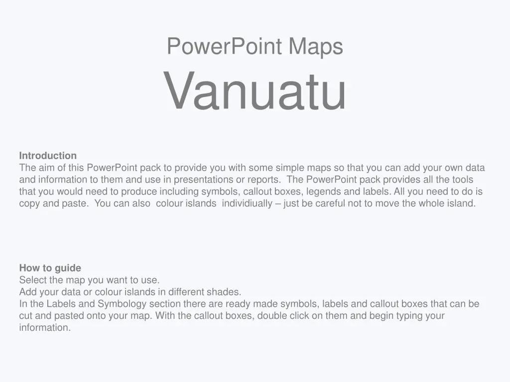
PowerPoint Maps Vanuatu Introduction The aim of this PowerPoint pack to provide you with some simple maps so that you can add your own data and information to them and use in presentations or reports. The PowerPoint pack provides all the tools that you would need to produce including symbols, callout boxes, legends and labels. All you need to do is copy and paste. You can also colour islands individiually – just be careful not to move the whole island. How to guide Select the map you want to use. Add your data or colour islands in different shades. In the Labels and Symbology section there are ready made symbols, labels and callout boxes that can be cut and pasted onto your map. With the callout boxes, double click on them and begin typing your information.
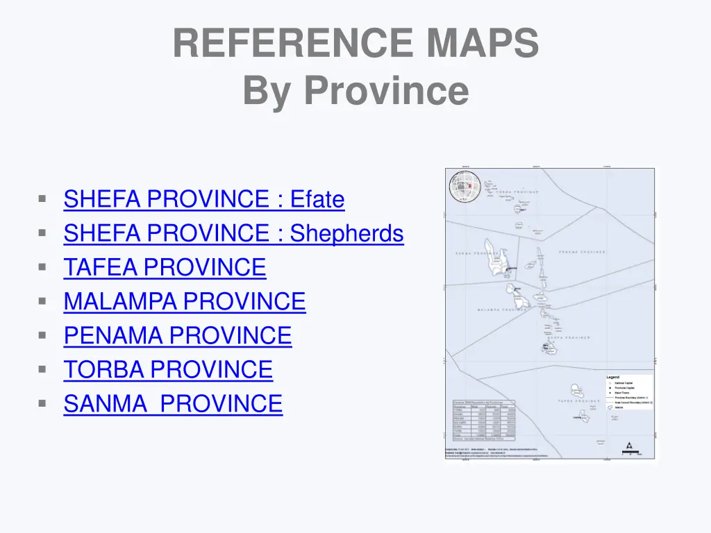
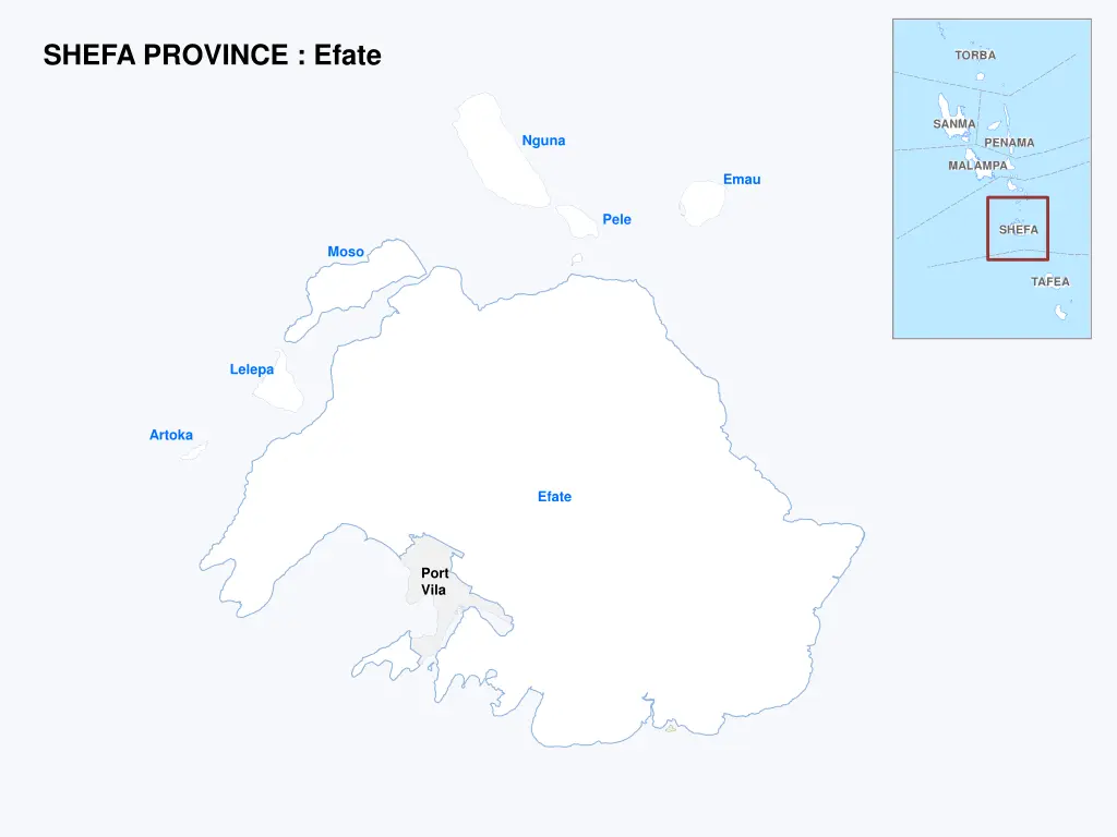
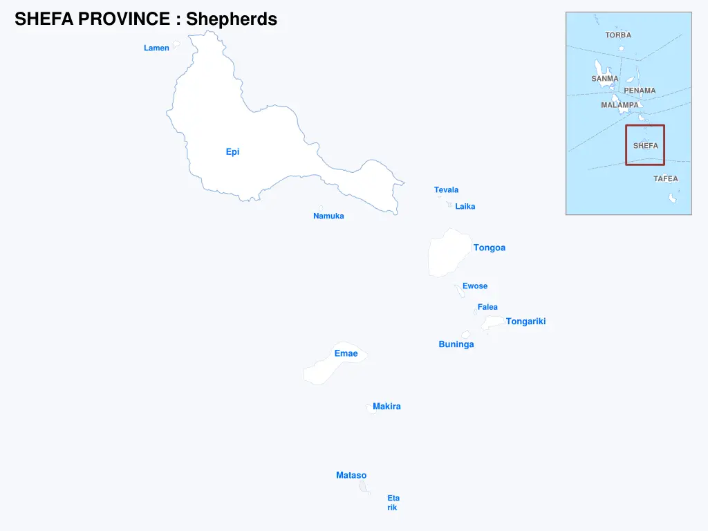
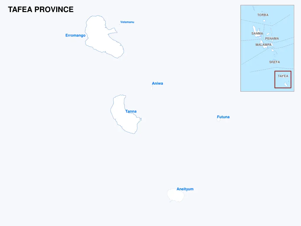
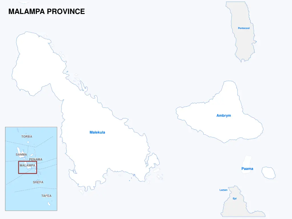
REFERENCE MAPS By Province SHEFA PROVINCE : Efate SHEFA PROVINCE : Shepherds TAFEA PROVINCE MALAMPA PROVINCE PENAMA PROVINCE TORBA PROVINCE SANMA PROVINCE
SHEFA PROVINCE : Efate TORBA SANMA Nguna PENAMA MALAMPA Emau Pele SHEFA Moso TAFEA Lelepa Artoka Efate Port Vila
SHEFA PROVINCE : Shepherds TORBA Lamen SANMA PENAMA MALAMPA SHEFA Epi TAFEA Tevala Laika Namuka Tongoa Ewose Falea Tongariki Buninga Emae Makira Mataso Eta rik
TAFEA PROVINCE TORBA Vetemanu SANMA Erromango PENAMA MALAMPA SHEFA TAFEA Aniwa Tanna Futuna Aneityum
MALAMPA PROVINCE Pentecost Ambrym Malekula TORBA SANMA PENAMA MALAMPA Paama SHEFA Lamen TAFEA Epi
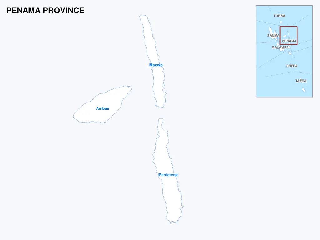
PENAMA PROVINCE TORBA SANMA PENAMA MALAMPA Maewo SHEFA TAFEA Ambae Pentecost
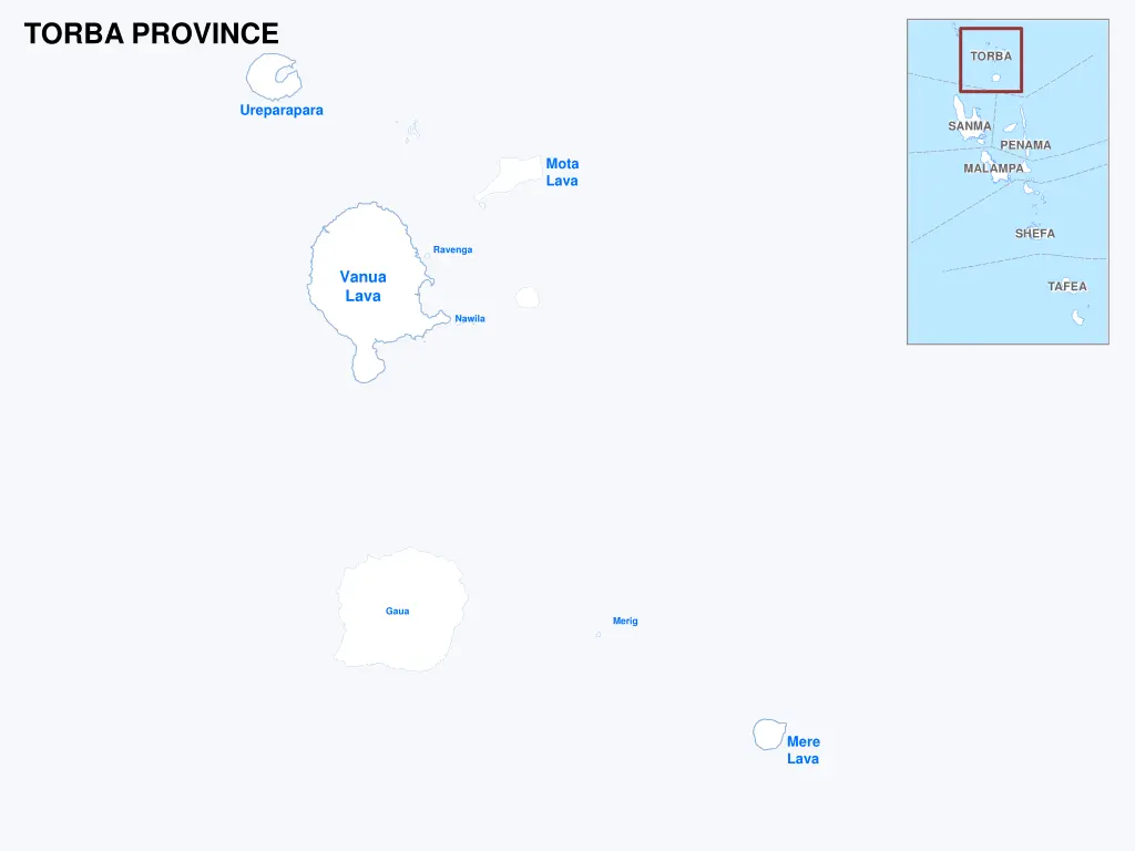
TORBA PROVINCE TORBA Ureparapara SANMA PENAMA Mota Lava MALAMPA SHEFA Ravenga Vanua Lava TAFEA Nawila Gaua Merig Mere Lava
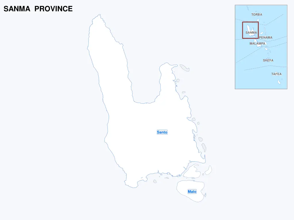
SANMA PROVINCE TORBA SANMA PENAMA MALAMPA SHEFA TAFEA Santo Malo
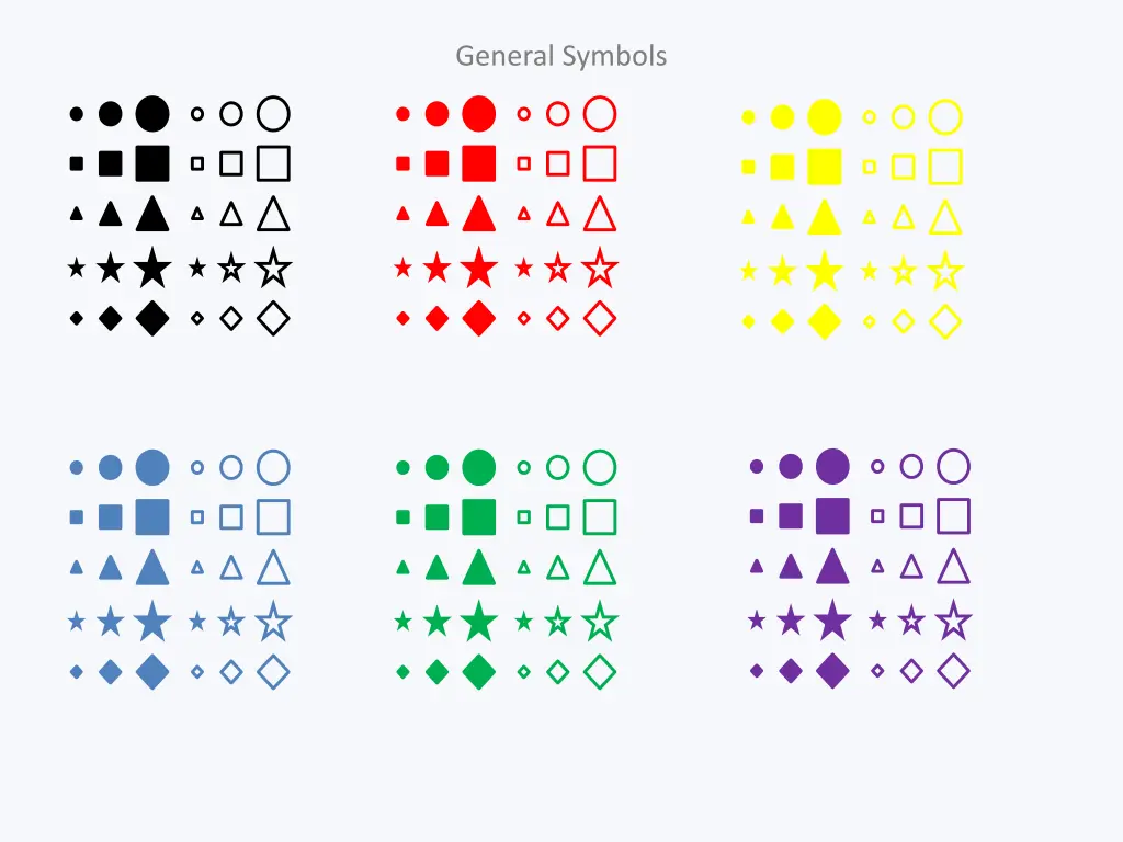
Labels and Symbology General Symbols Humanitarian Symbols Callout Boxes Contents
-
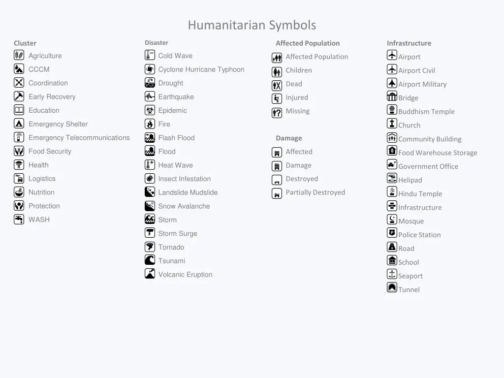
Humanitarian Symbols Disaster Cluster Affected Population Infrastructure Agriculture Cold Wave Affected Population Airport CCCM Cyclone Hurricane Typhoon Children Airport Civil Coordination Drought Dead Airport Military Early Recovery Earthquake Injured Bridge Education Epidemic Missing Buddhism Temple Emergency Shelter Fire Church Emergency Telecommunications Flash Flood Damage Community Building Food Security Flood Affected Food Warehouse Storage Health Heat Wave Damage Government Office Logistics Insect Infestation Destroyed Helipad Nutrition Landslide Mudslide Partially Destroyed Hindu Temple Protection Snow Avalanche Infrastructure WASH Storm Mosque Storm Surge Police Station Tornado Road Tsunami School Volcanic Eruption Seaport Tunnel
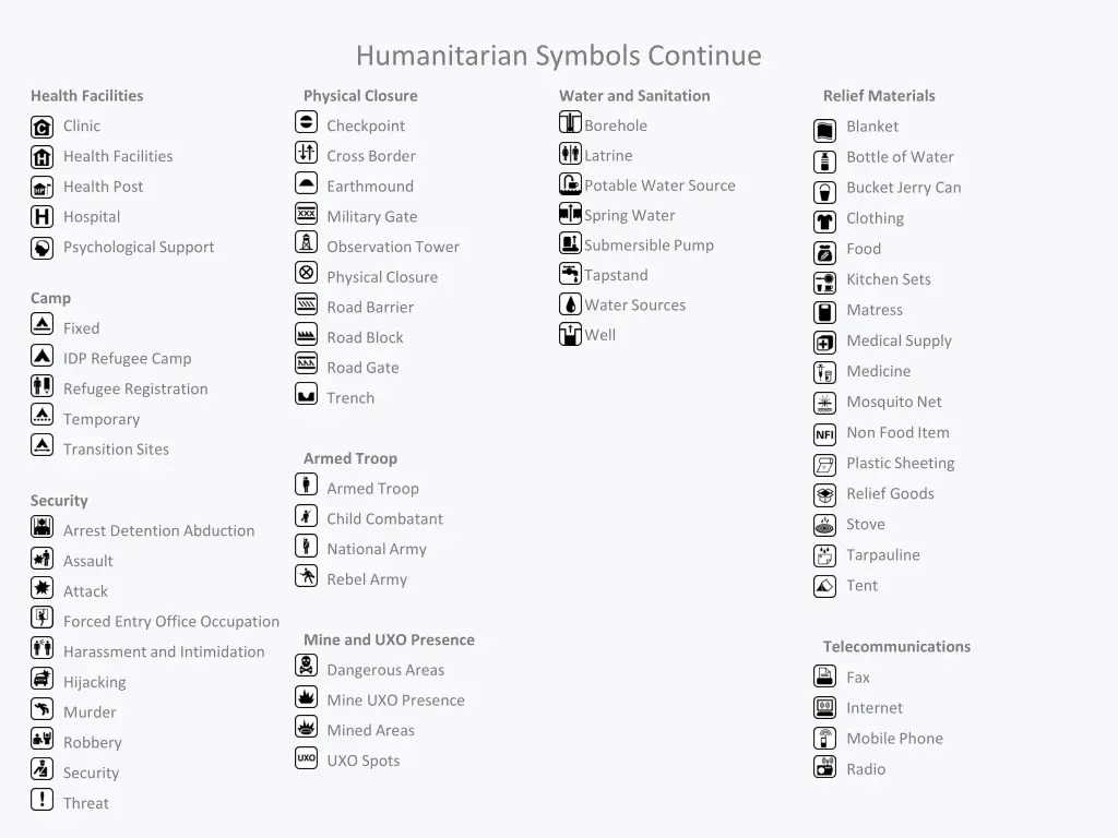
Humanitarian Symbols Continue Health Facilities Physical Closure Water and Sanitation Relief Materials Borehole Checkpoint Clinic Blanket Latrine Cross Border Health Facilities Bottle of Water Potable Water Source Earthmound Health Post Bucket Jerry Can Spring Water Military Gate Hospital Clothing Submersible Pump Observation Tower Psychological Support Food Tapstand Physical Closure Kitchen Sets Camp Water Sources Road Barrier Matress Fixed Well Road Block Medical Supply IDP Refugee Camp Road Gate Medicine Refugee Registration Trench Mosquito Net Temporary Non Food Item Transition Sites Armed Troop Plastic Sheeting Armed Troop Relief Goods Security Child Combatant Stove Arrest Detention Abduction National Army Tarpauline Assault Rebel Army Tent Attack Forced Entry Office Occupation Mine and UXO Presence Telecommunications Harassment and Intimidation Dangerous Areas Fax Hijacking Mine UXO Presence Internet Murder Mined Areas Mobile Phone Robbery UXO Spots Radio Security Threat
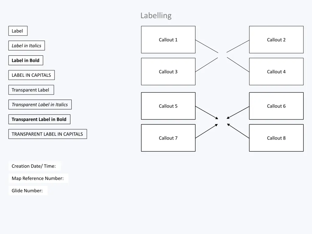
Labelling Label Callout 1 Callout 2 Label in Italics Label in Bold Callout 3 Callout 4 LABEL IN CAPITALS Transparent Label Transparent Label in Italics Callout 5 Callout 6 Transparent Label in Bold TRANSPARENT LABEL IN CAPITALS Callout 7 Callout 8 Creation Date/ Time: Map Reference Number: Glide Number:
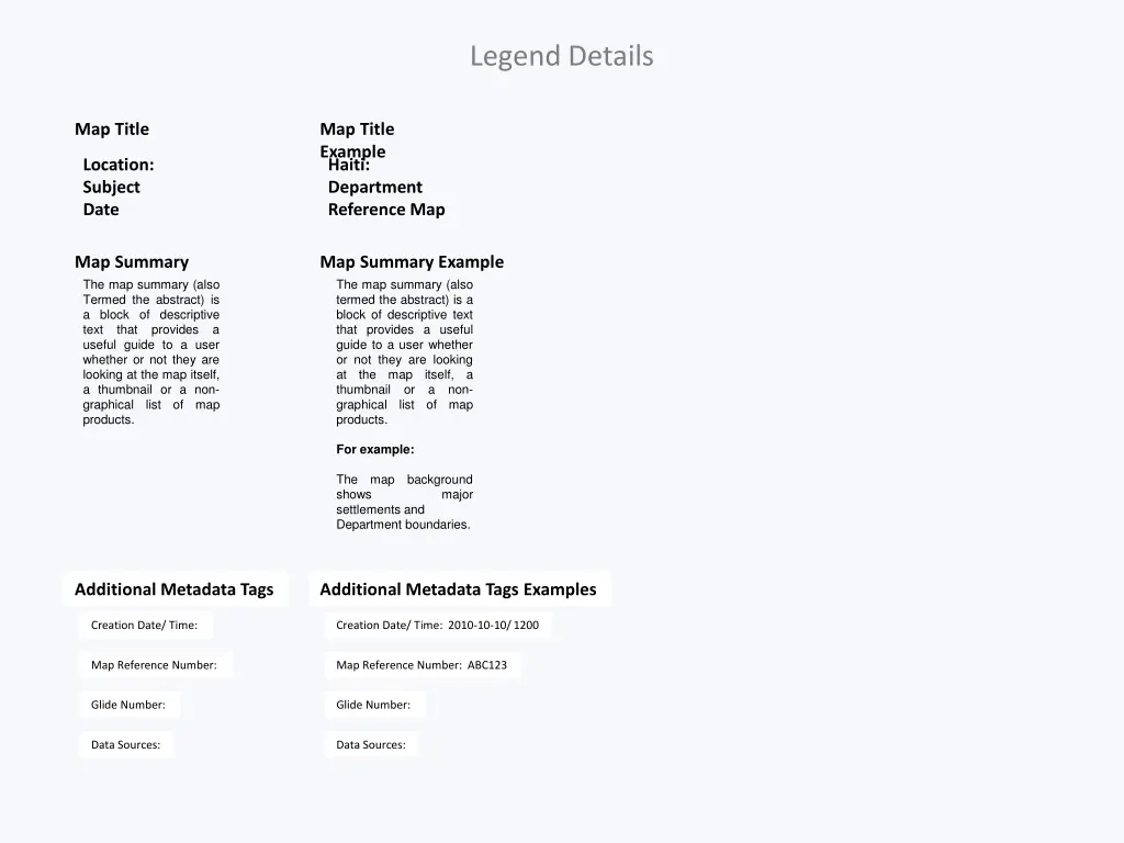
Legend Details Map Title Map Title Example Location: Subject Date Haiti: Department Reference Map Map Summary Map Summary Example The map summary (also Termed the abstract) is a block of descriptive text that useful guide to a user whether or not they are looking at the map itself, a thumbnail or a non- graphical list products. The map summary (also termed the abstract) is a block of descriptive text that provides a useful guide to a user whether or not they are looking at the map thumbnail or graphical list products. provides a itself, a of a non- map of map For example: The shows settlements and Department boundaries. map background major Additional Metadata Tags Additional Metadata Tags Examples Creation Date/ Time: Creation Date/ Time: 2010-10-10/ 1200 Map Reference Number: Map Reference Number: ABC123 Glide Number: Glide Number: Data Sources: Data Sources:
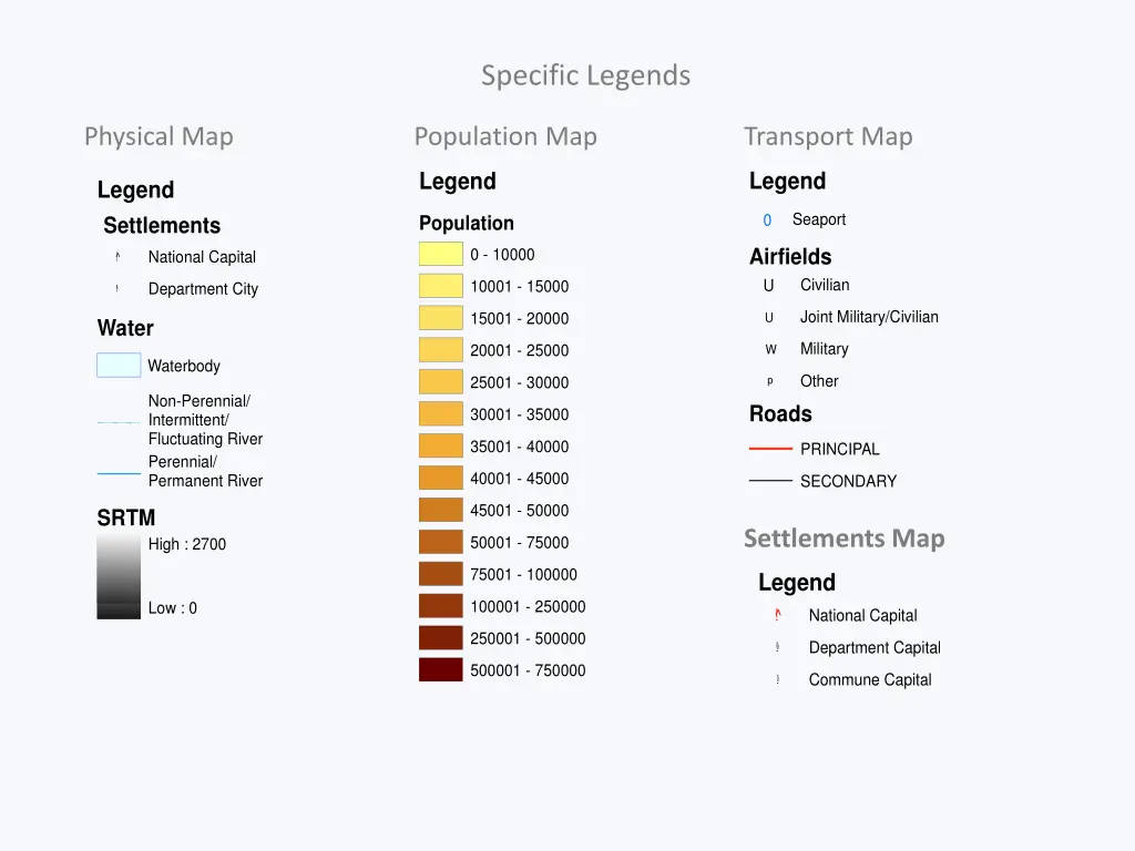
Specific Legends Physical Map Population Map Transport Map Legend Legend Legend Settlements Seaport 0 Population Airfields U 0 - 10000 National Capital !!^ Civilian 10001 - 15000 Department City !!!! Joint Military/Civilian 15001 - 20000 U Water Military 20001 - 25000 W Waterbody Other 25001 - 30000 p Non-Perennial/ Intermittent/ Fluctuating River Roads 30001 - 35000 35001 - 40000 PRINCIPAL Perennial/ Permanent River 40001 - 45000 SECONDARY 45001 - 50000 SRTM Settlements Map 50001 - 75000 High : 2700 75001 - 100000 Legend 100001 - 250000 Low : 0 !! ^ National Capital 250001 - 500000 Department Capital !!! 500001 - 750000 Commune Capital !!!!