ARCGIS Desktop
ARCGIS Desktop. John H. Porter. History of ESRI Products. ARC/INFO developed – 1980s* Couples INFO database with graphical tools for display and analysis Data structures Coverages Point Arc/Line Polygon *Dates in this lecture are approximate. Brief History of ESRI Products.

ARCGIS Desktop
E N D
Presentation Transcript
ARCGIS Desktop John H. Porter
History of ESRI Products • ARC/INFO developed – 1980s* • Couples INFO database with graphical tools for display and analysis • Data structures • Coverages • Point • Arc/Line • Polygon *Dates in this lecture are approximate
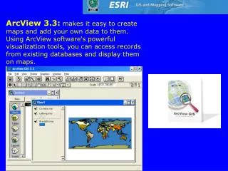
Brief History of ESRI Products • ArcView 1.0 – early 1990s • Very limited functionality • Display only • Buggy – crashes often • ARC/INFO continues to be enhanced by adding new commands • ARCTOOLS graphical interface attempts to make things simpler
Brief History of ESRI Products • ARCView versions 2 and 3 – mid to late 1990s • Greatly expanded capabilities • Data editing and analysis • AVENUE programming language allows extensions to be added to ARCVIEW • Data Structures • Shape Files (editable) • Coverages (display only) • Images • Grids (with extensions)
Brief History of ESRI Products • ArcGIS Desktop – 1999- present • Subsumes both ARC/INFO and ArcView • Restricted to Windows NT-family operating system • Arcview is a limited version of ARCGIS Desktop • Data Structures • Shape Files • Geodatabases • Script/Programming Language: Visual Basic
A Brief History of ESRI Products • ArcGIS Workstation • Traditional ARC/INFO • Command-line driven • Includes some functions not available in ArcGIS Desktop • Runs on multiple operating systems
ArcGIS Components • ArcCatalog • Manage data • ArcMap • Create maps • Analysis • ArcToolbox • Stand-alone Analysis and Conversion • ArcScene • 3-D display
ARCGIS Components • ARC Catalog
ArcCatalog • Locate Data for use with ARCGIS • What data is available? • Local Disks • Databases • Internet/Online • What are the properties of that data?
ArcCatalog - Preview • Preview Geodata and Tables
Metadata • ArcCatalog will also display or allow editing of simplified Metadata
ArcCatalog • Internet Savy – can connect to online map databases • Easy use of data without having to import it • Also talks to database servers and Geocoding services
ARGIS Components • ARCMAP
ArcMap • ArcMap is designed to help you create publication-quality maps • It extends the display capabilities of ArcView 3 but uses an entirely new interface • Everything is there, but you will need to work to locate it
ArcMap – Display Enhancements • Transparency • You can set layers to be partly transparent so that other layers show through • Projections • Automatically reprojects data to match the map projection (now you can mix and match UTM and Lat-Lon coverages) • But only if the source projection is defined
ArcMap Toolbars • Unlike Arcview which uses extensions to create new “top bar” options, ArcMap uses movable toolbars • You select the toolbars you want from the View menu
Tips • Most of the things that affect a single layer such as properties, display attributes or zooming (similar to the AV Theme & Legend menus) are found by hitting the RIGHT mouse button when selecting a layer
Terminological Changes • ArcGIS also introduces (yet another) whole new vocabulary for creation of maps • ArcView “Projects” become ArcGIS “Map Documents” • ArcView “Views” become ArcGIS “Data Frames” • ArcView “Themes” become ArcGIS “Layers”
Layouts • Unlike ArcView there are not separate “views” and “layouts” • You can use the “Data View” and “Layout View” options in the View menu • Layout Views and Data Views have separate zoom controls etc. • Instead there is a single map document that contains one or more data frames each of which can contain one or more layers
Data Structures • As ARC products have evolved, so have their data structures • The initial structure was the COVERAGE • Files are stored in two directories • Coverage name – unique files for the coverage • INFO – files for all the coverages in that workspace/directory • Exchanged using ARC/INFO Exchange Files (.E00)
Coverages • Coverages can be point, line or polygon • A single coverage can have points and lines, or lines and polygons, but never points and polygons • Polygon coverages partition the area into polygons • No overlap allowed between polygons • All areas in the coverage are part of some polygon
Coverages • Coverages are created using the BUILD and CLEAN commands • CLEAN attempts to fix problems in topology, sometimes moving points and lines • BUILD assumes the topology is “clean” and fails if topological problems are encountered • It creates Point, Arc and Polygon attribute tables
Grids • Grids were introduced to allow ARC to deal with RASTER (gridded) data • Each grid cell contains a single number • Like a coverage, files are stored in several directories, so to move a grid it is safest to EXPORT it • Grids have a .VAT or Value Attribute Table that relate codes in the grid to associated attributes
Shapefiles • Next to evolve were Shapefiles • Comprised of 4 files – coverage.shp, .sbn, .sbx and .dbf • The .dbf file contains the attribute data and can be opened with Excel, Access and other database editors that understand the .dbf format
Shapefiles • Polygons in shapefiles CAN overlap • This means that while POLYGON COVERAGES are easily converted to SHAPEFILES, SHAPEFILES are NOT easily converted to POLYGON COVERAGES • Overlaps need to be eliminated • When converted, polygons in the shapefile become REGIONS in the coverage • Regions are a set of polygons sharing certain attributes (e.g., the attributes of the shapefile polygons that generated them)
Geodatabases • “Geodatabase : An object-oriented geographic database that provides services for managing geographic data. These services include validation rules, relationships, and topological associations. A geodatabase contains feature datasets and is hosted inside of a relational database management system.”
Geodatabases • Geodatabases are stored in relational databases • Many large GIS users have large Oracle-based database systems that are used for GIS data using the ESRI Spatial Database Engine for conversion • You can also have “Personal Geodatabases” that are maintained on the local machine
Data Forms • Arc/INFO works with “coverages” (vector) and “grids” (raster) • ArcView prefers to work with “Shapefiles” (but can display coverages) • Spatial Analyst allows work with grids • ArcGIS prefers to work with “Geodatabases” and Shapefiles (but can display and do limited manipulation of coverages)
ArcToolbox • The ArcToolbox component of ArcGIS contains sets of stand-alone wizards designed to help you perform specific tasks
ArcToolbox • One of the biggest differences between the “ArcView” version of ArcGIS Desktop and the “Arc/INFO” version of ArcGIS is the variety of analysis tools • The ArcView version has only about 20 tools (mostly conversion & projection) • The “full” version has over 150 tools • Analysis and manipulation
ArcScene – 3 D Data Viewer • ArcScene is a 3-D data viewer that allows you to get different perspectives on three-dimensional landscapes • Tilt and rotate • View from a point
ArcReader Free!
ArcReader • ArcReader is a FREE stand-alone tool designed for DISPLAY and printing of local and web-accessible geodata • It requires that the map to be displayed be “published” to a special PMF file using an ARCGIS extension