Download
1 / 26
260 likes | 607 Views
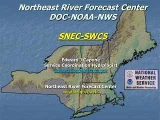
Northeast River Forecast Center. National Weather Service Implementation of the Community Hydrologic Prediction System David Vallee Hydrologist-in-Charge Northeast RFC NROW November 4-5, 2009. First – a bit about NERFC The Community Hydrologic Prediction System Background and history

E N D
Northeast River Forecast Center National Weather Service Implementation of the CommunityHydrologic Prediction System David Vallee Hydrologist-in-Charge Northeast RFC NROW November 4-5, 2009
First – a bit about NERFC The Community Hydrologic Prediction System Background and history Why are we doing this? How are we doing it? Outline
NERFC Service Area Major river basins include Genesee, Hudson, Mohawk, Housatonic, Connecticut, Merrimack , Blackstone, Pawtuxet, Kennebec ,Penobscot and Saint John ~180 forecast points Staffing profile: Hydrologist-in-Charge Service Coordination Hydrologist and Development & Operations Hydrologist 4 Senior Hydrologists & 1 Senior Hydromet Analysis & Support Meteorologist (HAS) 3 Hydrologists & 2 HAS 1 Admin Support/Hydro Technician
River Forecast Center Responsibilities • Calibrate and implement hydrologic /hydraulic models • Perform robust Data QC • Provide 48-72 hour QPF and Temperature forecasts • River flow and stage forecasts at 180 locations (220 basins) • Flash Flood Guidance • Ensemble streamflow predictions • Ice Jams and Dam Breaks • Water Supply forecasts • Partner with NOAA Line Offices to address issues relating to Hazard Resiliency, Water Resource Services, Ecosystem Health and Management, and Climate Change Moderate flooding - Connecticut River at Portland, CT.
Met-member Based Short Range Ensemble River Forecast System • Unbiased GEFS and SREF model forcings (temp/precip) • Runs 2x-day for each model
Decision Support at the local level Providing Remote or On-site Support! http://www.erh.noaa.gov/nerfc/self_brief.shtml Getting the high priority hydro-meteorological information at their fingertips! Whittenton Dam Crisis Montpelier Ice Jam
NOAA Regional CollaborationHarmful Algae Bloom Research http://www.oceanservice.noaa.gov/redtide NARR 1000 mb monthly wind anomolies (May 2005 and June 2009)
Algorithm Services Control Services Data Services Security Services Display Services Community Hydrologic Prediction System CHPS NOAA’s National Weather Service (NWS) River Forecast Centers (RFCs) are key partners in the provision of water resource information. The Community Hydrologic Prediction System (CHPS) will enable NOAA’s water research, development enterprise and operational service delivery infrastructure to be integrated and leveraged with other federal water agency activities, academia, and the private sector.
So Why the Move to CHPS?To meet the growing demands of our customers Floods, Drought, Water Supply, HABs, Power Generation, Fisheries Management, Ecosystem Health, Water Quality, Salt Water Intrusion, Dam/Levee Failures, Tropical Cyclone Impacts, Climate Change Impacts
Why CHPS? NWSRFS was a great architecture originally developed for use on mainframe computers lacks modern modularity difficult to add new models and techniques inhibits collaboration and research to operations CHPS will allow: greater ease in implementing new models greater collaboration with agency partners, universities, international community 1970s 1980s 1990s 2000s 2003 today 13
(2003) 2006 2007 2008 2009 2010 2011 Beta Sites • The CHPS Acceleration Team – or CAT pursuit of CHPS • ABRFC, NCRFC, NWRFC volunteered to work w/ OHD. CNRFC later drafted. • Criteria established through evaluation of NWSRFS strengths and weaknesses (Apex facilitation, available from HSEB) • Evaluate Delft-FEWS as a CHPS candidate • FEWS = Flood Early Warning System Exploration phase in 2003 • CAT River Forecast Centers
FEWS Architecture (2003) 2006 2007 2008 2009 2010 2011 • What is FEWS? • JAVA based system and repository for hydrologic and hydraulic modeling • Client/server architecture • Mature system developed by Delft Hydraulics|WL (now Deltares), a Dutch foundation, since the 1990s • Deterministic and ensemble capabilities • Employs Postgres database, system synchronization • Backup and stand-by • Inputs are grids! 15
FEWS Users 16
CAT Recommendation Proceed with implementation of Delft-FEWS as the CHPS software infrastructure. Target operational use at all RFCs within 3 years. Resource implications Re-direct OHD resources toward CHPS/FEWS Terminate “dead-end” NWSRFS enhancements Align/re-evaluate HSMB-oriented “Research to Operations” (RTO) projects (2003) 2006 2007 2008 2009 2010 2011 Approved by Office Director – Gary Carter – Jan 17, 2008 17
Implementation Strategy Port models that require calibration Hydrologic/Hydraulic Models Soil Moisture Models Snow Models Reservoir Models BASEFLOW, SARROUTE, CONS_USE, LAG/K, LAY-COEF, TATUM, TIDEREV, MUSKROUT, RES-J, RSNWELEV, SNOW-17, CHANLOSS, STAGE-Q, SSARRESV, STAGEREV, UNIT-HG, RES-SNGL, SAC-SMA Create adapters for other NWSRFS routines we wish to maintain Create adapters for several new models (e.g. HEC-RAS) (2003) 2006 2007 2008 2009 2010 2011 18
Ensemble Streamflow Prediction Services • FEWS will provide for existing level of ensemble operations, products, and services • Combination of porting existing software meshed with existing FEWS capabilities 19
Implementation Strategy Two tiers of deployment4 CAT RFCs: CN, NW, AB, NE Initial hardware delivered Oct ‘08 (Stand-by System) Initial migration software and training occurred in February ‘09 Second suite of operational hardware delivery fall 2009(On-line System) Full Baseline Operating Capability BOC-1 arrived in October 2009. (2003) 2006 2007 2008 2009 2010 2011 • Parallel operations are about to commence at NERFC!! 21
Implementation Strategy Two tiers of deployment Remaining 9 RFCs (BOC-2) Initial hardware delivery in October 2009 Migration/Systems training – Fall 2009 Migration begins January 2010 Parallel operations by October 2010 Goal is to “Retire” NWSRFS by January 2011 Entire system needs to be baselined into AWIPS II configuration at the RFCs (2003) 2006 2007 2008 2009 2010 2011 RFCs not required to drop NWSRFS until “fully ready” 22
Ultimate Outcome: • CHPS will include the same science algorithms initially – but tremendous potential to expand • Improved Efficiency for Forecaster • Greatly enhanced visualization, gridded forcings, and the ability to display time series of many more variables • Improved Tools for “What If” Scenarios • Improved Capabilities for New Science Integration • Through the use of Adaptors; HEC-RAS, RESSIM • Availability to use models in FEWS from other partners
Architecture • Duty (On-line) and Stand-by system • All data is synchronized between system via the Master Controller • NWS testing synchronization to paired offices – similar to WFOs Duty System Stand-by System RFC NWSHQ NOHRSC WFO?? 24
Northeast River Forecast Center National Weather Service Implementation of the CommunityHydrologic Prediction System David Vallee Hydrologist-in-Charge Northeast RFC NROW XI November 4-5, 2009